Roof Inspection in Alton, IL
Drone roof inspections with high-resolution imagery and 3D modeling. Identify damage, assess condition, and generate detailed reports for insurance and maintenance.
Serving Madison & the St. Louis Metropolitan Area (Metro East) area
Request a Free Quote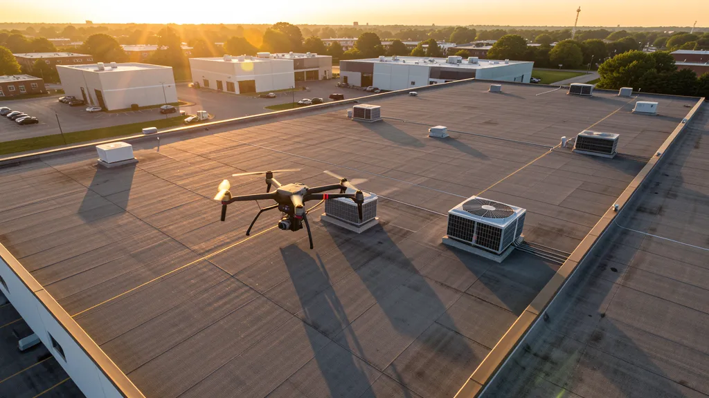
Get Matched With a Local Operator
Roof Inspection Pricing in Alton, IL
Low End
$350
High End
$1,100
Turnaround
1-3 days
Cost ranges are based on market data for St. Louis Metropolitan Area (Metro East). Actual pricing depends on site size, complexity, and deliverables.
Common Roof Inspection Applications in Alton
- Pre-purchase roof assessments
- Insurance claim documentation
- Storm damage evaluation
- Routine maintenance inspections
Local Drone Regulations
Roof inspections in Alton require compliance with local drone regulations:
Local Drone Ordinances:
The City of Alton does not have a specific municipal drone ordinance beyond Illinois state law. Commercial drone operators must hold a valid City of Alton business license. Drone operations in Alton parks require coordination with the Alton Park and Recreation Department, particularly at Riverfront Park, Gordon Moore Park, and Rock Spring Park. Operations near the Clark Bridge and Melvin Price Locks and Dam must coordinate with the U.S. Coast Guard, IDOT, and the U.S. Army Corps of Engineers. Operations near the Argosy Casino should coordinate with facility security. Commercial operators should carry general liability insurance of at least $1 million.
Restricted Airspace in Alton:
- [object Object]
- [object Object]
- [object Object]
- [object Object]
Illinois drone regulations require FAA Part 107 certification for all commercial drone operations. Our network of verified operators in Alton meets all federal and state requirements.
Drone Regulations in Alton, IL
Airports & LAANC Zones
- STL — St. Louis Lambert International Airport (Class C airspace, approximately 25 miles southwest, major commercial hub)
- ALN — St. Louis Regional Airport (Class D airspace, approximately 8 miles east near Bethalto, general aviation and flight training)
- 1LS — St. Louis Downtown Airport (Class E airspace, approximately 12 miles south, general aviation)
- BLV — Scott Air Force Base / MidAmerica St. Louis Airport (Class C airspace, approximately 25 miles southeast, joint military-civilian facility)
Restricted Airspace
- [object Object]
- [object Object]
- [object Object]
- [object Object]
Local Ordinances
The City of Alton does not have a specific municipal drone ordinance beyond Illinois state law. Commercial drone operators must hold a valid City of Alton business license. Drone operations in Alton parks require coordination with the Alton Park and Recreation Department, particularly at Riverfront Park, Gordon Moore Park, and Rock Spring Park. Operations near the Clark Bridge and Melvin Price Locks and Dam must coordinate with the U.S. Coast Guard, IDOT, and the U.S. Army Corps of Engineers. Operations near the Argosy Casino should coordinate with facility security. Commercial operators should carry general liability insurance of at least $1 million.
All drone operations in Alton must comply with FAA Part 107 rules. Operators must obtain LAANC authorization before flying in controlled airspace near Alton airports. Our network operators handle all permitting and airspace authorizations as part of their service.
Roof Inspection FAQ — Alton, IL
How does a drone roof inspection work in Alton?
We fly a drone equipped with high-resolution and optional thermal cameras over your roof in Alton, capturing detailed imagery of every surface, flashing, and penetration. No ladders, no scaffolding, no risk to personnel.
Can drone roof inspections detect leaks?
Yes. Thermal imaging detects moisture trapped under roofing materials by temperature differentials. This identifies active leaks and areas of concern before they become visible inside the building.
What does a roof inspection report include?
Your report includes high-resolution photos organized by roof section, a condition assessment with annotated problem areas, thermal imagery (if requested), and 3D model data for measurement and documentation. Reports are suitable for insurance claims and maintenance planning.
Drone Regulations FAQ — Alton, IL
Do I need LAANC authorization to fly a drone in Alton, IL?
Eastern sections of Alton near Route 140 may fall within St. Louis Regional Airport (ALN) Class D airspace. Most of central and western Alton, including downtown and the riverfront, is outside controlled airspace at commercial drone operating altitudes. Operators must check the FAA LAANC dashboard for their specific grid square. The city's position on the Mississippi River bluffs creates variable wind conditions that operators should account for in flight planning.
What are the drone laws in Illinois for commercial operators in Alton?
Commercial drone operators in Alton must comply with the Illinois Drones Omnibus Act (720 ILCS 5/48-1 et seq., Public Act 99-0566). Operators must hold a valid FAA Part 107 Remote Pilot Certificate and obtain LAANC authorization for controlled airspace. Alton does not have a specific municipal drone ordinance, but commercial operators must hold a City of Alton business license.
Can I fly a drone near the Clark Bridge and Melvin Price Locks and Dam?
The Clark Bridge (cable-stayed, connecting Alton to Missouri) and Melvin Price Locks and Dam No. 26 are critical bi-state infrastructure. Drone operations near these facilities must coordinate with the U.S. Coast Guard, IDOT, MoDOT, and the U.S. Army Corps of Engineers. The bridge requires periodic structural inspection, creating demand for drone-based bridge inspection services. The lock-and-dam is a major Corps of Engineers navigation facility with ongoing maintenance and aerial imaging demand. Operators should avoid the bridge during peak traffic hours.
What major construction projects in Alton need drone aerial imaging?
Alton's construction market includes riverfront mixed-use redevelopment (Alton Marina, Port of Alton, Riverfront Park), healthcare expansion (Alton Memorial Hospital), downtown historic preservation, Lewis and Clark Community College campus expansion, tourism infrastructure (National Great Rivers Museum area), and transportation infrastructure (Clark Bridge inspection, I-270 corridor, Route 3 and 143 improvements). The city's tourism economy drives hotel, restaurant, and entertainment construction.
Is Alton a good market for drone aerial imaging businesses?
Alton is a unique Metro East market with a tourism-driven economy and Mississippi River infrastructure. The Clark Bridge and Melvin Price Locks and Dam create specialized infrastructure inspection demand. The riverfront redevelopment provides multi-year aerial monitoring projects. Alton Memorial Hospital adds healthcare construction demand. The historic downtown renovation market generates steady demand for topographic data collection and aerial documentation. The city's position at the confluence of three rivers creates unique environmental monitoring and tourism documentation opportunities. The tourism economy differentiates Alton from other Metro East cities.
How does the Mississippi River affect drone operations in Alton?
Alton sits at the confluence of the Mississippi, Missouri, and Illinois rivers, creating unique geography with limestone bluffs rising above the riverfront. The Mississippi River creates variable wind conditions, especially near the bluffs, that operators should account for in flight planning. The Clark Bridge (cable-stayed) and Melvin Price Locks and Dam No. 26 are critical infrastructure requiring coordination with the U.S. Coast Guard and Corps of Engineers for drone operations. The riverfront has ongoing mixed-use redevelopment creating demand for aerial progress monitoring. The bluff geography creates unique aerial photography opportunities for tourism and real estate.
All Aerial Imaging Services in Alton, IL
Compare pricing across all aerial imaging services available in Alton, Illinois.
| Service | Low End | High End | Turnaround |
|---|---|---|---|
| Topographic Data Collection | $900 | $4,000 | 1-2 weeks |
| Drone Inspection | $550 | $2,500 | 3-5 days |
| LiDAR Scanning | $1,800 | $6,500 | 1-2 weeks |
| Environmental Monitoring | $1,100 | $4,800 | 1-2 weeks |
| Aerial Imagery | $450 | $2,000 | 2-5 days |
| Construction Monitoring | $750 | $3,200 | Weekly |
| Real Estate Photography | $300 | $1,100 | 2-3 days |
| Roof Inspection ← you are here | $350 | $1,100 | 1-3 days |
Pricing ranges are based on market data for St. Louis Metropolitan Area (Metro East). Actual costs depend on project scope, site conditions, and required deliverables.
Are You a Drone Operator in Alton, IL?
Join our network of FAA-certified operators. Get matched with roof inspection projects in Alton and the surrounding St. Louis Metropolitan Area (Metro East) area.
Apply to Join