Roof Inspection in Glenwood Springs, CO
Drone roof inspections with high-resolution imagery and 3D modeling. Identify damage, assess condition, and generate detailed reports for insurance and maintenance.
Serving Garfield County & the Glenwood Springs MSA area
Request a Free Quote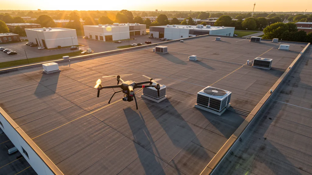
Get Matched With a Local Operator
Roof Inspection Pricing in Glenwood Springs, CO
Low End
$525
High End
$1,850
Turnaround
1-2 days
Cost ranges are based on market data for Glenwood Springs MSA. Actual pricing depends on site size, complexity, and deliverables.
Common Roof Inspection Applications in Glenwood Springs
- Pre-purchase roof assessments
- Insurance claim documentation
- Storm damage evaluation
- Routine maintenance inspections
Local Drone Regulations
Roof inspections in Glenwood Springs require compliance with local drone regulations:
Local Drone Ordinances:
Glenwood Springs Municipal Code Chapter 12.04 regulates activities in city parks; drone operation in parks requires city authorization. Glenwood Springs Municipal Code Chapter 9 covers nuisances with privacy provisions applicable to low-altitude drone flights over residential areas. Commercial filming permits are issued through the Glenwood Springs Community Development Department for city-owned property and public rights-of-way. The city expects Part 107 compliance and coordination with the uncontrolled airport traffic pattern at KGWS.
Restricted Airspace in Glenwood Springs:
- White River National Forest completely surrounds Glenwood Springs; commercial drone operations require a special use permit from the White River National Forest office in Glenwood Springs.
- Flat Tops Wilderness Area (north of Glenwood Springs) prohibits all drone operations as motorized equipment is banned in wilderness areas.
- Hanging Lake USFS-managed area prohibits drone use in the trail corridor and lake surroundings due to fragile ecosystem and National Natural Landmark status.
- Glenwood Canyon I-70 corridor is managed by CDOT; drone operations near the highway require CDOT coordination. The canyon has been subject to frequent closures since the Grizzly Creek Fire (2020) due to debris flows.
- Wildfire TFRs are common in the White River National Forest. The Grizzly Creek Fire burn area continues to generate debris flow events requiring aerial response and TFRs.
Colorado drone regulations require FAA Part 107 certification for all commercial drone operations. Our network of verified operators in Glenwood Springs meets all federal and state requirements.
Drone Regulations in Glenwood Springs, CO
Airports & LAANC Zones
- GWS — Glenwood Springs Municipal Airport (Class E surface area, no control tower, within city limits 1 mile south of downtown)
- EGE — Eagle County Regional Airport (Class D, commercial and GA, 45 miles east; serves Aspen/Vail corridor)
- RIL — Garfield County Regional Airport (Class D part-time, GA and limited commercial, 15 miles northwest near Rifle)
- GJT — Grand Junction Regional Airport (Class D, commercial and GA, 60 miles west)
Restricted Airspace
- White River National Forest completely surrounds Glenwood Springs; commercial drone operations require a special use permit from the White River National Forest office in Glenwood Springs.
- Flat Tops Wilderness Area (north of Glenwood Springs) prohibits all drone operations as motorized equipment is banned in wilderness areas.
- Hanging Lake USFS-managed area prohibits drone use in the trail corridor and lake surroundings due to fragile ecosystem and National Natural Landmark status.
- Glenwood Canyon I-70 corridor is managed by CDOT; drone operations near the highway require CDOT coordination. The canyon has been subject to frequent closures since the Grizzly Creek Fire (2020) due to debris flows.
- Wildfire TFRs are common in the White River National Forest. The Grizzly Creek Fire burn area continues to generate debris flow events requiring aerial response and TFRs.
Local Ordinances
Glenwood Springs Municipal Code Chapter 12.04 regulates activities in city parks; drone operation in parks requires city authorization. Glenwood Springs Municipal Code Chapter 9 covers nuisances with privacy provisions applicable to low-altitude drone flights over residential areas. Commercial filming permits are issued through the Glenwood Springs Community Development Department for city-owned property and public rights-of-way. The city expects Part 107 compliance and coordination with the uncontrolled airport traffic pattern at KGWS.
All drone operations in Glenwood Springs must comply with FAA Part 107 rules. Operators must obtain LAANC authorization before flying in controlled airspace near Glenwood Springs airports. Our network operators handle all permitting and airspace authorizations as part of their service.
Roof Inspection FAQ — Glenwood Springs, CO
How does a drone roof inspection work in Glenwood Springs?
We fly a drone equipped with high-resolution and optional thermal cameras over your roof in Glenwood Springs, capturing detailed imagery of every surface, flashing, and penetration. No ladders, no scaffolding, no risk to personnel.
Can drone roof inspections detect leaks?
Yes. Thermal imaging detects moisture trapped under roofing materials by temperature differentials. This identifies active leaks and areas of concern before they become visible inside the building.
What does a roof inspection report include?
Your report includes high-resolution photos organized by roof section, a condition assessment with annotated problem areas, thermal imagery (if requested), and 3D model data for measurement and documentation. Reports are suitable for insurance claims and maintenance planning.
Drone Regulations FAQ — Glenwood Springs, CO
What type of airspace is at Glenwood Springs Municipal Airport and what does that mean for drone operators?
Glenwood Springs Municipal Airport (KGWS) is a non-towered airport with a Class E surface area. There is no control tower, so LAANC authorization is not required, but Part 107 pilots must still comply with all FAA regulations including maintaining visual line of sight and yielding right-of-way to manned aircraft. The airport sits within city limits near the Roaring Fork River, and the traffic pattern extends over residential areas. Pilots should monitor CTAF frequency 122.8 MHz.
Can I fly a drone in Glenwood Canyon near I-70?
Glenwood Canyon is a narrow, heavily managed transportation corridor along I-70 operated by CDOT. Drone operations near the highway require coordination with CDOT and must not interfere with traffic or emergency operations. The canyon has been subject to frequent closures since the Grizzly Creek Fire of 2020 due to debris flows. Operators should contact the CDOT Region 3 office in Glenwood Springs for coordination.
Do I need a Forest Service permit for aerial imaging work in the White River National Forest around Glenwood Springs?
Yes. The White River National Forest completely surrounds Glenwood Springs, and the Forest Supervisor office is located in Glenwood Springs itself. Commercial drone operations require a special use permit involving FAA Part 107 certification, proof of insurance, and a description of project scope. Wilderness areas including the Flat Tops Wilderness prohibit all drone operations. The permit process can take 60-90 days.
Are drones allowed at Hanging Lake or other Glenwood Springs area natural attractions?
Hanging Lake, a USFS-managed area with a reservation-only trail system, prohibits drone operations within the area including the trail corridor and lake surroundings. The area has special protections due to its fragile ecosystem and National Natural Landmark status. Commercial operators should check with the Eagle-Holy Cross Ranger District for current restrictions.
How does the Roaring Fork Valley housing market affect demand for aerial imaging services in Glenwood Springs?
The Roaring Fork Valley, stretching from Glenwood Springs to Aspen, has some of the most expensive real estate in the Mountain West, creating strong demand for aerial photography, topographic data collection, and construction monitoring services. Residential development is constrained by steep terrain and limited flat land, making accurate topographic mapping essential for builders working on hillside lots.
All Aerial Imaging Services in Glenwood Springs, CO
Compare pricing across all aerial imaging services available in Glenwood Springs, Colorado.
| Service | Low End | High End | Turnaround |
|---|---|---|---|
| Topographic Data Collection | $1,300 | $4,800 | 2-5 days |
| Drone Inspection | $850 | $3,100 | 1-3 days |
| LiDAR Scanning | $2,700 | $8,200 | 3-7 days |
| Environmental Monitoring | $1,050 | $3,600 | 2-5 days |
| Aerial Imagery | $650 | $2,600 | 1-2 days |
| Construction Monitoring | $950 | $3,600 | 1-3 days |
| Real Estate Photography | $425 | $1,550 | 1-2 days |
| Roof Inspection ← you are here | $525 | $1,850 | 1-2 days |
Pricing ranges are based on market data for Glenwood Springs MSA. Actual costs depend on project scope, site conditions, and required deliverables.
Other Aerial Imaging Services in Glenwood Springs, CO
Are You a Drone Operator in Glenwood Springs, CO?
Join our network of FAA-certified operators. Get matched with roof inspection projects in Glenwood Springs and the surrounding Glenwood Springs MSA area.
Apply to Join