Roof Inspection in Lexington, NE
Drone roof inspections with high-resolution imagery and 3D modeling. Identify damage, assess condition, and generate detailed reports for insurance and maintenance.
Serving Dawson & the Lexington, NE Micropolitan Statistical Area (Dawson County, Platte River valley) area
Request a Free Quote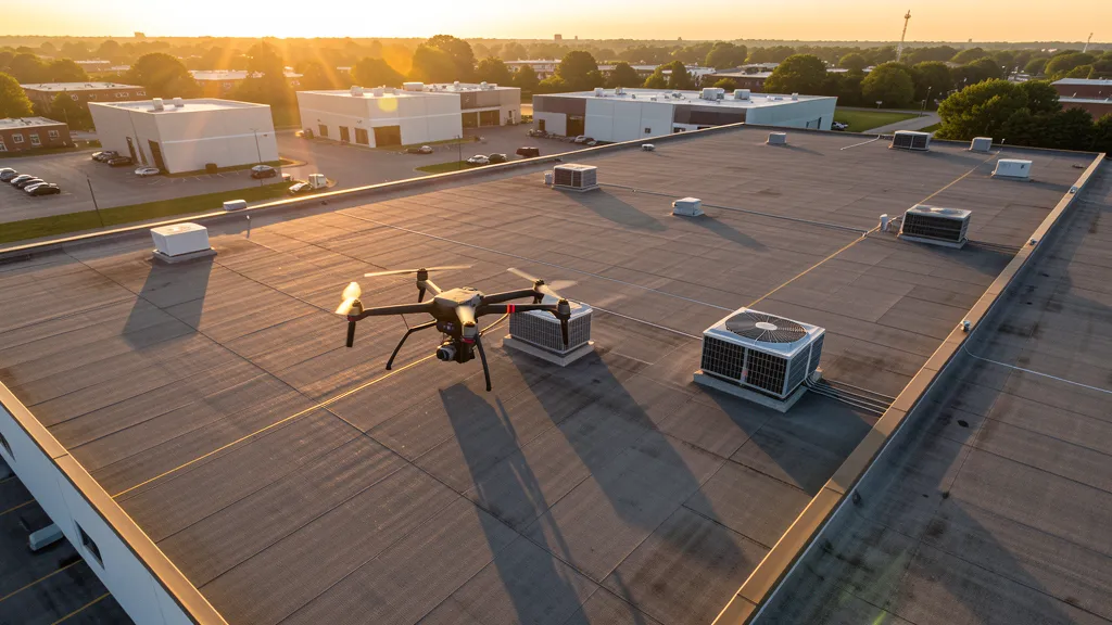
Get Matched With a Local Operator
Roof Inspection Pricing in Lexington, NE
Low End
$200
High End
$500
Turnaround
1-2 days
Cost ranges are based on market data for Lexington, NE Micropolitan Statistical Area (Dawson County, Platte River valley). Actual pricing depends on site size, complexity, and deliverables.
Common Roof Inspection Applications in Lexington
- Pre-purchase roof assessments
- Insurance claim documentation
- Storm damage evaluation
- Routine maintenance inspections
Local Drone Regulations
Roof inspections in Lexington require compliance with local drone regulations:
Local Drone Ordinances:
Lexington does not have a comprehensive city-specific drone ordinance, relying on FAA Part 107 regulations and Nebraska state law. Commercial drone operators must hold a valid FAA Part 107 Remote Pilot Certificate. The Lexington Parks and Recreation Department requires permits for commercial drone takeoff and landing on city-owned park property, including Kirkpatrick Memorial Park and Plum Creek Park. Operations near Lexington Airport (LXN) should follow Class E airspace procedures — while LAANC is not required for Class E surface areas, operators should monitor CTAF 122.9 MHz and file a NOTAM for operations within 5 NM of the airport. Nebraska Game and Parks Commission requires permits for drone operations at Platte River Wildlife Management Area and nearby state recreation lands. Nebraska Revised Statute § 2-4,119 restricts drone surveillance of agricultural operations without owner consent, relevant to the extensive agricultural and livestock operations surrounding Lexington in Dawson County.
Restricted Airspace in Lexington:
- Lexington Airport (LXN) operates in Class E airspace extending from the surface to 14,500 feet MSL. While Class E does not require LAANC authorization for commercial drone operations under Part 107, operators must register their drone with the FAA and maintain visual line of sight. The airport is uncontrolled (no tower), so drone operators should monitor CTAF frequency 122.9 MHz for traffic awareness. Check the FAA B4UFLY app to confirm airspace class at your specific flight location.
- North Platte Regional Airport (LBF) Class D airspace is approximately 55 nautical miles west of Lexington. Operators traveling between Lexington and North Platte along I-80 should be aware of the controlled airspace boundary. LAANC authorization is required for commercial drone operations within the LBF Class D surface area, which extends approximately 4.4 NM from the airport center.
- The Platte River corridor along the southern edge of Lexington contains irrigation infrastructure, diversion dams, and bridge crossings managed by the Central Nebraska Public Power and Irrigation District and the Dawson County Public Power District. Critical infrastructure drone inspections near these facilities should coordinate with property owners. The Platte River bridges on I-80 and US-30 may have specific security considerations for aerial inspection work.
- Lexington city parks require authorization from the Lexington Parks and Recreation Department for commercial drone takeoff and landing on city-owned property. Kirkpatrick Memorial Park, Plum Creek Park, and the Lexington Aquatic Center grounds are popular outdoor spaces where unauthorized drone operations can result in citations. Operations near Lexington Public Schools facilities should coordinate with the school district.
- Nebraska Game and Parks Commission requires permits for drone operations on state wildlife management areas and recreation lands near Lexington. The Platte River Wildlife Management Area and portions of the Mormon Island State Recreation Area along the Platte River corridor are managed by the state and require permits for commercial drone operations. Seasonal sandhill crane and whooping crane migration (February-April) brings additional restrictions on low-altitude flights over wildlife concentrations.
Nebraska drone regulations require FAA Part 107 certification for all commercial drone operations. Our network of verified operators in Lexington meets all federal and state requirements.
Drone Regulations in Lexington, NE
Airports & LAANC Zones
- LXN — Lexington Airport (FAA identifier LXN, Class E airspace, general aviation, no control tower, 3 NM south of downtown)
- GRI — Grand Island Regional Airport (Class E airspace, 55 NM east, nearest commercial charter service, no control tower)
- ODX — Ord Airport (Class E airspace, 65 NM north, general aviation, uncontrolled)
- LBF — North Platte Regional Airport (Lee Bird Field, Class D airspace, 55 NM west, controlled airspace requiring LAANC for commercial drone ops within 5 NM)
Restricted Airspace
- Lexington Airport (LXN) operates in Class E airspace extending from the surface to 14,500 feet MSL. While Class E does not require LAANC authorization for commercial drone operations under Part 107, operators must register their drone with the FAA and maintain visual line of sight. The airport is uncontrolled (no tower), so drone operators should monitor CTAF frequency 122.9 MHz for traffic awareness. Check the FAA B4UFLY app to confirm airspace class at your specific flight location.
- North Platte Regional Airport (LBF) Class D airspace is approximately 55 nautical miles west of Lexington. Operators traveling between Lexington and North Platte along I-80 should be aware of the controlled airspace boundary. LAANC authorization is required for commercial drone operations within the LBF Class D surface area, which extends approximately 4.4 NM from the airport center.
- The Platte River corridor along the southern edge of Lexington contains irrigation infrastructure, diversion dams, and bridge crossings managed by the Central Nebraska Public Power and Irrigation District and the Dawson County Public Power District. Critical infrastructure drone inspections near these facilities should coordinate with property owners. The Platte River bridges on I-80 and US-30 may have specific security considerations for aerial inspection work.
- Lexington city parks require authorization from the Lexington Parks and Recreation Department for commercial drone takeoff and landing on city-owned property. Kirkpatrick Memorial Park, Plum Creek Park, and the Lexington Aquatic Center grounds are popular outdoor spaces where unauthorized drone operations can result in citations. Operations near Lexington Public Schools facilities should coordinate with the school district.
- Nebraska Game and Parks Commission requires permits for drone operations on state wildlife management areas and recreation lands near Lexington. The Platte River Wildlife Management Area and portions of the Mormon Island State Recreation Area along the Platte River corridor are managed by the state and require permits for commercial drone operations. Seasonal sandhill crane and whooping crane migration (February-April) brings additional restrictions on low-altitude flights over wildlife concentrations.
Local Ordinances
Lexington does not have a comprehensive city-specific drone ordinance, relying on FAA Part 107 regulations and Nebraska state law. Commercial drone operators must hold a valid FAA Part 107 Remote Pilot Certificate. The Lexington Parks and Recreation Department requires permits for commercial drone takeoff and landing on city-owned park property, including Kirkpatrick Memorial Park and Plum Creek Park. Operations near Lexington Airport (LXN) should follow Class E airspace procedures — while LAANC is not required for Class E surface areas, operators should monitor CTAF 122.9 MHz and file a NOTAM for operations within 5 NM of the airport. Nebraska Game and Parks Commission requires permits for drone operations at Platte River Wildlife Management Area and nearby state recreation lands. Nebraska Revised Statute § 2-4,119 restricts drone surveillance of agricultural operations without owner consent, relevant to the extensive agricultural and livestock operations surrounding Lexington in Dawson County.
All drone operations in Lexington must comply with FAA Part 107 rules. Operators must obtain LAANC authorization before flying in controlled airspace near Lexington airports. Our network operators handle all permitting and airspace authorizations as part of their service.
Roof Inspection FAQ — Lexington, NE
How does a drone roof inspection work in Lexington?
We fly a drone equipped with high-resolution and optional thermal cameras over your roof in Lexington, capturing detailed imagery of every surface, flashing, and penetration. No ladders, no scaffolding, no risk to personnel.
Can drone roof inspections detect leaks?
Yes. Thermal imaging detects moisture trapped under roofing materials by temperature differentials. This identifies active leaks and areas of concern before they become visible inside the building.
What does a roof inspection report include?
Your report includes high-resolution photos organized by roof section, a condition assessment with annotated problem areas, thermal imagery (if requested), and 3D model data for measurement and documentation. Reports are suitable for insurance claims and maintenance planning.
Drone Regulations FAQ — Lexington, NE
Do I need LAANC authorization for drone flights in Lexington?
Lexington Airport (LXN) is in Class E airspace, which does not require LAANC authorization for commercial drone operations under Part 107. However, you must hold a valid FAA Part 107 Remote Pilot Certificate and comply with all federal regulations. If your flight location is near North Platte Regional Airport (LBF) Class D airspace — approximately 55 miles west — you would need LAANC authorization. Always check the FAA B4UFLY app to confirm airspace class at your specific location before flying.
What is the cost of an aerial imaging for a construction site in Lexington?
Topographic drone data collection in Lexington typically ranges from $700 to $2,200 depending on acreage and terrain. Construction monitoring visits cost $250 to $900 per session. LiDAR scanning runs $1,400 to $4,500. The flat Platte River valley terrain makes aerial imaging efficient, and the active construction market driven by Lexington Regional Health Center expansion, residential workforce housing, and Tyson plant infrastructure creates steady demand for aerial mapping services throughout Dawson County.
Are there drone restrictions near the Platte River corridor in Lexington?
The Platte River corridor along Lexington's southern border contains irrigation infrastructure, diversion dams, and bridge crossings managed by the Central Nebraska Public Power and Irrigation District and the Dawson County Public Power District. FAA Part 107 prohibits flying directly over non-participants and moving vehicles. For infrastructure inspection flights near bridges or canals, coordinate with facility owners. The Platte River is part of a critical migratory bird corridor — avoid low-altitude flights during crane migration season (February-April), and Nebraska Game and Parks requires permits for drone operations on adjacent wildlife management areas.
Can I fly a drone over the Tyson Fresh Meats facility in Lexington?
The Tyson Fresh Meats beef processing plant is one of the largest employers in the region with over 2,700 workers. It is private industrial property, and commercial drone operators must obtain permission from Tyson facility management before conducting aerial mappings or inspections of the plant or its infrastructure. The plant has active truck traffic, rail spurs, and outdoor processing areas where FAA Part 107 prohibits flying directly over non-participants. Coordinate with Tyson security and facilities management for any commercial drone work on or near the plant property.
Does Lexington have city-specific drone regulations beyond Nebraska state law?
Lexington does not have a comprehensive city drone ordinance beyond FAA Part 107 regulations and Nebraska state law. The Lexington Parks and Recreation Department requires permits for commercial drone takeoff and landing on city-owned park property, including Kirkpatrick Memorial Park and Plum Creek Park. Nebraska Revised Statute § 2-4,119 restricts drone surveillance of agricultural operations without owner consent, which is relevant for operators working in the extensive agricultural and livestock areas surrounding Lexington in Dawson County. Nebraska Game and Parks Commission requires permits for drone operations at Platte River Wildlife Management Area.
What construction projects are driving aerial imaging demand in Lexington?
Key construction projects driving demand include the Lexington Regional Health Center outpatient clinic expansion and emergency department renovation, north and west residential subdivision development for workforce housing, commercial retail expansion along Highway 30 and the I-80 interchange, Tyson Fresh Meats plant infrastructure upgrades, and Dawson County road and bridge projects including US-30 widening and Platte River bridge maintenance. The Lexington Industrial Park on the west side is also attracting new light industrial construction through Dawson County economic development efforts.
All Aerial Imaging Services in Lexington, NE
Compare pricing across all aerial imaging services available in Lexington, Nebraska.
| Service | Low End | High End | Turnaround |
|---|---|---|---|
| Topographic Data Collection | $700 | $2,200 | 2-4 days |
| Drone Inspection | $250 | $1,000 | 1-3 days |
| LiDAR Scanning | $1,400 | $4,500 | 3-6 days |
| Environmental Monitoring | $400 | $1,600 | 2-4 days |
| Aerial Imagery | $200 | $700 | 1-2 days |
| Construction Monitoring | $250 | $900 | 1-2 days per visit |
| Real Estate Photography | $125 | $350 | 1-2 days |
| Roof Inspection ← you are here | $200 | $500 | 1-2 days |
Pricing ranges are based on market data for Lexington, NE Micropolitan Statistical Area (Dawson County, Platte River valley). Actual costs depend on project scope, site conditions, and required deliverables.
Are You a Drone Operator in Lexington, NE?
Join our network of FAA-certified operators. Get matched with roof inspection projects in Lexington and the surrounding Lexington, NE Micropolitan Statistical Area (Dawson County, Platte River valley) area.
Apply to Join