Roof Inspection in Milledgeville, GA
Drone roof inspections with high-resolution imagery and 3D modeling. Identify damage, assess condition, and generate detailed reports for insurance and maintenance.
Serving Baldwin & the Milledgeville MSA area
Request a Free Quote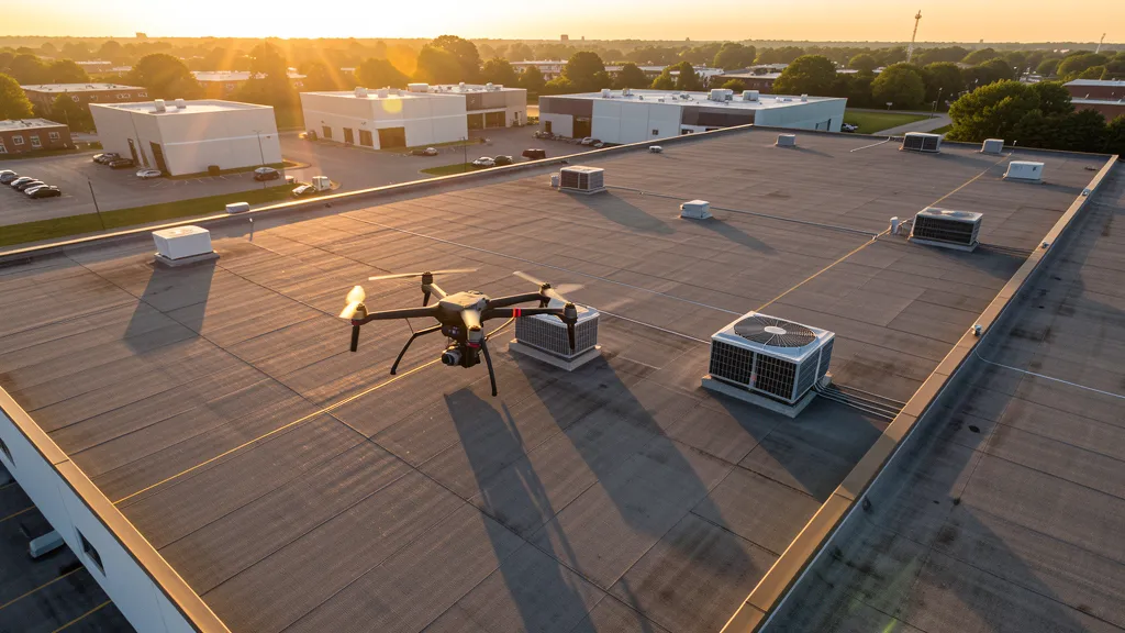
Get Matched With a Local Operator
Roof Inspection Pricing in Milledgeville, GA
Low End
$280
High End
$1,000
Turnaround
1-2 days
Cost ranges are based on market data for Milledgeville MSA. Actual pricing depends on site size, complexity, and deliverables.
Common Roof Inspection Applications in Milledgeville
- Pre-purchase roof assessments
- Insurance claim documentation
- Storm damage evaluation
- Routine maintenance inspections
Local Drone Regulations
Roof inspections in Milledgeville require compliance with local drone regulations:
Local Drone Ordinances:
Milledgeville does not require a separate city drone permit for commercial operations. The City of Milledgeville prohibits drone takeoff and landing in city parks without a permit from the Parks and Recreation Department. Operations within 5 miles of Baldwin County Airport should notify the airport operator per FAA Part 107 voluntary notification guidelines. The Georgia College campus requires coordination with the Georgia College Public Safety Office for commercial drone operations on university property. The historic district including the Old Governor's Mansion and the former state capitol building may require coordination with the Georgia Department of Natural Resources for commercial filming.
Restricted Airspace in Milledgeville:
- Baldwin County Airport (MLJ) has a Class E surface area and active GA traffic including Georgia College flight training. Notify the airport operator when flying within 5 miles per FAA Part 107 guidelines.
- Robins Air Force Base (Class D airspace) is approximately 35 miles south. The northern edge of the Class D may affect southern Baldwin County. LAANC may be required for operations in this area.
- Atrium Health Navicent Baldwin hospital campus has an active helipad for emergency medical flights. Maintain 500 ft clearance from helipad approach corridors during medical helicopter operations.
- Georgia College campus and the Georgia Military College campus have heavy pedestrian traffic during academic sessions. FAA Part 107 prohibits flights directly over non-participants without a waiver.
Georgia drone regulations require FAA Part 107 certification for all commercial drone operations. Our network of verified operators in Milledgeville meets all federal and state requirements.
Drone Regulations in Milledgeville, GA
Airports & LAANC Zones
- MLJ — Baldwin County Airport (untowered GA, 5 miles north)
- MCN — Middle Georgia Regional Airport (Class D, 30 miles southwest in Macon)
- WRB — Robins AFB (Class D, 35 miles south)
Restricted Airspace
- Baldwin County Airport (MLJ) has a Class E surface area and active GA traffic including Georgia College flight training. Notify the airport operator when flying within 5 miles per FAA Part 107 guidelines.
- Robins Air Force Base (Class D airspace) is approximately 35 miles south. The northern edge of the Class D may affect southern Baldwin County. LAANC may be required for operations in this area.
- Atrium Health Navicent Baldwin hospital campus has an active helipad for emergency medical flights. Maintain 500 ft clearance from helipad approach corridors during medical helicopter operations.
- Georgia College campus and the Georgia Military College campus have heavy pedestrian traffic during academic sessions. FAA Part 107 prohibits flights directly over non-participants without a waiver.
Local Ordinances
Milledgeville does not require a separate city drone permit for commercial operations. The City of Milledgeville prohibits drone takeoff and landing in city parks without a permit from the Parks and Recreation Department. Operations within 5 miles of Baldwin County Airport should notify the airport operator per FAA Part 107 voluntary notification guidelines. The Georgia College campus requires coordination with the Georgia College Public Safety Office for commercial drone operations on university property. The historic district including the Old Governor's Mansion and the former state capitol building may require coordination with the Georgia Department of Natural Resources for commercial filming.
All drone operations in Milledgeville must comply with FAA Part 107 rules. Operators must obtain LAANC authorization before flying in controlled airspace near Milledgeville airports. Our network operators handle all permitting and airspace authorizations as part of their service.
Roof Inspection FAQ — Milledgeville, GA
How does a drone roof inspection work in Milledgeville?
We fly a drone equipped with high-resolution and optional thermal cameras over your roof in Milledgeville, capturing detailed imagery of every surface, flashing, and penetration. No ladders, no scaffolding, no risk to personnel.
Can drone roof inspections detect leaks?
Yes. Thermal imaging detects moisture trapped under roofing materials by temperature differentials. This identifies active leaks and areas of concern before they become visible inside the building.
What does a roof inspection report include?
Your report includes high-resolution photos organized by roof section, a condition assessment with annotated problem areas, thermal imagery (if requested), and 3D model data for measurement and documentation. Reports are suitable for insurance claims and maintenance planning.
Drone Regulations FAQ — Milledgeville, GA
Do I need LAANC authorization to fly a drone in Milledgeville?
No. Baldwin County Airport (MLJ) is an untowered GA field with a Class E surface area. LAANC is not required for most of Milledgeville. However, if your project site is in southern Baldwin County, you may be near the northern edge of Robins AFB Class D airspace. Always check the FAA B4UFLY app to confirm airspace classification.
Can I fly a drone over the Georgia College campus?
Commercial drone operations on Georgia College property require coordination with the Georgia College Public Safety Office. The campus has heavy pedestrian traffic during academic sessions, and FAA Part 107 prohibits flying directly over people who are not part of your operation. Schedule flights during breaks or early morning hours.
Are there restrictions for flying drones near Atrium Health Navicent Baldwin?
Yes. The hospital has an active emergency medical helipad. FAA Part 107 requires yielding right-of-way to manned aircraft, including medical helicopters. Maintain at least 500 ft clearance from the helipad approach corridor, and check for active TFRs during emergency medical operations.
Can I fly a drone over the historic district and the Old Governor's Mansion?
The Milledgeville Commercial Historic District and the Old Governor's Mansion are state historic sites managed by the Georgia Department of Natural Resources. Commercial filming and drone operations may require coordination with the DNR. The campus area has pedestrian traffic and guided tours. Schedule flights during off-peak hours and avoid flying directly over non-participants.
What construction projects in Milledgeville need aerial imaging services?
The Atrium Health Navicent Baldwin hospital campus renovation, Georgia College student housing and academic building expansion, and Lake Sinclair residential development are the primary construction markets. Downtown historic district revitalization and the Andalusia farmhouse restoration also generate specialized data collection needs.
Can I fly a drone over Lake Sinclair for residential real estate photography?
Yes, with standard FAA Part 107 compliance. Lake Sinclair has extensive residential and vacation home development along its shoreline. Maintain the 400 ft altitude ceiling, avoid flying over boaters and swimmers, and coordinate with homeowners associations if takeoff and landing from community property is needed. The lake is popular for aerial real estate photography of waterfront properties.
All Aerial Imaging Services in Milledgeville, GA
Compare pricing across all aerial imaging services available in Milledgeville, Georgia.
| Service | Low End | High End | Turnaround |
|---|---|---|---|
| Topographic Data Collection | $1,100 | $4,200 | 3-5 days |
| Drone Inspection | $400 | $2,200 | 1-3 days |
| LiDAR Scanning | $2,000 | $8,000 | 5-7 days |
| Environmental Monitoring | $600 | $3,000 | 2-4 days |
| Aerial Imagery | $300 | $1,400 | 1-2 days |
| Construction Monitoring | $350 | $1,800 | 1-3 days per visit |
| Real Estate Photography | $180 | $800 | 1-2 days |
| Roof Inspection ← you are here | $280 | $1,000 | 1-2 days |
Pricing ranges are based on market data for Milledgeville MSA. Actual costs depend on project scope, site conditions, and required deliverables.
Other Aerial Imaging Services in Milledgeville, GA
Roof Inspection in Nearby Cities
Are You a Drone Operator in Milledgeville, GA?
Join our network of FAA-certified operators. Get matched with roof inspection projects in Milledgeville and the surrounding Milledgeville MSA area.
Apply to Join