Roof Inspection in Vancouver, WA
Drone roof inspections with high-resolution imagery and 3D modeling. Identify damage, assess condition, and generate detailed reports for insurance and maintenance.
Serving Clark County & the Portland area
Request a Free Quote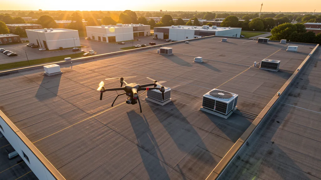
Get Matched With a Local Operator
Roof Inspection Pricing in Vancouver, WA
Low End
$320
High End
$1,200
Turnaround
1-2 days
Cost ranges are based on market data for Portland. Actual pricing depends on site size, complexity, and deliverables.
Common Roof Inspection Applications in Vancouver
- Pre-purchase roof assessments
- Insurance claim documentation
- Storm damage evaluation
- Routine maintenance inspections
Local Drone Regulations
Roof inspections in Vancouver require compliance with local drone regulations:
Local Drone Ordinances:
Vancouver requires a business license for commercial drone operations. The city regulates drone takeoff and landing on city-owned property including parks, the Waterfront Renaissance Trail, and Esther Short Park. Contact the Parks Department for filming permits. Washington ESSB 6001 governs law enforcement drone use. Much of Vancouver is within PDX Class C or VUO Class D airspace, requiring LAANC authorization. The Vancouver National Historic Reserve and Fort Vancouver may have additional federal restrictions. Commercial drone operators must obtain a City of Vancouver business license.
Restricted Airspace in Vancouver:
- PDX Class C airspace extends over much of Vancouver, particularly the western and southern areas. LAANC authorization is required for commercial drone flights in the Class C area. Check FAA UAS Facility Maps for specific altitude restrictions. The Class C shelf varies by altitude with lower shelves near the airport.
- Pearson Field (VUO) Class D airspace covers downtown Vancouver and the Columbia River waterfront. LAANC authorization is required for commercial drone flights in the VUO Class D area. Pearson Field is one of the oldest operating airports in the United States, with active general aviation operations.
- The Columbia River forms the border between Vancouver and Portland. Drone flights over the Columbia River should maintain visual line of sight and be aware of barge traffic, recreational boating, and floatplane operations. The I-5 and I-205 bridges are critical infrastructure.
- The Vancouver National Historic Reserve and Fort Vancouver are National Park Service properties with potential flight restrictions. Drone flights over federal historic sites may be prohibited. Check National Park Service regulations before flying near Fort Vancouver.
- The Port of Vancouver USA operates a major marine terminal and industrial facility on the Columbia River. Drone flights over port facilities require coordination with port security. The port handles grain, auto, and bulk cargo with extensive industrial operations.
Washington drone regulations require FAA Part 107 certification for all commercial drone operations. Our network of verified operators in Vancouver meets all federal and state requirements.
Drone Regulations in Vancouver, WA
Airports & LAANC Zones
- PDX - Portland International Airport (Class C, towered, 5 miles south, major commercial hub)
- VUO - Pearson Field Airport (Class D, towered, adjacent to downtown, general aviation + historic)
Restricted Airspace
- PDX Class C airspace extends over much of Vancouver, particularly the western and southern areas. LAANC authorization is required for commercial drone flights in the Class C area. Check FAA UAS Facility Maps for specific altitude restrictions. The Class C shelf varies by altitude with lower shelves near the airport.
- Pearson Field (VUO) Class D airspace covers downtown Vancouver and the Columbia River waterfront. LAANC authorization is required for commercial drone flights in the VUO Class D area. Pearson Field is one of the oldest operating airports in the United States, with active general aviation operations.
- The Columbia River forms the border between Vancouver and Portland. Drone flights over the Columbia River should maintain visual line of sight and be aware of barge traffic, recreational boating, and floatplane operations. The I-5 and I-205 bridges are critical infrastructure.
- The Vancouver National Historic Reserve and Fort Vancouver are National Park Service properties with potential flight restrictions. Drone flights over federal historic sites may be prohibited. Check National Park Service regulations before flying near Fort Vancouver.
- The Port of Vancouver USA operates a major marine terminal and industrial facility on the Columbia River. Drone flights over port facilities require coordination with port security. The port handles grain, auto, and bulk cargo with extensive industrial operations.
Local Ordinances
Vancouver requires a business license for commercial drone operations. The city regulates drone takeoff and landing on city-owned property including parks, the Waterfront Renaissance Trail, and Esther Short Park. Contact the Parks Department for filming permits. Washington ESSB 6001 governs law enforcement drone use. Much of Vancouver is within PDX Class C or VUO Class D airspace, requiring LAANC authorization. The Vancouver National Historic Reserve and Fort Vancouver may have additional federal restrictions. Commercial drone operators must obtain a City of Vancouver business license.
All drone operations in Vancouver must comply with FAA Part 107 rules. Operators must obtain LAANC authorization before flying in controlled airspace near Vancouver airports. Our network operators handle all permitting and airspace authorizations as part of their service.
Roof Inspection FAQ — Vancouver, WA
How does a drone roof inspection work in Vancouver?
We fly a drone equipped with high-resolution and optional thermal cameras over your roof in Vancouver, capturing detailed imagery of every surface, flashing, and penetration. No ladders, no scaffolding, no risk to personnel.
Can drone roof inspections detect leaks?
Yes. Thermal imaging detects moisture trapped under roofing materials by temperature differentials. This identifies active leaks and areas of concern before they become visible inside the building.
What does a roof inspection report include?
Your report includes high-resolution photos organized by roof section, a condition assessment with annotated problem areas, thermal imagery (if requested), and 3D model data for measurement and documentation. Reports are suitable for insurance claims and maintenance planning.
Drone Regulations FAQ — Vancouver, WA
Do I need LAANC authorization to fly a drone in Vancouver?
Much of Vancouver is within PDX Class C airspace (Portland International Airport) or VUO Class D airspace (Pearson Field). LAANC authorization is required for flights in these areas. Check FAA UAS Facility Maps for your specific location and altitude. Some eastern areas of Vancouver may be in Class G uncontrolled airspace. Plan ahead as PDX Class C can have altitude restrictions.
What is driving the construction boom in Vancouver?
Vancouver is the fastest-growing city in Washington by population. The Vancouver Waterfront mixed-use development on the Columbia River is transformative. Portland metro spillover and no state income tax are driving residential growth, particularly in Salmon Creek. The Port of Vancouver USA is expanding with terminal upgrades. The I-5 Bridge Replacement program is a major infrastructure project.
Can I fly a drone over Fort Vancouver National Historic Site?
Fort Vancouver is a National Park Service property and part of the Vancouver National Historic Reserve. Drone flights over federal historic sites and National Park Service properties may be prohibited. Check National Park Service regulations before flying near Fort Vancouver. The site includes reconstructed historic buildings and archaeological resources that require protection.
Are there restrictions on flying drones over the Columbia River from Vancouver?
Drone flights over the Columbia River should maintain visual line of sight and be aware of barge traffic, recreational boating, and floatplane operations. The I-5 and I-205 bridges are critical infrastructure that should be given wide berth. Much of the riverfront area is within VUO Class D or PDX Class C airspace, requiring LAANC authorization.
How much does an aerial imaging cost in Vancouver?
Topographic data collection projects in Vancouver range from $1,000 to $3,800. LiDAR scanning costs $2,300 to $6,800. Construction monitoring runs $850 to $3,200. Pricing reflects the Portland metro market. LAANC authorization complexity for PDX Class C and VUO Class D may add planning time.
All Aerial Imaging Services in Vancouver, WA
Compare pricing across all aerial imaging services available in Vancouver, Washington.
| Service | Low End | High End | Turnaround |
|---|---|---|---|
| Topographic Data Collection | $1,000 | $3,800 | 3-5 days |
| Drone Inspection | $650 | $2,500 | 2-4 days |
| LiDAR Scanning | $2,300 | $6,800 | 4-9 days |
| Environmental Monitoring | $1,200 | $4,400 | 3-6 days |
| Aerial Imagery | $400 | $1,500 | 1-2 days |
| Construction Monitoring | $850 | $3,200 | 2-5 days |
| Real Estate Photography | $280 | $1,100 | 1-2 days |
| Roof Inspection ← you are here | $320 | $1,200 | 1-2 days |
Pricing ranges are based on market data for Portland. Actual costs depend on project scope, site conditions, and required deliverables.
Are You a Drone Operator in Vancouver, WA?
Join our network of FAA-certified operators. Get matched with roof inspection projects in Vancouver and the surrounding Portland area.
Apply to Join