How to Become a Drone Operator in 2026: Complete Career Guide

Aerial imaging is one of the fastest-growing fields in commercial aviation and geospatial services. Drone operators use drones equipped with cameras, LiDAR sensors, and other instruments to capture aerial data for construction, mining, agriculture, real estate, and infrastructure projects. The work is technical, well-paid, and in demand: the commercial drone services market is projected to exceed $60 billion by 2030, with mapping and data collection representing one of the largest segments.
If you are wondering how to become a drone operator, this guide walks through every step: FAA certification, equipment selection, flight training, business setup, and client acquisition. By the end, you will have a clear roadmap from zero experience to your first paying data collection job.
What Does a Drone Operator Do?
A drone operator operates unmanned aircraft to collect aerial data that gets processed into maps, 3D models, point clouds, and measurements. The deliverables vary by project type:
- Topographic data collections: Contour maps and digital elevation models for construction site planning
- Construction monitoring: Weekly or monthly aerial progress photos and volume calculations
- Volumetric analysis: Stockpile measurements and cut/fill calculations for quarries and material yards
- Inspection: High-resolution and thermal imaging of bridges, roofs, cell towers, and utilities
- Real estate photography: Aerial photos and video for property listings
- Environmental monitoring: Wetland delineation, erosion tracking, and habitat assessment
The job combines three skill sets: piloting, data collection planning, and data processing. You need to fly safely and legally, plan flights that capture the right imagery with proper overlap and ground control, and process the raw data into deliverables using photogrammetry software.
How Much Can a Drone Operator Earn?
Drone operator income varies widely based on specialization, location, and business model:
- Entry-level (Part 107 only, basic equipment): $30,000 to $50,000 per year working as a pilot for an existing data collection or engineering firm
- Mid-level (2-3 years, specialized equipment): $50,000 to $80,000 per year with construction or inspection specialization
- Independent business owner: $75,000 to $150,000+ per year once you have recurring clients and a full equipment package
- Enterprise-level (LiDAR, mining, multiple pilots): $200,000+ per year for established businesses with multiple aircraft and specialized sensors
Per-project earnings depend on service type and acreage. A 10-acre topographic data collection typically bills at $2,000 to $5,000. A single roof inspection runs $200 to $900. Construction monitoring packages range from $350 per flight to $3,000 per month for weekly visits. See our aerial imaging cost guide for detailed pricing by service type.
Step 1: Get Your FAA Part 107 Certification
The FAA Part 107 Remote Pilot Certificate is the only legally required credential for commercial drone operations in the United States. You cannot fly a drone for compensation without it.
What the Test Covers
The Part 107 knowledge test is a 60-question multiple-choice exam covering five subject areas:
- Regulations: FAA rules for small UAS (under 55 lbs), registration requirements, operating limitations
- Operating requirements: Visual line of sight, maximum altitude (400 feet), airspace classifications, LAANC authorization
- Aviation weather: Reading METARs, understanding density altitude, wind effects, micrometeorology
- Emergency procedures: Lost link, flyaway, battery failure, safety management
- Airspace and chart reading: Sectional charts, controlled airspace, restricted areas, special use airspace
How to Prepare
The test costs $175 and is administered at FAA-approved testing centers (PSI and LaserGrade). You need a minimum score of 70% to pass. Most people spend 15 to 30 hours studying. Here are the most effective preparation resources:
- Free study materials: The FAA's Part 107 Study Guide (ACS-10) is available for free on the FAA website and covers every test topic
- Online courses ($150 to $300): RemotePilot101, Pilot Institute, and Drone Pilot Ground School all offer structured video courses with practice tests
- Practice exams: Take at least 3 full practice tests before scheduling the real exam. Free practice tests are available from the FAA and several training providers
- Sectional charts: Spend extra time on chart reading and airspace classification, as this is where most test takers lose points
Once you pass, your certificate is valid for two years. Recurrent training (either online or in-person) is required to maintain it. The recurrent requirement was simplified in 2021 to an online training module, no re-test needed.
Additional Certifications
Part 107 is the legal minimum, but several additional credentials can help you stand out:
- ASPRS Certified Photogrammetrist: Demonstrates technical competence in photogrammetry and mapping. Requires experience and a written exam.
- FAA Part 107 Night Waiver: While night flying is now allowed under Part 107 without a waiver (since 2021), you must complete updated training. This opens up inspection and monitoring work that happens after dark.
- OSHA 30: Useful if you plan to work on active construction sites or industrial facilities
- State-specific licenses: Some states have additional requirements. Check your state's regulations before operating commercially.
In practice, many successful drone operators did not start in aerial imaging at all. Some came from biology and GIS backgrounds, others from real estate photography, and still others from construction site management. The common thread is rarely a linear career path—nearly all of them got Part 107 certified first, then learned photogrammetry software, and then found their first clients through construction firms or drone service marketplaces. If you are transitioning from another field, your existing domain knowledge is an asset, not a detour. A construction professional understands site logistics; a real estate photographer understands client communication; a GIS analyst understands spatial data. Each background gives you a head start in a specific niche of aerial imaging.
Step 2: Choose Your Equipment
Your equipment determines what services you can offer and what quality you can deliver. There are three tiers of aerial imaging equipment, from starter kits to enterprise-grade systems.
Starter Tier ($3,000 to $8,000)
This tier is for new drone operators building a portfolio and taking on smaller projects. You can handle basic aerial imagery, real estate photography, and simple topographic data collection.
- Drone: DJI Mavic 3 Enterprise or DJI Air 2S. The Mavic 3 Enterprise includes an RTK module for centimeter-level positioning.
- Software: DroneDeploy or Pix4D Cloud subscription ($300 to $500/month) for photogrammetry processing
- Accessories: Extra batteries (4 minimum), ND filters, hard case, propeller guards
- Ground control: Basic ground control points (GCPs) and a handheld GPS rover for marking targets
Professional Tier ($15,000 to $50,000)
This is the sweet spot for a working aerial imaging business. You can handle construction monitoring, topographic data collection, volumetric analysis, and detailed inspections.
- Drone: DJI Matrice 350 RTK or DJI Phantom 4 RTK. The Matrice 350 is the industry workhorse with swappable payloads, 55-minute flight time, and centimeter-level accuracy.
- Sensors: Zenmuse P1 (full-frame photogrammetry camera), Zenmuse H30T (thermal + visual inspection), or Zenmuse L2 (LiDAR)
- Software: Pix4D Mapper or Agisoft Metashape Pro (desktop processing, no recurring fees) plus DroneDeploy for client-facing deliverables
- Ground control: RTK rover (Emlid Reach RS2+ or Trimble R2) for precise GCP placement
- Tablet: DJI RC Pro Enterprise or rugged Android tablet for flight control
Enterprise Tier ($80,000+)
For 3D scanninging, mining, and large-scale infrastructure work. This tier requires significant investment but commands the highest project rates.
- Drone: DJI Matrice 350 RTK or specialized platforms like the Wingcopter 198
- LiDAR sensor: Riegl miniVUX-3UAV, Hesai XT-32, or DJI Zenmuse L2. These sensors cost $12,000 to $80,000 and can penetrate vegetation for bare-earth models.
- Software: LiDAR processing tools (TerraSolid, LP360, or CloudCompare) plus photogrammetry software
- Base station: RTK base station for real-time corrections without GCPs
For a detailed breakdown of how equipment affects project pricing, see our aerial imaging cost calculator.
Many new drone operators underestimate the ongoing cost of processing software. DroneDeploy and Pix4D Cloud subscriptions run $300 to $500 per month, which is a significant recurring expense on top of your drone hardware. It's common for pilots just starting out to prefer desktop software like Agisoft Metashape Pro, which offers a one-time license with no monthly fees, allowing you to keep overhead low while you build your client base. The trade-off is that desktop software has a steeper learning curve and lacks the cloud collaboration features that larger clients may eventually expect.
Step 3: Build Flight Experience and Processing Skills
Certification gets you legal. Practice gets you competent. The two skills you need to develop are flight planning and data processing.
Flight Planning Practice
Before flying paid jobs, log at least 50 hours of practice flights. Focus on:
- Grid missions: Practice flying automated grid patterns with proper overlap (70% front, 60% side for photogrammetry). Most flight planning apps (DroneDeploy, Pix4Dcapture, DJI Pilot 2) handle this automatically, but you need to understand how overlap and altitude affect data quality.
- Orbit and inspection flights: Practice manual orbit patterns around structures. Inspection work requires controlled, smooth flight that captures every angle of a subject.
- Different terrain: Fly in open fields, urban environments, and hilly terrain. Each presents different challenges for flight planning and ground control placement.
- Weather conditions: Practice in light wind (under 10 mph) and varying lighting conditions. Overcast days produce more consistent imagery than bright sun with harsh shadows.
Data Processing Training
Processing is where raw images become deliverables. This is the skill that separates drone pilots from drone operators. Focus on:
- Photogrammetry fundamentals: Understand how overlap, ground sampling distance (GSD), and camera calibration affect output quality
- Software proficiency: Learn one processing tool thoroughly before branching out. Pix4D Mapper and Agisoft Metashape are the industry standards for survey-grade work.
- Quality control: Learn to read processing reports, check root mean square error (RMSE) values, and verify accuracy against ground control points
- Deliverable formats: Practice exporting orthomosaics (GeoTIFF), point clouds (LAS/LAZ), digital elevation models, and 3D mesh models
Recommended training resources:
- Pix4D offers free online certification courses covering their software end-to-end
- Agisoft Metashape has extensive tutorial videos on YouTube
- The ASPRS (American Society for Photogrammetry and Remote Sensing) offers workshops and certification programs
In practice, the accuracy question is often what separates the hired pilot from the one who does not get the job. Clients frequently ask about accuracy before hiring—and many new drone operators stumble here because they cannot confidently explain the difference between RTK, PPK, and GPS-only workflows, or articulate what 1 to 3 centimeter accuracy means in practical terms. Being able to walk a client through how ground control points work, why RTK corrections matter, and what RMSE values you typically achieve on similar projects is a differentiator that signals competence. If you can speak fluently about accuracy in a pre-job conversation, you are already ahead of most pilots competing for the same work.
Step 4: Choose Your Specialization
Aerial imaging is a broad field. Most successful operators specialize in one or two service areas rather than trying to do everything. Here are the main specializations and what each requires:
Construction Monitoring and Topographic Data Collection
The largest market for aerial imaging. Construction firms need weekly or monthly aerial progress documentation, topographic data collection for site planning, and volume calculations for earthwork tracking. Requires photogrammetry equipment and construction site safety awareness. This is the best specialization for new drone operators because the volume of work is high and the technical requirements are manageable with a professional-tier setup.
Roof and Infrastructure Inspection
Inspection work pays well per project ($200 to $6,000 per job) but requires specialized sensors. Thermal imaging is a major differentiator, as roof inspections, solar panel inspections, and electrical inspections all benefit from temperature data. This specialization requires less processing skill but more manual flying precision.
Real Estate Photography
The lowest barrier to entry. Residential real estate drone photography pays $150 to $500 per shoot and requires only a basic drone and photography skills. Good for building flight hours and portfolio, but the per-job revenue is lower than data collection work.
Agriculture and Multispectral Imaging
Crop health analysis using multispectral sensors (NDVI). This requires specialized sensors and knowledge of agricultural workflows. The market is concentrated in farming regions and requires relationship building with agronomists and farm managers.
3D Scanning
The highest-revenue specialization but also the highest barrier to entry. LiDAR equipment costs $12,000 to $80,000+ and requires advanced processing skills. 3D surveyors handle forestry, corridor mapping (roads, pipelines, power lines), and flood analysis where photogrammetry cannot penetrate vegetation.
Step 5: Set Up Your Business
Once you have certification, equipment, and skills, you need a legal business structure to operate commercially.
Business Formation
- Entity type: An LLC (Limited Liability Company) is the most common structure for solo drone operators. It protects personal assets and costs $50 to $500 to set up depending on your state. An S-Corporation may be beneficial once revenue exceeds $80,000 per year for tax optimization.
- Business name: Choose a name that communicates professionalism. Many drone operators use their own name plus 'Aerial Mapping' or 'Drone Services.'
- Business bank account: Keep business and personal finances separate from day one.
- Accounting: Track all equipment purchases, software subscriptions, mileage, and project revenue. Most drone operators use QuickBooks or FreshBooks.
Insurance
Insurance is non-negotiable for commercial drone operations. Most clients require proof of insurance before hiring you.
- Liability insurance: $1 million to $5 million in general liability coverage. Specialized drone insurance providers like SkyWatch, Thimble, and BW Flynn offer policies starting at $500 to $1,500 per year for solo operators.
- Hull insurance: Covers damage to your drone. Typically 5% to 10% of the drone's value annually.
- Errors and omissions: Professional liability coverage for data collection accuracy. Recommended once you are producing deliverables for construction or engineering clients.
Pricing Strategy
Price your services based on the value you deliver, not just your time. Most drone operators use one of three pricing models:
- Per-acre pricing: $60 to $1,800 per acre depending on service type. Per-acre costs drop as project size increases due to economies of scale. See our aerial imaging cost guide for detailed pricing benchmarks.
- Per-flight pricing: $350 to $5,000 per flight, common for construction monitoring and inspection work
- Retainer pricing: $1,500 to $10,000 per month for recurring monitoring packages (weekly or monthly construction site visits)
When quoting jobs, provide clear deliverables, turnaround time, and accuracy specifications. Clients will pay more for guaranteed accuracy and fast delivery. Use our drone vs traditional ground-based methods comparison to help clients understand the value proposition.
Step 6: Find Clients
Getting your first paying clients is the hardest part of starting any business. Here are the most effective channels for drone operators:
Join a Marketplace
Platforms like AeriusView connect clients who need aerial imaging with qualified local operators. This is the fastest way to get your first jobs because the platform handles lead generation, quoting, and client communication. You focus on flying and processing. AeriusView serves 626 cities across 15 states, so there is likely demand in your area.
Direct Outreach to Construction Firms
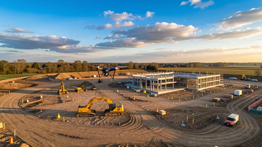
Construction companies are the largest consumers of aerial imaging services. Reach out to general contractors, excavation companies, and engineering firms in your area. Offer a free demonstration flight on one of their active sites. Once they see the quality and speed of drone data, recurring monitoring contracts often follow.
Real Estate Agents and Brokers
Real estate photography is a good entry point. Contact local brokerages and offer aerial photography packages for luxury and commercial property listings. Many agents pay $150 to $500 per shoot and need new listings photographed regularly.
Engineering and Aerial Data Acquisition Firms
Traditional land data collection firms increasingly partner with drone operators to handle the aerial portion of their projects. This is a B2B relationship: the aerial imaging firm subcontracts you for the drone work while they handle boundary determination and legal certification. Reach out to local PLS (Professional Land Surveyor) firms and offer your services as a subcontractor.
Insurance and Roofing Companies
Insurance adjusters and roofing companies need roof inspections after storms. This is a high-volume market in storm-prone regions. Contact local insurance agencies and roofing companies to offer post-storm inspection services.
Build a Portfolio Website
A professional website with sample deliverables (orthomosaic maps, 3D models, inspection reports) builds credibility. Include your FAA certification number, insurance information, service area, and pricing. Showcase before-and-after examples of your work. A simple website with 5 to 10 project examples is enough to start landing clients.
Many new drone operators find that it takes roughly 3 to 6 months from Part 107 certification to their first paying client. The fastest path is almost always joining a marketplace or partnering with an existing aerial imaging firm that needs drone capability but has not built it in-house. Going fully solo from day one—cold-calling construction firms with no portfolio and no referrals—is significantly harder and typically takes longer. If cash flow is a concern while you build your business, consider subcontracting for an established aerial imaging company first; it pays less per project but generates income quickly while you develop your own client base.
Step 7: Scale Your Business
Once you have a steady stream of clients, scaling becomes the next challenge. Here are the primary growth paths:
Add Services
Expand from basic photogrammetry to higher-value services like LiDAR scanning, thermal inspection, or volumetric analysis. Each new service requires equipment investment but opens a new revenue stream with less competition.
Hire Pilots
Once you have more work than you can handle, hire Part 107-certified pilots to fly jobs while you handle client management, processing, and business development. This is the transition from solo operator to business owner.
Expand Your Service Area
Most drone operators start within a 50-mile radius. Expanding to 100 to 200 miles opens up more projects, especially in rural areas where competition is low. Travel fees ($0.50 to $1.50 per mile) keep remote projects profitable.
Bid on Government Contracts
Federal, state, and local government agencies contract aerial imaging services for infrastructure inspection, environmental monitoring, and public works documentation. These contracts are typically larger and longer-term than private work. Register on SAM.gov to bid on federal contracts.
Frequently Asked Questions
How long does it take to become a drone operator?
You can get your FAA Part 107 certification in 2 to 4 weeks with focused study. Building the flight experience and data processing skills to take on paying data collection work takes another 2 to 6 months. Most new drone operators land their first paying client within 3 to 6 months of getting certified, assuming they invest in equipment and practice consistently.
How much does a drone operator make?
Drone operator income ranges from $30,000 per year for entry-level pilots working for established firms to $150,000+ per year for independent business owners with recurring clients. Per-project earnings typically range from $200 for a basic inspection to $5,000 for a 10-acre topographic data collection. Established businesses with LiDAR equipment and multiple pilots can exceed $200,000 per year.
Do I need a college degree to be a drone operator?
No. The FAA Part 107 certification does not require any college education. You need to be at least 16 years old, pass the knowledge test, and pass a TSA background check. However, a background in aerial imaging, engineering, GIS, or photography will help you learn faster and command higher rates.
Do I need to be a licensed land surveyor to do aerial imaging?
No. You do not need to be a licensed Professional Land Surveyor (PLS) to fly drones and produce maps, point clouds, volumetric calculations, or 3D models for construction monitoring, inspection, or progress documentation. However, certain deliverables—boundary data collection projects, property line determinations, and anything that will be legally stamped or recorded—require a PLS. Some drone pilots eventually pursue a PLS license, but that is a separate path that can take 8 to 10 years depending on your state's education, experience, and examination requirements. The key distinction is knowing what you can legally produce and sign off on versus what requires a licensed surveyor's stamp. Many drone operators build a strong business without ever becoming a PLS by focusing on construction monitoring, volumetrics, inspection, and other non-boundary work.
What equipment do I need to start an aerial imaging business?
A starter aerial imaging setup costs $3,000 to $8,000 and includes a DJI Mavic 3 Enterprise drone, photogrammetry software subscription, extra batteries, and basic ground control points. A professional setup that can handle construction monitoring and detailed topographic data collection costs $15,000 to $50,000. Enterprise LiDAR setups start at $80,000. Start with the minimum equipment for your chosen specialization and upgrade as revenue allows.
Is aerial imaging a good career in 2026?
Yes. The commercial drone services market is growing rapidly, with aerial imaging and mapping representing one of the largest and highest-paying segments. Construction firms, engineering companies, and government agencies are increasing their use of aerial imaging as the technology proves its value over traditional methods. Aerial imaging flights cost 50 to 75 percent less than traditional ground-based data collection while delivering comparable accuracy for most applications. See our drone vs traditional ground-based methods comparison for details.
Can I do aerial imaging without a pilot's license?
You cannot fly a drone for commercial compensation without an FAA Part 107 Remote Pilot Certificate. This is not a traditional pilot's license for manned aircraft, it is a knowledge-based certification specific to small unmanned aircraft. The test costs $175 and covers regulations, airspace, weather, and emergency procedures. You do not need flight training or a medical certificate, just the knowledge test.
Ready to start your aerial imaging career? Join the AeriusView network to find clients in your area, or browse our aerial imaging services to see what deliverables clients are looking for.
Need an Operator?
Get matched with FAA-certified aerial mapping professionals in your area. No cost, no obligation.
Get a Free QuoteFind a Drone Operator in Your Area
We connect project managers with FAA-certified drone operators across 15 states. Browse our location pages to find local aerial mapping services near you.
Browse All Locations