LiDAR vs Photogrammetry: Which Imaging Method Wins in 2026
LiDAR vs photogrammetry is the single biggest technology decision a project manager or drone operator makes in 2026. Pick the wrong method and you either overspend on a sensor you did not need, or you deliver a surface model that misses the ground under vegetation. The good news is that the tradeoffs are now well understood, and the right call depends on your site conditions, deliverable requirements, and budget. This guide breaks down real accuracy numbers, real equipment costs, and when to use LiDAR aerial imaging workflows versus photogrammetry, with a practical decision framework you can apply to your next project.
If you already know you need LiDAR and want to find a qualified provider, check our LiDAR scanning services page. If you are still deciding, the comparison below covers what matters.
LiDAR vs Photogrammetry: What Has Changed in 2026
The gap between these two technologies narrowed significantly this year, but it did not close. Drone LiDAR sensors that cost $50,000-plus in 2023 now start around $12,000 to $20,000 for entry-level units, with professional-grade payloads running $30,000 to $80,000. That price drop put LiDAR within reach of mid-size data collection firms for the first time. Meanwhile, photogrammetry processing got faster and cheaper, with cloud platforms returning initial results for 50-acre sites in under two hours compared to overnight runs two years ago.
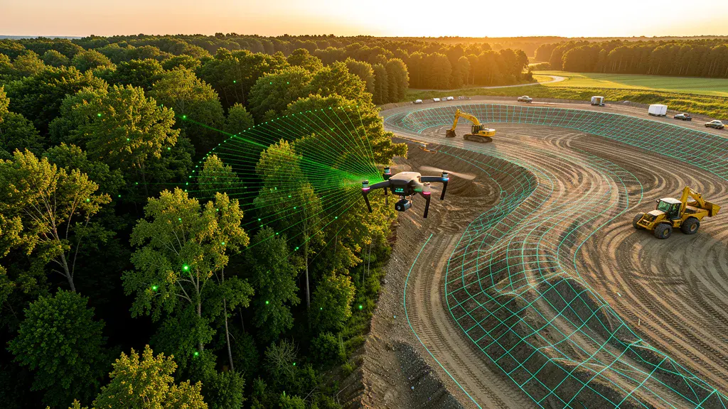
But the fundamental physics did not change. LiDAR uses laser pulses to measure distances directly, firing hundreds of thousands of pulses per second and recording returns to build a 3D point cloud. Photogrammetry reconstructs 3D geometry from overlapping 2D photographs using structure-from-motion algorithms. Each approach has inherent strengths and limitations that no amount of processing power can eliminate.
Accuracy Comparison: Drone 3D Scanning Accuracy vs Photogrammetry
Let us get to the numbers that actually matter. With proper ground control and RTK corrections, both methods can achieve impressive accuracy, but they differ in where that accuracy shows up.
| Metric | LiDAR | Photogrammetry |
|---|---|---|
| Horizontal accuracy | Down to 1 cm | Down to 1 cm |
| Vertical accuracy | 1 to 3 cm | 2 to 4 cm |
| Ground points under vegetation | Yes, penetrates canopy | No, blocked by foliage |
| Performance in low light | Works day or night | Requires good lighting |
| Point density (typical) | 100 to 500 pts/m² | 50 to 200 pts/m² |
| Visual texture detail | Low (point cloud only) | High (photo-realistic orthomosaic) |
For horizontal accuracy on open, textured surfaces like concrete, asphalt, or bare dirt, both methods perform nearly identically. The divergence comes in vertical accuracy and, more importantly, in how each method handles real-world site conditions.
Drone 3D scanning accuracy shines in two scenarios: when you need bare-earth terrain models under vegetation, and when you need reliable vertical precision on complex terrain. LiDAR pulses pass through gaps in leaves and branches, returning ground points that photogrammetry simply cannot see. On a wooded 20-acre site, photogrammetry produces a surface model that sits on top of the canopy. LiDAR produces a ground model that reflects the actual terrain. For any project involving earthwork quantities, drainage design, or flood mapping in vegetated areas, that difference is the entire ballgame.
When to Use LiDAR Aerial Imaging Methods
LiDAR is the right call when your project has one or more of these conditions:
- Vegetation cover. Forested sites, overgrown fields, riparian corridors, and any area where you need ground elevation data beneath canopy. LiDAR is the only drone-based method that reliably returns ground points through vegetation.
- Complex or rugged terrain. Steep slopes, rock outcrops, and irregular surfaces where photogrammetry struggles with image matching. LiDAR fires pulses in multiple directions and captures geometry that nadir photography misses.
- Low-light or time-constrained operations. LiDAR does not depend on ambient light. You can fly at dawn, dusk, or overcast days without quality loss. For projects with tight windows, this flexibility matters.
- Power line and utility corridor mapping. LiDAR detects thin features like wires and conductors that photogrammetry reconstructs poorly or misses entirely. Utilities increasingly require LiDAR deliverables for vegetation management and clearance analysis.
- High point density requirements. When your deliverable needs dense, uniform point spacing across variable terrain, LiDAR delivers more consistent point distribution than photo-based reconstruction.
For projects matching these conditions, our LiDAR scanning service connects you with providers who have the right sensor payload for your site. If you are working in key markets like Texas or Colorado, where vegetation and terrain vary widely, LiDAR is often the default choice.
When Photogrammetry Wins
Photogrammetry is not a compromise. For many projects, it is the better method, and here is why.
- Cost efficiency. A photogrammetry setup requires a capable drone and a high-resolution camera. Total equipment cost runs $5,000 to $15,000 compared to $25,000 to $100,000-plus for a LiDAR-equipped system. That cost difference flows through to project pricing.
- Visual deliverables. Photogrammetry produces orthomosaics, 3D textured meshes, and photo-realistic models that LiDAR cannot match. If your client needs to see the site, identify features visually, or present plans to stakeholders, photo-based deliverables are far more useful.
- Open sites with good texture. Construction sites, quarries, agricultural fields, and bare-earth plots are ideal for photogrammetry. The method thrives on visual features, and these surfaces provide plenty.
- Stockpile and volumetric measurements. On open stockpiles with good lighting, photogrammetry achieves 1 to 3 percent volumetric accuracy, comparable to LiDAR. For aggregate yards and mining operations without vegetation issues, photo-based aerial imaging flights are faster and cheaper.
- Faster processing for large areas. With modern cloud platforms, a 100-acre photogrammetry job can return results in 2 to 4 hours. LiDAR point cloud processing, especially classification and ground filtering, typically takes longer and requires more manual cleanup.
The Hidden Cost Factor in 2026
Equipment price is only part of the cost equation. A recent analysis of sub-$20,000 LiDAR sensors found that cheaper units often require 30 to 40 hours of manual processing labor per project to clean up noise and classify ground points properly. A more expensive sensor with better signal-to-noise ratio and more returns per pulse can cut that labor to under 10 hours. Over a year of projects, the cheaper sensor costs more per deliverable.
Photogrammetry has its own hidden costs. If lighting conditions are poor or the site lacks visual texture, reprocessing and reflights eat into the time savings. GCPs (ground control points) are mandatory for reliable accuracy, and placing them adds field time. Both methods require skilled operators. Neither is truly plug-and-play.
Decision Framework: Which Method for Your Project
Use this checklist to make the call:
- If your site has more than 20 percent vegetation cover and you need ground elevations, choose LiDAR.
- If you need photo-realistic visual deliverables for presentations or stakeholder review, choose photogrammetry.
- If your budget is under $20,000 for equipment and you are working open sites, choose photogrammetry.
- If you are mapping utilities, power lines, or thin structures, choose LiDAR.
- If you need bare-earth models for flood analysis, drainage design, or earthwork quantities in any vegetated area, choose LiDAR.
- If you are doing repeat stockpile data collection projects on open aggregate yards, choose photogrammetry.
Still unsure? Use our LiDAR vs Photogrammetry selector tool to get a recommendation based on your specific project parameters. It takes 30 seconds and accounts for vegetation density, deliverable type, budget, and timeline.
The Hybrid Approach
More data collection teams in 2026 are running both methods on the same site. A common workflow uses photogrammetry for the open areas where visual detail matters, and LiDAR for vegetated or complex sections where ground penetration is critical. The datasets are merged in processing software to produce a single, unified surface model. This approach costs more than either method alone, but it delivers the best of both worlds on complex sites. For large projects with mixed terrain, the hybrid approach often produces the most complete and accurate deliverable.
Bottom Line
Neither LiDAR nor photogrammetry wins outright in 2026. LiDAR wins on vegetation penetration, vertical accuracy in complex terrain, and low-light flexibility. Photogrammetry wins on cost, visual detail, and efficiency on open sites. The right choice depends on what you are aerial imaging, what you need to deliver, and what your site looks like. The technology has matured enough that the decision is now driven by project requirements, not by what equipment happens to be available.
Ready to get your data collection project started with the right method? Contact AeriusView and we will match you with a qualified provider who has the sensor payload and experience for your specific site conditions.
Need an Operator?
Get matched with FAA-certified aerial mapping professionals in your area. No cost, no obligation.
Get a Free QuoteFind a Drone Operator in Your Area
We connect project managers with FAA-certified drone operators across 15 states. Browse our location pages to find local aerial mapping services near you.
Browse All Locations