Roof Inspection in El Paso, TX
Drone roof inspections with high-resolution imagery and 3D modeling. Identify damage, assess condition, and generate detailed reports for insurance and maintenance.
Serving El Paso County & the El Paso-Las Cruces area
Request a Free Quote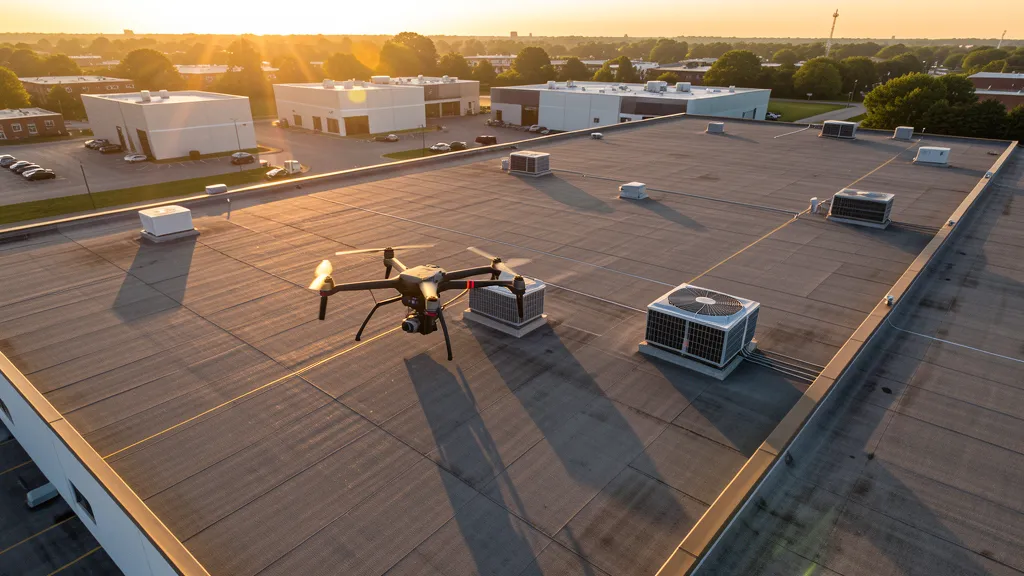
Get Matched With a Local Operator
Roof Inspection Pricing in El Paso, TX
Low End
$175
High End
$650
Turnaround
1-2 days
Cost ranges are based on market data for El Paso-Las Cruces. Actual pricing depends on site size, complexity, and deliverables.
Common Roof Inspection Applications in El Paso
- Pre-purchase roof assessments
- Insurance claim documentation
- Storm damage evaluation
- Routine maintenance inspections
Local Drone Regulations
Roof inspections in El Paso require compliance with local drone regulations:
Local Drone Ordinances:
El Paso does not issue a separate city-level drone permit for commercial operators. FAA Part 107 certification and LAANC authorization for ELP Class C airspace are the primary requirements. Commercial filming on city property requires a permit through the El Paso Film Commission. The city prohibits drone takeoff and landing in city parks without a special use permit, including Keystone Heritage Park, San Jacinto Plaza, and Memorial Park. Flights near the U.S.-Mexico border should be coordinated with CBP. Flights over Fort Bliss require authorization from Fort Bliss Range Control. Flights from private property (with owner permission) must comply with all FAA Part 107 rules and Texas Government Code Chapter 423 critical infrastructure restrictions.
Restricted Airspace in El Paso:
- Class C airspace around El Paso International Airport (ELP) — located within city limits. LAANC authorization is required for commercial drone flights within the Class C shelves, which extend across central and eastern El Paso. The airport is one of the busiest in West Texas with commercial airline traffic, military cross-field operations, and general aviation.
- Biggs Army Airfield (BIG) — military restricted airspace on Fort Bliss. This is a U.S. Army airfield supporting training operations and is strictly off-limits to drone flights without explicit authorization from Fort Bliss Range Control. The restricted airspace overlays significant portions of northeast El Paso. Any data collection work near the Fort Bliss eastern boundary requires coordination with military authorities.
- Fort Bliss military installation — at 1.12 million acres, Fort Bliss is the largest U.S. Army installation by land area. Drone flights over the installation are prohibited without authorization. The post spans from northeast El Paso into New Mexico. The $3B+ military construction program includes barracks, training facilities, aviation hangars, and medical facilities — all generating data collection demand, but data collection work must be coordinated through Fort Bliss DPW and contract vehicles.
- U.S.-Mexico border zone — CBP and border security operations maintain heightened surveillance along the Rio Grande. While not formal restricted airspace, drone flights near the border should be coordinated with CBP. Flights south of I-10 and near the border fence require extra caution and may attract law enforcement attention. Always carry Part 107 documentation and project authorization.
- Franklin Mountains State Park — the largest urban park in the nation at 26,000+ acres, running north-south through central El Paso. While not formal restricted airspace, drone flights in Texas state parks require a permit from Texas Parks and Wildlife. The mountainous terrain creates wind turbulence and challenging flight conditions, especially in afternoon hours.
- Dust storms and weather: El Paso experiences severe dust storms (haboobs) during spring and early summer, reducing visibility to near zero. High winds and extreme heat (100°F+ days common May through September) significantly impact flight windows. Morning flights are strongly preferred. The arid climate also means rapid battery drain in high temperatures — monitor battery levels closely.
Texas drone regulations require FAA Part 107 certification for all commercial drone operations. Our network of verified operators in El Paso meets all federal and state requirements.
Drone Regulations in El Paso, TX
Airports & LAANC Zones
- ELP — El Paso International Airport (Class C, located within city limits — LAANC required)
- BIG — Biggs Army Airfield (military restricted airspace, Fort Bliss — DO NOT fly without authorization)
- DHT — Doña Ana County Airport (general aviation, 25 miles northwest in New Mexico, uncontrolled Class G/E)
Restricted Airspace
- Class C airspace around El Paso International Airport (ELP) — located within city limits. LAANC authorization is required for commercial drone flights within the Class C shelves, which extend across central and eastern El Paso. The airport is one of the busiest in West Texas with commercial airline traffic, military cross-field operations, and general aviation.
- Biggs Army Airfield (BIG) — military restricted airspace on Fort Bliss. This is a U.S. Army airfield supporting training operations and is strictly off-limits to drone flights without explicit authorization from Fort Bliss Range Control. The restricted airspace overlays significant portions of northeast El Paso. Any data collection work near the Fort Bliss eastern boundary requires coordination with military authorities.
- Fort Bliss military installation — at 1.12 million acres, Fort Bliss is the largest U.S. Army installation by land area. Drone flights over the installation are prohibited without authorization. The post spans from northeast El Paso into New Mexico. The $3B+ military construction program includes barracks, training facilities, aviation hangars, and medical facilities — all generating data collection demand, but data collection work must be coordinated through Fort Bliss DPW and contract vehicles.
- U.S.-Mexico border zone — CBP and border security operations maintain heightened surveillance along the Rio Grande. While not formal restricted airspace, drone flights near the border should be coordinated with CBP. Flights south of I-10 and near the border fence require extra caution and may attract law enforcement attention. Always carry Part 107 documentation and project authorization.
- Franklin Mountains State Park — the largest urban park in the nation at 26,000+ acres, running north-south through central El Paso. While not formal restricted airspace, drone flights in Texas state parks require a permit from Texas Parks and Wildlife. The mountainous terrain creates wind turbulence and challenging flight conditions, especially in afternoon hours.
- Dust storms and weather: El Paso experiences severe dust storms (haboobs) during spring and early summer, reducing visibility to near zero. High winds and extreme heat (100°F+ days common May through September) significantly impact flight windows. Morning flights are strongly preferred. The arid climate also means rapid battery drain in high temperatures — monitor battery levels closely.
Local Ordinances
El Paso does not issue a separate city-level drone permit for commercial operators. FAA Part 107 certification and LAANC authorization for ELP Class C airspace are the primary requirements. Commercial filming on city property requires a permit through the El Paso Film Commission. The city prohibits drone takeoff and landing in city parks without a special use permit, including Keystone Heritage Park, San Jacinto Plaza, and Memorial Park. Flights near the U.S.-Mexico border should be coordinated with CBP. Flights over Fort Bliss require authorization from Fort Bliss Range Control. Flights from private property (with owner permission) must comply with all FAA Part 107 rules and Texas Government Code Chapter 423 critical infrastructure restrictions.
All drone operations in El Paso must comply with FAA Part 107 rules. Operators must obtain LAANC authorization before flying in controlled airspace near El Paso airports. Our network operators handle all permitting and airspace authorizations as part of their service.
Roof Inspection FAQ — El Paso, TX
How does a drone roof inspection work in El Paso?
We fly a drone equipped with high-resolution and optional thermal cameras over your roof in El Paso, capturing detailed imagery of every surface, flashing, and penetration. No ladders, no scaffolding, no risk to personnel.
Can drone roof inspections detect leaks?
Yes. Thermal imaging detects moisture trapped under roofing materials by temperature differentials. This identifies active leaks and areas of concern before they become visible inside the building.
What does a roof inspection report include?
Your report includes high-resolution photos organized by roof section, a condition assessment with annotated problem areas, thermal imagery (if requested), and 3D model data for measurement and documentation. Reports are suitable for insurance claims and maintenance planning.
Drone Regulations FAQ — El Paso, TX
Do I need a permit for an aerial imaging in El Paso?
El Paso does not issue a separate city-level drone permit for commercial operators. FAA Part 107 certification is mandatory. LAANC authorization is required for flights within the ELP Class C airspace, which covers central and eastern El Paso. Biggs Army Airfield (BIG) and Fort Bliss are military restricted airspace — drone flights require authorization from Fort Bliss Range Control. Drone takeoff and landing in city parks requires a special use permit from El Paso Parks and Recreation.
How much does an aerial imaging cost in El Paso?
El Paso pricing is generally 10-15% below Austin and Dallas metro rates due to the lower cost of living. Topographic data collection projects typically range from $1,400 to $4,200. LiDAR scanning runs $2,400 to $8,500 for the desert terrain and mountainous sites near the Franklin Mountains. Roof inspections cost $175 to $650 per building. Construction monitoring is typically $850 to $2,600 per month for recurring flights at Fort Bliss military construction sites and border logistics warehouses.
Can I fly a drone near Fort Bliss?
Fort Bliss is the largest U.S. Army installation by land area at 1.12 million acres. Drone flights over the installation are strictly prohibited without authorization from Fort Bliss Range Control. Biggs Army Airfield (BIG) on the post is military restricted airspace. However, the $3B+ military construction program at Fort Bliss generates substantial data collection demand — this work is performed under federal contract vehicles with base access credentials. Civilian drone operators cannot fly over the installation without prior coordination.
Are there restrictions near the U.S.-Mexico border?
While not formal restricted airspace, the U.S.-Mexico border zone is subject to heightened surveillance by CBP and other agencies. Drone flights near the border fence and south of I-10 should be coordinated with CBP. Always carry Part 107 documentation and project authorization. Flights near the Zaragoza and Ysleta ports of entry require extra caution due to cross-border traffic and security operations.
What weather considerations affect drone operations in El Paso?
El Paso's desert climate presents unique challenges. Severe dust storms (haboobs) are common in spring and early summer, reducing visibility to near zero. Temperatures regularly exceed 100°F from May through September, causing rapid battery drain and reducing flight times. High winds through the Franklin Mountains corridor create turbulence. Morning flights (before 10 AM) are strongly preferred, especially during summer months. Always monitor battery levels closely in extreme heat.
What makes El Paso unique for aerial imaging work?
El Paso combines three powerful demand drivers: the $3B+ military construction program at Fort Bliss (the largest U.S. Army installation), a border logistics boom with warehousing along the I-10 corridor, and healthcare expansion including Texas Tech Health El Paso. The city's geographic isolation means it has a self-contained data collection market with less competition than Austin or Dallas. The desert terrain is ideal for aerial photogrammetry with minimal vegetation interference, though dust and heat require careful flight planning. The El Paso-Las Cruces metro of 850,000 residents sustains residential and commercial development on the eastside and in the Lower Valley.
All Aerial Imaging Services in El Paso, TX
Compare pricing across all aerial imaging services available in El Paso, Texas.
| Service | Low End | High End | Turnaround |
|---|---|---|---|
| Topographic Data Collection | $1,400 | $4,200 | 3-5 days |
| Drone Inspection | $200 | $700 | 1-2 days |
| LiDAR Scanning | $2,400 | $8,500 | 5-7 days |
| Environmental Monitoring | $800 | $3,200 | 2-4 days |
| Aerial Imagery | $150 | $450 | 1-2 days |
| Construction Monitoring | $850 | $2,600 | Monthly |
| Real Estate Photography | $140 | $400 | 1-2 days |
| Roof Inspection ← you are here | $175 | $650 | 1-2 days |
Pricing ranges are based on market data for El Paso-Las Cruces. Actual costs depend on project scope, site conditions, and required deliverables.
Roof Inspection in Nearby Cities
Are You a Drone Operator in El Paso, TX?
Join our network of FAA-certified operators. Get matched with roof inspection projects in El Paso and the surrounding El Paso-Las Cruces area.
Apply to Join