Roof Inspection in Houston, TX
Drone roof inspections with high-resolution imagery and 3D modeling. Identify damage, assess condition, and generate detailed reports for insurance and maintenance.
Serving Harris County & the Houston-The Woodlands-Sugar Land area
Request a Free Quote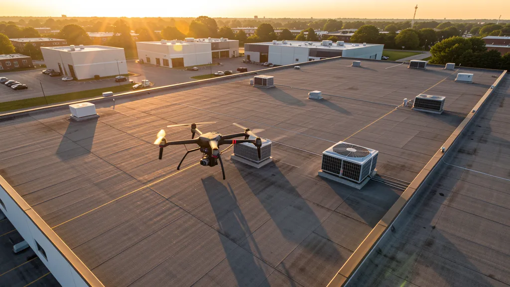
Get Matched With a Local Operator
Roof Inspection Pricing in Houston, TX
Low End
$200
High End
$850
Turnaround
1-2 days
Cost ranges are based on market data for Houston-The Woodlands-Sugar Land. Actual pricing depends on site size, complexity, and deliverables.
Common Roof Inspection Applications in Houston
- Pre-purchase roof assessments
- Insurance claim documentation
- Storm damage evaluation
- Routine maintenance inspections
Local Drone Regulations
Roof inspections in Houston require compliance with local drone regulations:
Local Drone Ordinances:
Houston does not issue a separate city-level drone permit for commercial operators, but drone takeoff and landing on city-owned property, including parks, requires a special use permit from Houston Parks and Recreation. FAA Part 107 certification and LAANC authorization for Class B and Class C airspace around IAH and HOU are the primary requirements. Commercial filming on city property requires a film permit through the Houston Film Commission. The city prohibits drone flights over stadiums and large public gatherings (Texans games at NRG Stadium, Astros games at Minute Maid Park, Rockets games at Toyota Center) without specific FAA authorization. Flights from private property (with owner permission) do not require a city permit but must comply with all FAA Part 107 rules and Texas Government Code Chapter 423 critical infrastructure restrictions.
Restricted Airspace in Houston:
- Class B airspace around George Bush Intercontinental (IAH) — extends approximately 10 nautical miles from the airport with multiple shelves from surface to 10,000 ft MSL. LAANC authorization required for all commercial drone flights within this zone.
- Class C airspace around William P. Hobby Airport (HOU) — 5 NM radius surface area with shelves extending to 10 NM, LAANC required for commercial operations. Hobby sits just 7 miles southeast of downtown, making this airspace particularly impactful for urban core data collection projects.
- Ellington Field Joint Reserve Base (EFD) — active military airspace sharing Class D with civilian operations. Home to NASA Johnson Space Center flight operations, Texas Air National Guard 147th Attack Wing, and Coast Guard units. Drone flights within 5 miles require coordination with base operations and NASA Johnson Space Center security.
- NASA Johnson Space Center (Clear Lake) — restricted airspace and critical infrastructure under TX Government Code Chapter 423. Drone flights over JSC facilities without authorization violate both FAA and Texas state law.
- Port of Houston Authority facilities — critical infrastructure designation under Texas law. The Houston Ship Channel industrial corridor from the Port of Houston to Galveston Bay contains refineries, chemical plants, and petrochemical terminals where unauthorized drone flights are a state misdemeanor.
- Houston Parks and Recreation prohibits drone takeoff/landing on city park property without a special use permit. Hermann Park, Memorial Park, and Buffalo Bayou Park are actively patrolled. Discovery Green downtown requires event-specific authorization.
- Hurricane preparedness and tropical weather: Houston is in a high-risk hurricane zone. Drone operations during tropical storm warnings or hurricane watches are restricted. Post-storm assessment flights require coordination with FEMA, TxDOT, and local emergency management. Summer thunderstorms and Gulf Coast humidity affect flight windows — morning flights are strongly preferred May through September.
Texas drone regulations require FAA Part 107 certification for all commercial drone operations. Our network of verified operators in Houston meets all federal and state requirements.
Drone Regulations in Houston, TX
Airports & LAANC Zones
- IAH — George Bush Intercontinental Airport (Class B airspace)
- HOU — William P. Hobby Airport (Class C airspace)
- EFD — Ellington Field Joint Reserve Base (Class D, military/civilian)
- DWH — David Wayne Hooks Memorial Airport (general aviation, Tomball)
- SGR — Sugar Land Regional Airport (general aviation, Fort Bend County)
- LVJ — Pearland Regional Airport (general aviation, Brazoria County)
Restricted Airspace
- Class B airspace around George Bush Intercontinental (IAH) — extends approximately 10 nautical miles from the airport with multiple shelves from surface to 10,000 ft MSL. LAANC authorization required for all commercial drone flights within this zone.
- Class C airspace around William P. Hobby Airport (HOU) — 5 NM radius surface area with shelves extending to 10 NM, LAANC required for commercial operations. Hobby sits just 7 miles southeast of downtown, making this airspace particularly impactful for urban core data collection projects.
- Ellington Field Joint Reserve Base (EFD) — active military airspace sharing Class D with civilian operations. Home to NASA Johnson Space Center flight operations, Texas Air National Guard 147th Attack Wing, and Coast Guard units. Drone flights within 5 miles require coordination with base operations and NASA Johnson Space Center security.
- NASA Johnson Space Center (Clear Lake) — restricted airspace and critical infrastructure under TX Government Code Chapter 423. Drone flights over JSC facilities without authorization violate both FAA and Texas state law.
- Port of Houston Authority facilities — critical infrastructure designation under Texas law. The Houston Ship Channel industrial corridor from the Port of Houston to Galveston Bay contains refineries, chemical plants, and petrochemical terminals where unauthorized drone flights are a state misdemeanor.
- Houston Parks and Recreation prohibits drone takeoff/landing on city park property without a special use permit. Hermann Park, Memorial Park, and Buffalo Bayou Park are actively patrolled. Discovery Green downtown requires event-specific authorization.
- Hurricane preparedness and tropical weather: Houston is in a high-risk hurricane zone. Drone operations during tropical storm warnings or hurricane watches are restricted. Post-storm assessment flights require coordination with FEMA, TxDOT, and local emergency management. Summer thunderstorms and Gulf Coast humidity affect flight windows — morning flights are strongly preferred May through September.
Local Ordinances
Houston does not issue a separate city-level drone permit for commercial operators, but drone takeoff and landing on city-owned property, including parks, requires a special use permit from Houston Parks and Recreation. FAA Part 107 certification and LAANC authorization for Class B and Class C airspace around IAH and HOU are the primary requirements. Commercial filming on city property requires a film permit through the Houston Film Commission. The city prohibits drone flights over stadiums and large public gatherings (Texans games at NRG Stadium, Astros games at Minute Maid Park, Rockets games at Toyota Center) without specific FAA authorization. Flights from private property (with owner permission) do not require a city permit but must comply with all FAA Part 107 rules and Texas Government Code Chapter 423 critical infrastructure restrictions.
All drone operations in Houston must comply with FAA Part 107 rules. Operators must obtain LAANC authorization before flying in controlled airspace near Houston airports. Our network operators handle all permitting and airspace authorizations as part of their service.
Roof Inspection FAQ — Houston, TX
How does a drone roof inspection work in Houston?
We fly a drone equipped with high-resolution and optional thermal cameras over your roof in Houston, capturing detailed imagery of every surface, flashing, and penetration. No ladders, no scaffolding, no risk to personnel.
Can drone roof inspections detect leaks?
Yes. Thermal imaging detects moisture trapped under roofing materials by temperature differentials. This identifies active leaks and areas of concern before they become visible inside the building.
What does a roof inspection report include?
Your report includes high-resolution photos organized by roof section, a condition assessment with annotated problem areas, thermal imagery (if requested), and 3D model data for measurement and documentation. Reports are suitable for insurance claims and maintenance planning.
Drone Regulations FAQ — Houston, TX
Do I need a permit for an aerial imaging in Houston?
Houston does not issue a separate city-level drone permit for commercial operators. You need a special use permit only if you plan to take off or land on city-owned park property. FAA Part 107 certification is mandatory, and LAANC authorization is required for flights within the Class B airspace around Bush Intercontinental (IAH) or Class C around Hobby Airport (HOU). Commercial filming on city property may require a permit through the Houston Film Commission.
How much does an aerial imaging cost in Houston?
Costs vary by service type. Topographic data collection projects in the Houston metro typically range from $1,800 to $5,500 depending on site size and terrain. LiDAR scanning runs $2,800 to $10,000 for large industrial or petrochemical sites. Roof inspections cost $200 to $850 per building. Construction monitoring is typically $1,000 to $3,500 per month for recurring flights. Houston rates are competitive due to the large number of active drone operators serving the energy and medical sectors.
Can drones fly near Bush Intercontinental or Hobby Airport?
Both airports have controlled airspace requiring LAANC authorization. Bush Intercontinental (IAH) has Class B airspace extending approximately 10 nautical miles from the airport. Hobby Airport (HOU) has Class C airspace with a 5 NM surface radius and shelves to 10 NM. Our network drone operators handle all LAANC approvals through FAA-approved providers. Downtown Houston data collection projects are particularly complex because they fall within the Hobby Class C surface area.
Are there restricted military or NASA airspace zones near Houston?
Yes. Ellington Field Joint Reserve Base in southeast Houston has active military airspace with NASA Johnson Space Center flight operations, Texas Air National Guard, and Coast Guard units. Drone flights within 5 miles require coordination with base operations. NASA Johnson Space Center in Clear Lake is designated critical infrastructure under Texas Government Code Chapter 423, making unauthorized drone flights a state misdemeanor. The Houston Ship Channel industrial corridor has similar critical infrastructure restrictions.
Does Houston's hurricane risk affect drone operations?
Yes. Houston is in a high-risk hurricane zone, and drone operations during tropical storm warnings or hurricane watches are restricted. Post-storm damage assessment flights require coordination with FEMA, TxDOT, and local emergency management. Summer thunderstorms and Gulf Coast humidity also affect flight windows — morning flights are strongly preferred May through September. Our drone operators monitor NOAA weather feeds and reschedule flights when wind speeds exceed 15 mph or precipitation is forecast within 2 hours.
How long does a topographic data collection take in Houston?
A standard 50-acre site can be flown in a single morning, weather permitting. Deliverables (DEM, contour maps, orthomosaic, point cloud) are typically ready within 3-5 business days. Larger industrial sites along the Ship Channel or master-planned communities in Cypress and Katy may require 5-7 days due to acreage. Houston's flat terrain generally makes data collection flights efficient, but summer heat and afternoon thunderstorms can narrow flight windows significantly.
All Aerial Imaging Services in Houston, TX
Compare pricing across all aerial imaging services available in Houston, Texas.
| Service | Low End | High End | Turnaround |
|---|---|---|---|
| Topographic Data Collection | $1,800 | $5,500 | 3-5 days |
| Drone Inspection | $250 | $950 | 1-2 days |
| LiDAR Scanning | $2,800 | $10,000 | 5-7 days |
| Environmental Monitoring | $900 | $4,000 | 2-4 days |
| Aerial Imagery | $175 | $600 | 1-2 days |
| Construction Monitoring | $1,000 | $3,500 | Monthly |
| Real Estate Photography | $175 | $500 | 1-2 days |
| Roof Inspection ← you are here | $200 | $850 | 1-2 days |
Pricing ranges are based on market data for Houston-The Woodlands-Sugar Land. Actual costs depend on project scope, site conditions, and required deliverables.
Roof Inspection in Nearby Cities
Are You a Drone Operator in Houston, TX?
Join our network of FAA-certified operators. Get matched with roof inspection projects in Houston and the surrounding Houston-The Woodlands-Sugar Land area.
Apply to Join