Roof Inspection in Syracuse, NY
Drone roof inspections with high-resolution imagery and 3D modeling. Identify damage, assess condition, and generate detailed reports for insurance and maintenance.
Serving Onondaga County & the Syracuse, NY MSA (Onondaga, Oswego, Madison, and Cayuga Counties, Central New York) area
Request a Free Quote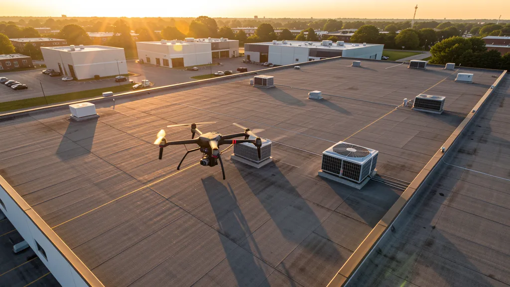
Get Matched With a Local Operator
Roof Inspection Pricing in Syracuse, NY
Low End
$250
High End
$750
Turnaround
1-2 days
Cost ranges are based on market data for Syracuse, NY MSA (Onondaga, Oswego, Madison, and Cayuga Counties, Central New York). Actual pricing depends on site size, complexity, and deliverables.
Common Roof Inspection Applications in Syracuse
- Pre-purchase roof assessments
- Insurance claim documentation
- Storm damage evaluation
- Routine maintenance inspections
Local Drone Regulations
Roof inspections in Syracuse require compliance with local drone regulations:
Local Drone Ordinances:
Syracuse is governed by New York state drone law (NY Penal Law 250.55) and FAA Part 107 regulations. The City of Syracuse does not have a specific municipal drone ordinance as of 2026, but commercial drone takeoff and landing on city-owned property requires authorization from the Syracuse Department of Parks, Recreation and Youth Programs. City parks including Onondaga Park, Thornden Park, Burnet Park, and the Creekwalk trail system require explicit permission for commercial drone operations. Onondaga County parks (including Onondaga Lake Park, Green Lakes State Park, and Jamesville Beach County Park) require a commercial use permit from the Onondaga County Parks Department. Commercial drone filming for movies, TV, or advertising requires a film permit from the Syracuse/Onondaga County Film Office. New York State parks require a permit under 9 NYCRR 375.1. The Onondaga Lake environmental remediation site has specific airspace coordination requirements managed by Honeywell and the NYS DEC — commercial aerial imaging of the remediation area requires project-level authorization. FAA Part 107 Remote Pilot Certification is required for all commercial operations. LAANC authorization is required for flights within SYR Class C airspace boundaries.
Restricted Airspace in Syracuse:
- Syracuse Hancock International Airport (SYR) has Class C airspace with a 5 NM radius surface area and outer shelf extending to 10 NM. The Class C covers northern Syracuse, the town of Salina, DeWitt, and parts of Liverpool and Clay. Commercial drone operations within the SYR Class C lateral boundaries require LAANC authorization. SYR is the primary commercial airport for Central New York with significant passenger, cargo, and military charter traffic. Downtown Syracuse is generally within the Class C outer shelf area.
- Hancock Field Air National Guard Base, co-located with Syracuse Hancock International Airport, hosts the 174th Attack Wing which operates MQ-9 Reaper unmanned aerial systems. The 174th Wing conducts training operations in the Syracuse military operations areas and restricted airspace over Lake Ontario. Commercial drone operators in the Syracuse region should check NOTAMs for MQ-9 training activity, as military UAS operations can affect airspace availability at lower altitudes. The 174th Wing also operates the Eastern Air Defense Sector (EADS) which monitors the Northeast U.S. airspace.
- The Griffiss International Airport (RME) in Rome, NY, approximately 40 NM east of Syracuse, has Class D airspace and was formerly Griffiss Air Force Base. The Air Force Research Laboratory (AFRL) Information Directorate at Griffiss conducts drone research and development, and the site has been designated as one of the FAA's UAS test sites (NERC — Northeast UAS Airspace Integration Research Alliance). Commercial operators working across the Syracuse-Rome corridor should check for UAS test site activities and Griffiss Class D boundaries.
- Onondaga Lake and the surrounding Onondaga Lake Park have moderate helicopter traffic including news, medevac, and State Police helicopters. The lake is a former industrial site undergoing a $500+ million environmental remediation managed by Honeywell. Drone operators flying near the lakefront and the Onondaga Lake cleanup sites should coordinate with the NYS Department of Environmental Conservation and Honeywell remediation teams, as aerial mapping of the cleanup is an active commercial drone application.
- The Adirondack Park boundary begins approximately 40 NM northeast of Syracuse. The Adirondack Park is a 6-million-acre state-protected area with specific drone regulations under the Adirondack Park Agency (APA). Commercial drone operations within the park require an APA permit in addition to the standard state parks permit (9 NYCRR 375.1). While Syracuse itself is outside the park, operators traveling to projects in the Adirondack region should be aware of these additional restrictions.
New York drone regulations require FAA Part 107 certification for all commercial drone operations. Our network of verified operators in Syracuse meets all federal and state requirements.
Drone Regulations in Syracuse, NY
Airports & LAANC Zones
- SYR — Syracuse Hancock International Airport (Class C airspace, approximately 5 NM north of downtown — medium-hub commercial airport serving Central New York; LAANC available)
- OZR — Oswego County Airport (Class E airspace, approximately 35 NM northwest — uncontrolled GA airport near Lake Ontario; no LAANC required but check NOTAMs)
- RME — Rome Griffiss International Airport (Class D airspace, approximately 40 NM east — former Air Force base with Air National Guard 174th Attack Wing MQ-9 Reaper operations; LAANC available and check for military UAS activity)
- SYF — Syracuse Airpark (private/restricted airspace, within city limits — small GA facility; check restrictions before operating)
- UCA — Oneonta Municipal Airport (Class E airspace, approximately 65 NM southeast — uncontrolled GA airport; no LAANC required)
Restricted Airspace
- Syracuse Hancock International Airport (SYR) has Class C airspace with a 5 NM radius surface area and outer shelf extending to 10 NM. The Class C covers northern Syracuse, the town of Salina, DeWitt, and parts of Liverpool and Clay. Commercial drone operations within the SYR Class C lateral boundaries require LAANC authorization. SYR is the primary commercial airport for Central New York with significant passenger, cargo, and military charter traffic. Downtown Syracuse is generally within the Class C outer shelf area.
- Hancock Field Air National Guard Base, co-located with Syracuse Hancock International Airport, hosts the 174th Attack Wing which operates MQ-9 Reaper unmanned aerial systems. The 174th Wing conducts training operations in the Syracuse military operations areas and restricted airspace over Lake Ontario. Commercial drone operators in the Syracuse region should check NOTAMs for MQ-9 training activity, as military UAS operations can affect airspace availability at lower altitudes. The 174th Wing also operates the Eastern Air Defense Sector (EADS) which monitors the Northeast U.S. airspace.
- The Griffiss International Airport (RME) in Rome, NY, approximately 40 NM east of Syracuse, has Class D airspace and was formerly Griffiss Air Force Base. The Air Force Research Laboratory (AFRL) Information Directorate at Griffiss conducts drone research and development, and the site has been designated as one of the FAA's UAS test sites (NERC — Northeast UAS Airspace Integration Research Alliance). Commercial operators working across the Syracuse-Rome corridor should check for UAS test site activities and Griffiss Class D boundaries.
- Onondaga Lake and the surrounding Onondaga Lake Park have moderate helicopter traffic including news, medevac, and State Police helicopters. The lake is a former industrial site undergoing a $500+ million environmental remediation managed by Honeywell. Drone operators flying near the lakefront and the Onondaga Lake cleanup sites should coordinate with the NYS Department of Environmental Conservation and Honeywell remediation teams, as aerial mapping of the cleanup is an active commercial drone application.
- The Adirondack Park boundary begins approximately 40 NM northeast of Syracuse. The Adirondack Park is a 6-million-acre state-protected area with specific drone regulations under the Adirondack Park Agency (APA). Commercial drone operations within the park require an APA permit in addition to the standard state parks permit (9 NYCRR 375.1). While Syracuse itself is outside the park, operators traveling to projects in the Adirondack region should be aware of these additional restrictions.
Local Ordinances
Syracuse is governed by New York state drone law (NY Penal Law 250.55) and FAA Part 107 regulations. The City of Syracuse does not have a specific municipal drone ordinance as of 2026, but commercial drone takeoff and landing on city-owned property requires authorization from the Syracuse Department of Parks, Recreation and Youth Programs. City parks including Onondaga Park, Thornden Park, Burnet Park, and the Creekwalk trail system require explicit permission for commercial drone operations. Onondaga County parks (including Onondaga Lake Park, Green Lakes State Park, and Jamesville Beach County Park) require a commercial use permit from the Onondaga County Parks Department. Commercial drone filming for movies, TV, or advertising requires a film permit from the Syracuse/Onondaga County Film Office. New York State parks require a permit under 9 NYCRR 375.1. The Onondaga Lake environmental remediation site has specific airspace coordination requirements managed by Honeywell and the NYS DEC — commercial aerial imaging of the remediation area requires project-level authorization. FAA Part 107 Remote Pilot Certification is required for all commercial operations. LAANC authorization is required for flights within SYR Class C airspace boundaries.
All drone operations in Syracuse must comply with FAA Part 107 rules. Operators must obtain LAANC authorization before flying in controlled airspace near Syracuse airports. Our network operators handle all permitting and airspace authorizations as part of their service.
Roof Inspection FAQ — Syracuse, NY
How does a drone roof inspection work in Syracuse?
We fly a drone equipped with high-resolution and optional thermal cameras over your roof in Syracuse, capturing detailed imagery of every surface, flashing, and penetration. No ladders, no scaffolding, no risk to personnel.
Can drone roof inspections detect leaks?
Yes. Thermal imaging detects moisture trapped under roofing materials by temperature differentials. This identifies active leaks and areas of concern before they become visible inside the building.
What does a roof inspection report include?
Your report includes high-resolution photos organized by roof section, a condition assessment with annotated problem areas, thermal imagery (if requested), and 3D model data for measurement and documentation. Reports are suitable for insurance claims and maintenance planning.
Drone Regulations FAQ — Syracuse, NY
Do I need LAANC authorization to fly a drone in Syracuse?
Most of Syracuse falls within the Syracuse Hancock International Airport (SYR) Class C airspace, which has a 5 NM radius surface area and outer shelves to 10 NM. The Class C covers northern Syracuse, Salina, DeWitt, Liverpool, and Clay — including the massive Micron Technology construction site. Commercial drone operations within the SYR Class C lateral boundaries require LAANC authorization. Additionally, Hancock Field hosts the 174th Attack Wing operating MQ-9 Reaper drones; check NOTAMs for military UAS activity.
What is the cost of an aerial imaging for a construction site in Syracuse?
Topographic drone data collection in Syracuse typically ranges from $1,100 to $3,800 depending on acreage, terrain complexity, and proximity to SYR Class C airspace or the Onondaga Lake waterfront. Construction monitoring visits cost $350 to $1,500 per session. LiDAR scanning runs $2,000 to $6,500. The Micron Technology megaproject in Clay is creating unprecedented demand for drone aerial imaging, construction monitoring, and environmental documentation across thousands of acres.
Can I fly a drone over the Micron Technology construction site in Clay?
The Micron Technology semiconductor campus in Clay is one of the largest construction sites in North America. Commercial aerial imaging of the site requires coordination with Micron site security, the general contractor, and the SYR Class C airspace LAANC system. The site is within the SYR Class C lateral boundaries. Drone aerial imaging is actively used for site grading verification, cut-fill analysis, and construction progress documentation on this massive project.
Are there military drone operations near Syracuse that affect commercial flying?
Yes. Hancock Field Air National Guard Base at Syracuse Hancock International Airport hosts the 174th Attack Wing, which operates MQ-9 Reaper unmanned aerial systems. The 174th conducts training in military operations areas and restricted airspace over Lake Ontario. Commercial drone operators should check NOTAMs for MQ-9 training activity. The Eastern Air Defense Sector (EADS) at Hancock Field monitors Northeast U.S. airspace. Additionally, Griffiss International Airport in Rome NY (40 NM east) is an FAA-designated UAS test site.
Can I fly a drone over Onondaga Lake or the environmental remediation site?
Onondaga Lake and its shoreline are the site of a $500+ million environmental remediation managed by Honeywell and the NYS DEC. Commercial drone operations over the lake and remediation areas require project-level authorization from Honeywell and the DEC. The Onondaga Lake Park trail system requires authorization from Onondaga County Parks. Drone aerial imaging is an active tool used for monitoring the remediation progress, shoreline restoration, and vegetation recovery, but flights must be coordinated with the remediation project team.
Can I fly a drone in Syracuse city parks or Onondaga County parks?
Syracuse city parks (including Onondaga Park, Thornden Park, and Burnet Park) require authorization from the Syracuse Department of Parks for commercial drone takeoff and landing. Onondaga County parks (including Onondaga Lake Park and Green Lakes State Park) require a commercial use permit from the Onondaga County Parks Department. New York State parks require a permit under 9 NYCRR 375.1. The Adirondack Park, approximately 40 miles northeast, requires an additional Adirondack Park Agency permit for commercial drone operations.
All Aerial Imaging Services in Syracuse, NY
Compare pricing across all aerial imaging services available in Syracuse, New York.
| Service | Low End | High End | Turnaround |
|---|---|---|---|
| Topographic Data Collection | $1,100 | $3,800 | 3-7 days |
| Drone Inspection | $350 | $1,700 | 1-3 days |
| LiDAR Scanning | $2,000 | $6,500 | 4-10 days |
| Environmental Monitoring | $500 | $2,400 | 2-5 days |
| Aerial Imagery | $300 | $1,100 | 1-2 days |
| Construction Monitoring | $350 | $1,500 | 1-3 days per visit |
| Real Estate Photography | $200 | $550 | 1-2 days |
| Roof Inspection ← you are here | $250 | $750 | 1-2 days |
Pricing ranges are based on market data for Syracuse, NY MSA (Onondaga, Oswego, Madison, and Cayuga Counties, Central New York). Actual costs depend on project scope, site conditions, and required deliverables.
Are You a Drone Operator in Syracuse, NY?
Join our network of FAA-certified operators. Get matched with roof inspection projects in Syracuse and the surrounding Syracuse, NY MSA (Onondaga, Oswego, Madison, and Cayuga Counties, Central New York) area.
Apply to Join