Aerial Imaging Services in Syracuse, NY
Syracuse golden-hour aerial showing downtown and the Syracuse University campus with the Carrier Dome, Onondaga Lake glimmering to the northwest with its environmental remediation shoreline, and the massive Micron Technology construction site visible to the north in Clay.
Located in Onondaga County with a population of 142,000, Syracuse sits within the Syracuse, NY MSA (Onondaga, Oswego, Madison, and Cayuga Counties, Central New York). Syracuse is the fifth-largest city in New York State with a population of approximately 142,000 and serves as the economic and educational hub of Central New York. The city is experiencing a transformative construction boom driven by the Micron Technology semiconductor megaproject, the largest private investment in New York State history. Major projects include the Micron Technology chip fabrication campus (a $100+ billion investment over 20 years in the town of Clay, adjacent to Syracuse — the largest semiconductor manufacturing facility in the Western Hemisphere, creating thousands of construction jobs and driving demand for site aerial imaging, environmental monitoring, and construction progress documentation), the Syracuse University campus expansion (the JMA Wireless Dome renovation, new research buildings, and the Center for Advanced Technology in Computer Science), the Interstate 81 viaduct replacement project (a $1+ billion NYSDOT project replacing the aging elevated highway through downtown with a community grid — one of the largest highway reconstruction projects in Upstate NY), the Inner Harbor redevelopment (transforming the former industrial waterfront on Onondaga Lake into a mixed-use residential and commercial district), the downtown Syracuse Innovation Crossroads (a state-funded tech incubator and research facility), and the Onondaga Lake remediation and waterfront restoration ($500+ million environmental cleanup creating new parkland and development sites). SUNY ESF (State University of New York College of Environmental Science and Forestry) is expanding its research facilities. Onondaga County building permit values exceeded $700 million in 2024 and are expected to surge with Micron-related construction. The city benefits from its concentration of higher education (Syracuse University, SUNY ESF, SUNY Upstate Medical University, Le Moyne College), its position as the regional hub for Central New York, and the transformative impact of the Micron investment on the entire regional economy.
Serving Onondaga County & the Syracuse, NY MSA (Onondaga, Oswego, Madison, and Cayuga Counties, Central New York) area
Request a Free Quote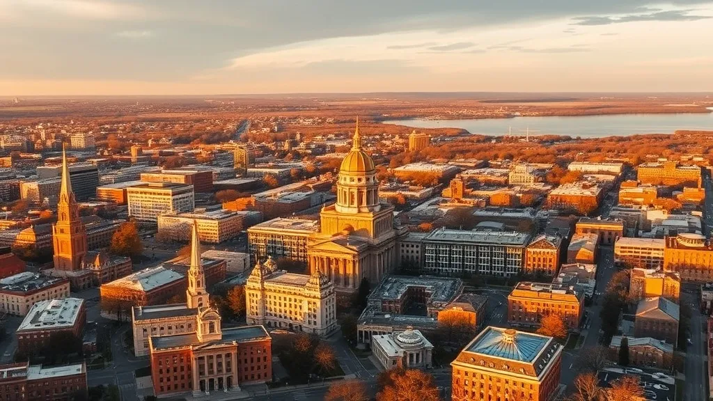
Get Matched With a Local Drone Operator
Aerial Data Services for Syracuse Projects
Syracuse is the fifth-largest city in New York State with a population of 142,000 and the economic hub of Central New York. The region is experiencing a transformative construction boom driven by the $100+ billion Micron Technology semiconductor megaproject in Clay — the largest private investment in state history. The $1+ billion I-81 viaduct replacement, Onondaga Lake $500 million remediation, and Syracuse University campus expansion add to a surging aerial imaging market for site grading, construction monitoring, and environmental documentation.
Local Airspace & Regulations in Syracuse, NY
FAA Part 107 Requirements
Part 107 is the federal baseline for paid drone work in Syracuse. Each operator in the network holds an active Remote Pilot Certificate, verified at onboarding.
State Drone Laws
Syracuse sits under New York's statewide UAS framework (NY Penal Law 250.55 (2023 amendment); NY AB 7068 / SB 6422D (2024); NYC Local Law 152 of 2024; 9 NYCRR 375.1; FAA Part 107); local permitting in Onondaga County is what varies site to site. Syracuse is governed by New York state drone law (NY Penal Law 250.55) and FAA Part 107 regulations. Full New York drone law →
Local Ordinances
Syracuse is governed by New York state drone law (NY Penal Law 250.55) and FAA Part 107 regulations. The City of Syracuse does not have a specific municipal drone ordinance as of 2026, but commercial drone takeoff and landing on city-owned property requires authorization from the Syracuse Department of Parks, Recreation and Youth Programs. City parks including Onondaga Park, Thornden Park, Burnet Park, and the Creekwalk trail system require explicit permission for commercial drone operations. Onondaga County parks (including Onondaga Lake Park, Green Lakes State Park, and Jamesville Beach County Park) require a commercial use permit from the Onondaga County Parks Department. Commercial drone filming for movies, TV, or advertising requires a film permit from the Syracuse/Onondaga County Film Office. New York State parks require a permit under 9 NYCRR 375.1. The Onondaga Lake environmental remediation site has specific airspace coordination requirements managed by Honeywell and the NYS DEC — commercial aerial imaging of the remediation area requires project-level authorization. FAA Part 107 Remote Pilot Certification is required for all commercial operations. LAANC authorization is required for flights within SYR Class C airspace boundaries.
Restricted Airspace
- Syracuse Hancock International Airport (SYR) has Class C airspace with a 5 NM radius surface area and outer shelf extending to 10 NM. The Class C covers northern Syracuse, the town of Salina, DeWitt, and parts of Liverpool and Clay. Commercial drone operations within the SYR Class C lateral boundaries require LAANC authorization. SYR is the primary commercial airport for Central New York with significant passenger, cargo, and military charter traffic. Downtown Syracuse is generally within the Class C outer shelf area.
- Hancock Field Air National Guard Base, co-located with Syracuse Hancock International Airport, hosts the 174th Attack Wing which operates MQ-9 Reaper unmanned aerial systems. The 174th Wing conducts training operations in the Syracuse military operations areas and restricted airspace over Lake Ontario. Commercial drone operators in the Syracuse region should check NOTAMs for MQ-9 training activity, as military UAS operations can affect airspace availability at lower altitudes. The 174th Wing also operates the Eastern Air Defense Sector (EADS) which monitors the Northeast U.S. airspace.
- The Griffiss International Airport (RME) in Rome, NY, approximately 40 NM east of Syracuse, has Class D airspace and was formerly Griffiss Air Force Base. The Air Force Research Laboratory (AFRL) Information Directorate at Griffiss conducts drone research and development, and the site has been designated as one of the FAA's UAS test sites (NERC — Northeast UAS Airspace Integration Research Alliance). Commercial operators working across the Syracuse-Rome corridor should check for UAS test site activities and Griffiss Class D boundaries.
- Onondaga Lake and the surrounding Onondaga Lake Park have moderate helicopter traffic including news, medevac, and State Police helicopters. The lake is a former industrial site undergoing a $500+ million environmental remediation managed by Honeywell. Drone operators flying near the lakefront and the Onondaga Lake cleanup sites should coordinate with the NYS Department of Environmental Conservation and Honeywell remediation teams, as aerial mapping of the cleanup is an active commercial drone application.
- The Adirondack Park boundary begins approximately 40 NM northeast of Syracuse. The Adirondack Park is a 6-million-acre state-protected area with specific drone regulations under the Adirondack Park Agency (APA). Commercial drone operations within the park require an APA permit in addition to the standard state parks permit (9 NYCRR 375.1). While Syracuse itself is outside the park, operators traveling to projects in the Adirondack region should be aware of these additional restrictions.
Airports in the area: SYR — Syracuse Hancock International Airport (Class C airspace, approximately 5 NM north of downtown — medium-hub commercial airport serving Central New York; LAANC available), OZR — Oswego County Airport (Class E airspace, approximately 35 NM northwest — uncontrolled GA airport near Lake Ontario; no LAANC required but check NOTAMs), RME — Rome Griffiss International Airport (Class D airspace, approximately 40 NM east — former Air Force base with Air National Guard 174th Attack Wing MQ-9 Reaper operations; LAANC available and check for military UAS activity), SYF — Syracuse Airpark (private/restricted airspace, within city limits — small GA facility; check restrictions before operating), UCA — Oneonta Municipal Airport (Class E airspace, approximately 65 NM southeast — uncontrolled GA airport; no LAANC required)
Typical Project Costs in New York
What Syracuse projects usually cost, based on current Syracuse, NY MSA (Onondaga, Oswego, Madison, and Cayuga Counties, Central New York) market data. Exact pricing depends on site size, complexity, and deliverables.
| Service Type | Low End | High End |
|---|---|---|
| Topographic Data Collection | $1,075 | $3,700 |
| Drone Inspection | $350 | $1,650 |
| LiDAR Scanning | $1,950 | $6,350 |
| Environmental Monitoring | $500 | $2,350 |
| Aerial Imagery | $300 | $1,100 |
| Construction Monitoring | $350 | $1,500 |
| Real Estate Photography | $200 | $550 |
| Roof Inspection | $250 | $750 |
Free cost calculator, ROI calculator, and 14-page buyer's guide. No signup required.
Are you a drone operator serving Syracuse? List your business on AeriusView and get pre-qualified leads in your service area.
List Your Business →Aerial Imaging for Syracuse's Construction Market
Syracuse is the fifth-largest city in New York State with a population of approximately 142,000 and serves as the economic and educational hub of Central New York. The city is experiencing a transformative construction boom driven by the Micron Technology semiconductor megaproject, the largest private investment in New York State history. Major projects include the Micron Technology chip fabrication campus (a $100+ billion investment over 20 years in the town of Clay, adjacent to Syracuse — the largest semiconductor manufacturing facility in the Western Hemisphere, creating thousands of construction jobs and driving demand for site aerial imaging, environmental monitoring, and construction progress documentation), the Syracuse University campus expansion (the JMA Wireless Dome renovation, new research buildings, and the Center for Advanced Technology in Computer Science), the Interstate 81 viaduct replacement project (a $1+ billion NYSDOT project replacing the aging elevated highway through downtown with a community grid — one of the largest highway reconstruction projects in Upstate NY), the Inner Harbor redevelopment (transforming the former industrial waterfront on Onondaga Lake into a mixed-use residential and commercial district), the downtown Syracuse Innovation Crossroads (a state-funded tech incubator and research facility), and the Onondaga Lake remediation and waterfront restoration ($500+ million environmental cleanup creating new parkland and development sites). SUNY ESF (State University of New York College of Environmental Science and Forestry) is expanding its research facilities. Onondaga County building permit values exceeded $700 million in 2024 and are expected to surge with Micron-related construction. The city benefits from its concentration of higher education (Syracuse University, SUNY ESF, SUNY Upstate Medical University, Le Moyne College), its position as the regional hub for Central New York, and the transformative impact of the Micron investment on the entire regional economy.
Active Developers in the Area:
- Micron Technology (Clay NY semiconductor megaproject — $100 billion investment creating the largest chip fabrication campus in North America with associated site development, infrastructure, and support facilities)
- Cor Development (Syracuse-based developer with downtown residential and mixed-use projects across Central New York including the Inner Harbor and former factory conversions)
- Pioneer Companies (Syracuse-headquartered developer with suburban commercial, residential, and retail projects across the region)
- Syracuse University / SUNY-ESF (institutional developers with $300+ million in active campus expansion and research facility construction)
- New York State Department of Transportation (I-81 viaduct replacement — $1+ billion highway reconstruction project through downtown Syracuse)
- Honeywell / NYS DEC (Onondaga Lake remediation — $500+ million environmental cleanup and waterfront restoration project)

Why Syracuse Project Managers Choose Aerius View
FAA-Certified
Every operator holds an active Part 107 Remote Pilot Certificate.
Local to Syracuse
Operators working Onondaga County daily — familiar with Syracuse, NY MSA (Onondaga, Oswego, Madison, and Cayuga Counties, Central New York) airspace including SYR — Syracuse Hancock International Airport (Class C airspace, approximately 5 NM north of downtown — medium-hub commercial airport serving Central New York; LAANC available) and local permitting.
No Cost to Quote
Submit your project at no charge. Pay the operator directly if you proceed.
Fast Turnaround
Quotes in Syracuse commonly move inside 2 business days once your request is in.
AeriusView is expanding in Syracuse, NY
AeriusView is building its Syracuse network now — active development work by teams like Micron Technology keeps demand high. Nearby coverage is live across 4 surrounding cities, so projects in Syracuse are matched on arrival.
Request a QuoteWhat Deliverables Do You Get?
Every Syracuse project includes professional-grade deliverables compatible with the construction and engineering software used across the Syracuse, NY MSA (Onondaga, Oswego, Madison, and Cayuga Counties, Central New York). Projects like those delivered for Micron Technology across Onondaga County need data that drops straight into their workflow.
- Progress reports with side-by-side comparisons for construction monitoring
- Orthomosaic maps (GeoTIFF) for site overview and documentation
- Point clouds (LAS/LAZ) for 3D modeling and volumetric analysis
- DEM/DSM terrain models for cut/fill and grade analysis
- Contour lines (DXF/DWG, CAD-ready) for Civil 3D and Revit
- Coordinate systems matched to your project datum — the New York State Plane zone, UTM, or a local datum your surveyor specifies
Insurance & Liability Protection
Pilot Insurance Required
Every operator matched to a Syracuse project carries active liability insurance — minimum $1,000,000 general liability, verified from the certificate before the pilot joins the network. Syracuse is governed by New York state drone law (NY Penal Law 250.55) and FAA Part 107 regulations. The City of Syracuse does not have a specific municipal drone ordinance as of 2026, but commercial drone takeoff and landing on city-owned property requires authorization from the Syracuse Department of Parks, Recreation and Youth Programs. City parks including Onondaga Park, Thornden Park, Burnet Park, and the Creekwalk trail system require explicit permission for commercial drone operations. Onondaga County parks (including Onondaga Lake Park, Green Lakes State Park, and Jamesville Beach County Park) require a commercial use permit from the Onondaga County Parks Department. Commercial drone filming for movies, TV, or advertising requires a film permit from the Syracuse/Onondaga County Film Office. New York State parks require a permit under 9 NYCRR 375.1. The Onondaga Lake environmental remediation site has specific airspace coordination requirements managed by Honeywell and the NYS DEC — commercial aerial imaging of the remediation area requires project-level authorization. FAA Part 107 Remote Pilot Certification is required for all commercial operations. LAANC authorization is required for flights within SYR Class C airspace boundaries.
FAA Part 107 Verified
Each pilot's Remote Pilot Certificate is checked against the FAA Airmen Inquiry before they can serve Onondaga County bookings. Expired certificates are flagged automatically.
Equipment Documentation
Pilots register their airframes and sensors (RGB, LiDAR, thermal, multispectral) so Syracuse requests route to crews with the right payload for the job.
Site Safety Coordination
Pilots coordinate with your site superintendent for safe operations on active Syracuse construction sites, including flight plans that avoid worker areas and equipment zones. Syracuse is governed by New York state drone law (NY Penal Law 250.55) and FAA Part 107 regulations. The City of Syracuse does not have a specific municipal drone ordinance as of 2026, but commercial drone takeoff and landing on city-owned property requires authorization from the Syracuse Department of Parks, Recreation and Youth Programs. City parks including Onondaga Park, Thornden Park, Burnet Park, and the Creekwalk trail system require explicit permission for commercial drone operations. Onondaga County parks (including Onondaga Lake Park, Green Lakes State Park, and Jamesville Beach County Park) require a commercial use permit from the Onondaga County Parks Department. Commercial drone filming for movies, TV, or advertising requires a film permit from the Syracuse/Onondaga County Film Office. New York State parks require a permit under 9 NYCRR 375.1. The Onondaga Lake environmental remediation site has specific airspace coordination requirements managed by Honeywell and the NYS DEC — commercial aerial imaging of the remediation area requires project-level authorization. FAA Part 107 Remote Pilot Certification is required for all commercial operations. LAANC authorization is required for flights within SYR Class C airspace boundaries.
Syracuse Aerial Imaging FAQ
Do I need LAANC authorization to fly a drone in Syracuse?
Most of Syracuse falls within the Syracuse Hancock International Airport (SYR) Class C airspace, which has a 5 NM radius surface area and outer shelves to 10 NM. The Class C covers northern Syracuse, Salina, DeWitt, Liverpool, and Clay — including the massive Micron Technology construction site. Commercial drone operations within the SYR Class C lateral boundaries require LAANC authorization. Additionally, Hancock Field hosts the 174th Attack Wing operating MQ-9 Reaper drones; check NOTAMs for military UAS activity.
What is the cost of an aerial imaging for a construction site in Syracuse?
Topographic drone data collection in Syracuse typically ranges from $1,100 to $3,800 depending on acreage, terrain complexity, and proximity to SYR Class C airspace or the Onondaga Lake waterfront. Construction monitoring visits cost $350 to $1,500 per session. LiDAR scanning runs $2,000 to $6,500. The Micron Technology megaproject in Clay is creating unprecedented demand for drone aerial imaging, construction monitoring, and environmental documentation across thousands of acres.
Can I fly a drone over the Micron Technology construction site in Clay?
The Micron Technology semiconductor campus in Clay is one of the largest construction sites in North America. Commercial aerial imaging of the site requires coordination with Micron site security, the general contractor, and the SYR Class C airspace LAANC system. The site is within the SYR Class C lateral boundaries. Drone aerial imaging is actively used for site grading verification, cut-fill analysis, and construction progress documentation on this massive project.
Are there military drone operations near Syracuse that affect commercial flying?
Yes. Hancock Field Air National Guard Base at Syracuse Hancock International Airport hosts the 174th Attack Wing, which operates MQ-9 Reaper unmanned aerial systems. The 174th conducts training in military operations areas and restricted airspace over Lake Ontario. Commercial drone operators should check NOTAMs for MQ-9 training activity. The Eastern Air Defense Sector (EADS) at Hancock Field monitors Northeast U.S. airspace. Additionally, Griffiss International Airport in Rome NY (40 NM east) is an FAA-designated UAS test site.
Can I fly a drone over Onondaga Lake or the environmental remediation site?
Onondaga Lake and its shoreline are the site of a $500+ million environmental remediation managed by Honeywell and the NYS DEC. Commercial drone operations over the lake and remediation areas require project-level authorization from Honeywell and the DEC. The Onondaga Lake Park trail system requires authorization from Onondaga County Parks. Drone aerial imaging is an active tool used for monitoring the remediation progress, shoreline restoration, and vegetation recovery, but flights must be coordinated with the remediation project team.
Can I fly a drone in Syracuse city parks or Onondaga County parks?
Syracuse city parks (including Onondaga Park, Thornden Park, and Burnet Park) require authorization from the Syracuse Department of Parks for commercial drone takeoff and landing. Onondaga County parks (including Onondaga Lake Park and Green Lakes State Park) require a commercial use permit from the Onondaga County Parks Department. New York State parks require a permit under 9 NYCRR 375.1. The Adirondack Park, approximately 40 miles northeast, requires an additional Adirondack Park Agency permit for commercial drone operations.
Aerial Imaging Terms for Syracuse Projects
New to aerial imaging? These are the terms you will see in Syracuse project quotes and deliverables. Most Syracuse projects in our cost table start around $200.
Ground Sample Distance
The spatial resolution of drone imagery, measured in cm/pixel.
Orthomosaic
A geometrically corrected aerial photo map stitched from many images.
Point Cloud
A 3D dataset of points representing the captured surface.
Real-Time Kinematic
RTK GPS correction for centimeter-level positional accuracy.
LiDAR
Laser scanning that captures terrain through vegetation.
Digital Elevation Model
A 3D representation of terrain elevation across the site.
Ground Control Point
Known reference markers used to anchor and validate mapping accuracy.
Aerial Mapping
Data collection from above to map and measure a site.
Are You a Drone Operator in Syracuse?
Get pre-qualified leads from Syracuse and its 4 nearby communities. No membership fees, no monthly minimums. First lead free.
Ready to Start Your Project in Syracuse, NY?
Get matched with a local, FAA-certified drone operator serving Syracuse and 16+ surrounding zip codes. No cost, no obligation. Projects in Onondaga County start around $200.
Request a Free QuoteAeriusView connects clients with FAA-certified drone operators. Services are not licensed land surveying. Deliverables are not authoritative for boundary determination, design, or legal purposes.