Drone Real Estate Photography: Costs & ROI
Drone real estate photography has shifted from a luxury add-on to a competitive necessity in 2026. Listings that include aerial imagery sell 68% faster than those with standard ground-level photos alone, and they receive up to 94% more views on listing platforms. For agents and property developers managing multiple listings, that gap translates directly into reduced carrying costs, faster commissions, and stronger negotiating leverage. This guide breaks down what drone real estate photography actually costs this year, the real ROI behind the numbers, and practical tips for getting the most out of aerial property photography.
Whether you are listing a suburban home on a quarter-acre lot or a 50-acre commercial parcel, understanding how aerial real estate listings perform against traditional marketing is the difference between a property that lingers and one that moves. We pulled current pricing data, agent experiences, and MLS statistics to give you a grounded picture of what works.
What Drone Real Estate Photography Costs in 2026
Pricing for drone real estate photography has stabilized in 2026 after several years of equipment costs dropping and competition increasing. A standard residential aerial shoot runs $150 to $350, which typically includes 10 to 15 edited photos with basic color correction and a 30 to 45 minute on-site session. Adding a cinematic video flyover brings the range to $250 to $400, and luxury estate packages with twilight shots, extended photo sets, and multi-minute video run $400 to $800.
Commercial properties cost more. A full commercial aerial package with boundary overlays, neighborhood context shots, and video runs $500 to $1,500 or more depending on building size and complexity. For context, standard ground-level real estate photography alone costs $110 to $300 per shoot in 2026, so adding drone imagery typically increases the total marketing investment by 50% to 100% while delivering disproportionately higher engagement.
One real estate photographer who has been shooting listings for three years shared that they include aerial shots as a standard part of every package now. They noted that the days of agents paying $500 to $1,000 for drone-only shoots are largely gone, but the value of bundling aerial into a full photography package has only increased. Agents who skip it are losing listings to competitors who offer it.
The ROI: Faster Sales, Higher Prices, More Views
The numbers behind aerial real estate listings are consistent across multiple data sources. According to MLS data aggregated from Florida, Texas, California, and New York markets, listings with aerial photography receive 68% more views, generate 95% more inquiries, and sell 31% faster on average than listings without aerial photos. The National Association of Realtors reports that 83% of sellers prefer agents who use video and aerial marketing as part of their listing strategy.
The financial impact is measurable. For a $500,000 home, a $300 to $400 drone photography investment delivers an average sale price increase of $3,400 and roughly 15 days faster time on market. Factor in carrying cost savings of approximately $1,200 for mortgage, utilities, and maintenance over those 15 days, and the total benefit reaches $4,600 on a $350 investment. That is a 1,314% ROI.
Luxury homes see even bigger returns. A $2 million estate with a $800 to $1,200 premium drone package, including cinematic video and twilight photography, sees average sale price increases of $25,000 to $50,000 and 30 days faster time on market. Waterfront properties can see premiums up to $75,000 when aerial coverage fully showcases dock access, water proximity, and shoreline features that ground photography simply cannot capture.
A person experienced in listing residential properties in a competitive Midwestern market reported that their listings with drone photos consistently drew more showings in the first week than comparable properties without aerial imagery. They estimated that aerial shots reduced average time on market by at least two weeks on properties over $400,000, which directly translated to faster commission payouts and more seller referrals.
Which Properties Benefit Most from Aerial Photography
Not every listing needs drone shots. A standard suburban home on a small lot with no notable exterior features may not see a meaningful return. But for the following property types, aerial real estate listings are essential in 2026:
Large lots and acreage. The only way to show the full extent of a 10-acre parcel or a 50-acre ranch is from above. Ground photos cannot convey lot boundaries, land use patterns, or the relationship between structures and open space. Buyers evaluating land for development, agriculture, or equestrian use need that aerial perspective to make a decision.
Waterfront and golf course properties. Proximity to water, beach access, dock facilities, and fairway views are primary selling points that are invisible from the street. Aerial shots make these features the first thing a buyer sees.
Commercial and multi-building properties. Commercial real estate buyers need to understand parking capacity, building footprints, loading dock access, and surrounding infrastructure. Aerial imagery answers those questions in a single frame. For commercial projects requiring detailed site documentation, professional aerial imagery services deliver the resolution and coverage that buyers and lenders expect.
New construction developments. Showcasing a development in progress, demonstrating scale, and highlighting proximity to amenities helps pre-sell lots and units before construction completes.
UAV Property Photography Tips for Better Results
Getting the most out of drone real estate photography requires more than just launching a drone and pressing record. Here are practical tips that separate professional results from amateur output:
Shoot during golden hour. The 30 to 45 minutes after sunrise and before sunset produce the warmest, most flattering light for exterior photography. For luxury properties, twilight shots, where the interior lights are on and the sky holds deep blue tones, create the most emotionally compelling images. Many top agents now schedule twilight drone sessions as a standard upgrade for properties over $750,000.
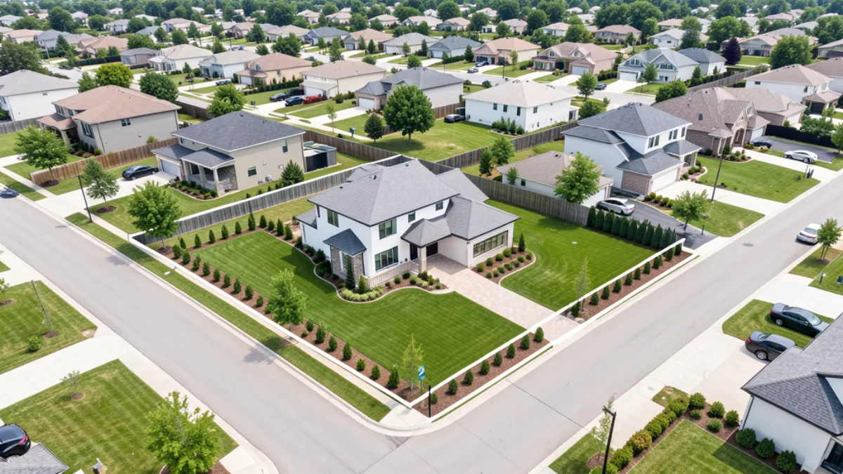
Capture the key angles. A professional drone shoot should always include an elevated front shot that removes visual obstructions like parked cars and power lines, an overhead nadir shot showing property lines and lot layout, and contextual neighborhood shots showing proximity to amenities. A 60-second video flyover set to licensed music creates a cinematic listing tour that buyers watch four times longer than ground-only video.
Use the right equipment. The best drones for real estate photography in 2026 include the DJI Air 3S, DJI Mavic 4 Pro, and DJI Mini 4 Pro. A 1-inch sensor or larger is recommended for professional work, and 35 to 45 minutes of flight time per battery ensures you can capture all necessary angles without landing. For agents and developers who need reliable, FAA-compliant aerial work without managing equipment themselves, specialized real estate drone photography services handle the licensing, flight planning, and post-production.
Know the FAA rules. Any commercial drone photography requires a Part 107 Remote Pilot Certificate. Flying without one exposes the agent and the photographer to FAA enforcement action and fines up to $32,666 per violation. In 2026, Part 108 BVLOS rules also now allow expanded flight operations for properly equipped operators, which matters for large-acreage properties that previously required multiple pilot repositioning stops.
Local Market Expertise Matters
Real estate markets vary significantly by region, and local aerial photography expertise matters. Properties in Pittsburgh and its hilly terrain require different flight planning than flat lots in Chicago and its suburban developments. Working with a drone provider who understands local airspace restrictions, seasonal lighting conditions, and regional buyer expectations produces consistently better results.
The Bottom Line
Drone real estate photography is no longer a differentiator. In 2026, it is table stakes for any property where lot size, location, or exterior features matter. For a $300 to $400 investment on a standard residential listing, you get measurably more views, faster sales, and higher sale prices. For luxury and commercial properties, the ROI compounds into tens of thousands of dollars. Agents who continue to rely on ground-only photography are competing with one hand tied behind their back.
Ready to get started? Contact AeriusView to discuss your project and get a quote for professional drone real estate photography.
Need an Operator?
Get matched with FAA-certified aerial mapping professionals in your area. No cost, no obligation.
Get a Free QuoteFind a Drone Operator in Your Area
We connect project managers with FAA-certified drone operators across 15 states. Browse our location pages to find local aerial mapping services near you.
Browse All Locations