Aerial Imaging Services in Chicago, IL
Third-largest US construction market with $8B annual spending — O'Hare 21 expansion, Lincoln Yards, The 78, and continuous expressway reconstruction under the most complex urban airspace in the Midwest.
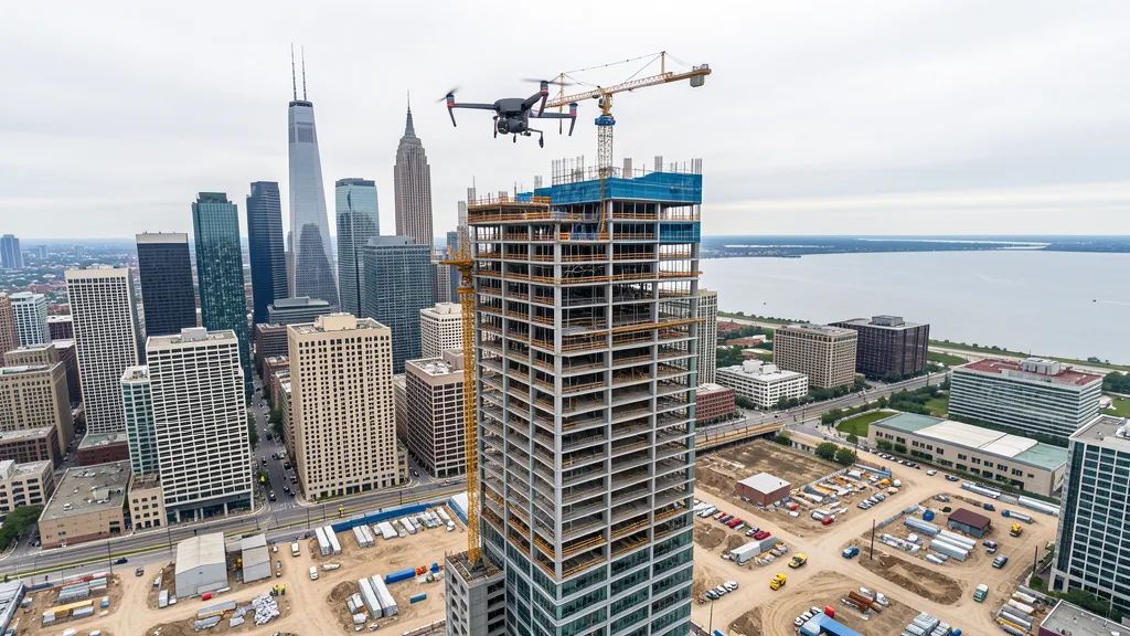
Chicago (Illinois) is part of the Chicago Metropolitan Area and has a population of approximately 2,664,000. Chicago anchors the third-largest construction market in the United States, with over $8 billion in annual spending and a population of 2.6 million. The city operates within the most complex urban airspace in the Midwest, with O'Hare Class B and Midway Class C airspace overlapping across most of the city. The $8.5 billion O'Hare 21 expansion program, CTA Red Line Extension, Lincoln Yards, and The 78 mega-development represent multi-billion-dollar construction pipelines. Chicago's own municipal drone ordinance requires city registration, creating a competitive barrier that benefits compliant Part 107 operators.
Serving Cook & the Chicago Metropolitan Area area
Request a Free Quote
Get a Chicago Aerial Quote
Drone Services Serving Chicago, IL
Chicago anchors the third-largest construction market in the United States, with over $8 billion in annual spending and a population of 2.6 million. The city operates within the most complex urban airspace in the Midwest, with O'Hare Class B and Midway Class C airspace overlapping across most of the city. The $8.5 billion O'Hare 21 expansion program, CTA Red Line Extension, Lincoln Yards, and The 78 mega-development represent multi-billion-dollar construction pipelines. Chicago's own municipal drone ordinance requires city registration, creating a competitive barrier that benefits compliant Part 107 operators.
Aerial Imaging Pricing Across Illinois
Cost ranges are based on market data for Chicago Metropolitan Area. Actual pricing depends on site size, complexity, and deliverables.
| Service Type | Low End | High End |
|---|---|---|
| Topographic Data Collection | $1,525 | $7,550 |
| Drone Inspection | $925 | $5,150 |
| LiDAR Scanning | $3,050 | $12,250 |
| Environmental Monitoring | $1,825 | $7,050 |
| Aerial Imagery | $800 | $3,550 |
| Construction Monitoring | $1,225 | $6,100 |
| Real Estate Photography | $450 | $2,000 |
| Roof Inspection | $500 | $2,050 |
Free cost calculator, ROI calculator, and 14-page buyer's guide. No signup required.
Are you a drone operator serving Chicago? List your business on AeriusView and get pre-qualified leads in your service area.
List Your Business →Drone Regulations & Airspace Rules for Chicago
FAA Part 107 Requirements
Flying for hire in Chicago? That is commercial operation under FAA Part 107, which requires a Remote Pilot Certificate — a credential we verify for every operator.
State Drone Laws
Commercial drone work in Chicago follows Illinois UAS law (720 ILCS 5/48-1 et seq. (Drones Omnibus Act, PA 99-0566, 2017); FAA Part 107; IDOT Division of Aeronautics; Chicago Municipal Code 10-36-070), with city-level rules on top: Chicago has its own municipal drone ordinance under the Chicago Municipal Code (Section 10-36-070), which requires all commercial drone operators to register with the City of Chicago before conducting operations within city limits. Full Illinois drone law →
Local Ordinances
Chicago has its own municipal drone ordinance under the Chicago Municipal Code (Section 10-36-070), which requires all commercial drone operators to register with the City of Chicago before conducting operations within city limits. The ordinance prohibits drone flights over people not directly involved in the operation, restricts flights over Chicago Park District property without a permit, and bans drone operations within 5 miles of O'Hare or Midway airports without FAA authorization. Commercial operators must provide proof of FAA Part 107 Remote Pilot Certificate and liability insurance of at least $1 million when registering with the city. The Chicago Police Department enforces drone regulations and may require additional permits for operations near critical infrastructure, government buildings, and event venues. Drone flights are prohibited over Millennium Park, Grant Park, Navy Pier, and the Chicago Riverwalk during events without special permits. Operations near Navy Pier, Soldier Field, and McCormick Place require coordination with venue security and CPD. The Chicago Department of Buildings may require drone-specific permits for construction site aerial imaging on permitted projects.
Restricted Airspace
- Class B: Chicago O'Hare International Airport (ORD) Class B Airspace. O'Hare Class B airspace extends in a layered structure up to 10,000 ft MSL, covering approximately 30 nautical miles around the airport. The inner core (10 nm radius) extends from the surface to 10,000 ft MSL. Successive shelves step outward and downward. Most of downtown Chicago and the North Side fall within O'Hare Class B at various altitude bands. Commercial drone operations at or below 400 ft AGL may be permitted in certain grid squares via LAANC, but operators must check the FAA LAANC dashboard for each specific location. The approach corridors to O'Hare runways create dynamic altitude restrictions that change based on active runway configurations. Drone operations in downtown Chicago and along the lakefront are particularly complex due to overlapping O'Hare and Midway approach paths.
- Class C: Chicago Midway International Airport (MDW) Class C Airspace. Midway Class C airspace extends approximately 5 nautical miles from the airport up to 4,000 ft MSL, with an outer area extending 10 nm. Southwest Side neighborhoods including Pilsen, Little Village, Brighton Park, and Garfield Ridge fall within Midway's Class C airspace. Commercial drone operators in these areas must obtain LAANC authorization before flight. Midway handles substantial commercial traffic (Southwest Airlines hub), creating continuous approach and departure corridors that drone operators must avoid. The Cicero and Bedford Park industrial corridors near Midway generate significant warehouse and logistics construction demand requiring drone aerial imaging services.
- Infrastructure: Downtown Chicago / Chicago Loop / Lakefront. Downtown Chicago presents unique drone airspace challenges. The Chicago River, Lake Shore Drive, and the Lake Michigan waterfront create complex wind patterns. The Chicago Helicopter Route along the lakefront and river is used by emergency medical, news, and tourism helicopters. Drone operations near Willis Tower, John Hancock Center, Aon Center, and other supertall buildings must coordinate with building management and the Chicago Department of Aviation. The Chicago Air and Water Show (August) creates a large TFR along the lakefront. Navy Pier and Millennium Park are high-pedestrian areas where drone operations require special coordination with the Chicago Park District and CPD.
- Military: Naval Station Great Lakes / Great Lakes Training Center. Naval Station Great Lakes, located approximately 35 miles north of downtown Chicago in North Chicago, is the U.S. Navy's largest training installation. The base has restricted airspace and active TFR zones that can affect drone operations in northern Chicago neighborhoods and suburbs along the Lake Michigan corridor. Operators working on North Side projects near the lakefront should check for active TFRs related to Navy training flights and VIP movements. The base also generates military construction demand including barracks, training facilities, and infrastructure modernization projects.
Airports in the area: ORD — Chicago O'Hare International Airport (Class B airspace, major commercial hub, located on the northwest side of the city), MDW — Chicago Midway International Airport (Class C airspace, southwest side of the city, commercial and cargo), CGX — Chicago Executive Heliport (Class D, downtown riverfront, emergency and corporate helicopter operations), PWK — Chicago/Wheeling Executive Airport (Class D, general aviation, approximately 20 miles northwest)
How Chicago Builders Use Aerial Data
Chicago is the third-largest construction market in the United States, with over $8 billion in annual construction spending. The city has 2.6 million residents and anchors a metropolitan area of 9.5 million people. Major construction sectors include: downtown high-rise development (the Chicago skyline has ongoing supertall tower projects including the Salesforce Tower, 400 Lake Shore Drive, and Vista Tower-adjacent developments), transit infrastructure (CTA Red/Purple Line Modernization, L station reconstructions, Federal Railroad Administration corridor improvements), the O'Hare 21 expansion program ($8.5 billion runway, terminal, and airfield reconstruction), healthcare campus expansion (Northwestern Medicine, Rush University Medical Center, University of Chicago Medical Center), university campus construction (University of Illinois Chicago, Northwestern, University of Chicago), and the Chicago Housing Authority Plan for Transformation (mixed-income development replacing public housing). The industrial corridor along the Stevenson Expressway (I-55) and Cicero Avenue has massive warehouse and logistics construction driven by e-commerce. The Lincoln Yards, The 78, and 78-acre South Loop developments represent multi-billion-dollar mixed-use projects. The Illinois Department of Transportation (IDOT) maintains continuous expressway reconstruction projects across the city.
Active Developers in the Area:
- Chicago Department of Aviation (CDA) — O'Hare 21 expansion program ($8.5B runway and terminal reconstruction), Terminal 2 replacement, Global Terminal construction, airfield reconfiguration, Midway terminal modernization
- CTA / Chicago Transit Authority — Red Line Extension to 130th Street, Red/Purple Modernization (RPM) Phase 1, station reconstructions across the L system, Forest Park Branch Blue Line reconstruction
- Related Midwest / Sterling Bay — The 78 mega-development (62-acre South Loop innovation corridor), Lincoln Yards (55-acre North Side mixed-use development), One Chicago Square, 400 Lake Shore Drive tower
- Chicago Housing Authority (CHA) — Plan for Transformation mixed-income developments, North Side and South Side housing redevelopment, senior living facility construction, scattered-site housing rehabilitation
- IDOT / Illinois State Toll Highway Authority — Jane Addams Memorial Tollway (I-90) reconstruction, Kennedy Expressway reconstruction, Dan Ryan Expressway rehabilitation, Circle Interchange reconstruction, expressway bridge inspections citywide
Why Hire Through Aerius View in Chicago, IL?
FAA-Certified
Every operator holds an active Part 107 Remote Pilot Certificate.
Local to Chicago
Based in the Chicago Metropolitan Area and fluent in Illinois drone law, with 31 nearby Chicago service communities in reach.
No Cost to Quote
Submit your project at no charge. Pay the operator directly if you proceed.
Fast Turnaround
A local operator contacts you within 2 business days — typical for Chicago Metropolitan Area jobs.
AeriusView is expanding in Chicago, IL
Chicago is an expansion market for the network, with demand driven by projects from Chicago Department of Aviation and other local builders. Submit here and a verified operator covering Cook is assigned.
Request a QuoteDrone Data Deliverables for Chicago Projects
These are the files you receive with a Chicago booking — all compatible with standard construction and engineering software. Projects like those delivered for Chicago Department of Aviation across Cook need data that drops straight into their workflow.
- Contour lines (DXF/DWG, CAD-ready) for Civil 3D and Revit
- Progress reports with side-by-side comparisons for construction monitoring
- Orthomosaic maps (GeoTIFF) for site overview and documentation
- Point clouds (LAS/LAZ) for 3D modeling and volumetric analysis
- DEM/DSM terrain models for cut/fill and grade analysis
- Coordinate systems matched to your project datum — the Illinois State Plane zone, UTM, or a local datum your surveyor specifies
Insurance & Liability Protection
Pilot Insurance Required
Every operator matched to a Chicago project carries active liability insurance — minimum $1,000,000 general liability, verified from the certificate before the pilot joins the network. Chicago has its own municipal drone ordinance under the Chicago Municipal Code (Section 10-36-070), which requires all commercial drone operators to register with the City of Chicago before conducting operations within city limits. The ordinance prohibits drone flights over people not directly involved in the operation, restricts flights over Chicago Park District property without a permit, and bans drone operations within 5 miles of O'Hare or Midway airports without FAA authorization. Commercial operators must provide proof of FAA Part 107 Remote Pilot Certificate and liability insurance of at least $1 million when registering with the city. The Chicago Police Department enforces drone regulations and may require additional permits for operations near critical infrastructure, government buildings, and event venues. Drone flights are prohibited over Millennium Park, Grant Park, Navy Pier, and the Chicago Riverwalk during events without special permits. Operations near Navy Pier, Soldier Field, and McCormick Place require coordination with venue security and CPD. The Chicago Department of Buildings may require drone-specific permits for construction site aerial imaging on permitted projects.
FAA Part 107 Verified
Each pilot's Remote Pilot Certificate is checked against the FAA Airmen Inquiry before they can serve Cook bookings. Expired certificates are flagged automatically.
Equipment Documentation
Pilots register their airframes and sensors (RGB, LiDAR, thermal, multispectral) so Chicago requests route to crews with the right payload for the job.
Site Safety Coordination
Pilots coordinate with your site superintendent for safe operations on active Chicago construction sites, including flight plans that avoid worker areas and equipment zones. Chicago has its own municipal drone ordinance under the Chicago Municipal Code (Section 10-36-070), which requires all commercial drone operators to register with the City of Chicago before conducting operations within city limits. The ordinance prohibits drone flights over people not directly involved in the operation, restricts flights over Chicago Park District property without a permit, and bans drone operations within 5 miles of O'Hare or Midway airports without FAA authorization. Commercial operators must provide proof of FAA Part 107 Remote Pilot Certificate and liability insurance of at least $1 million when registering with the city. The Chicago Police Department enforces drone regulations and may require additional permits for operations near critical infrastructure, government buildings, and event venues. Drone flights are prohibited over Millennium Park, Grant Park, Navy Pier, and the Chicago Riverwalk during events without special permits. Operations near Navy Pier, Soldier Field, and McCormick Place require coordination with venue security and CPD. The Chicago Department of Buildings may require drone-specific permits for construction site aerial imaging on permitted projects.
Drone Services FAQ for Chicago, IL
Do I need LAANC authorization to fly a drone in Chicago, IL?
Most of Chicago falls within Class B (O'Hare) or Class C (Midway) controlled airspace. Commercial drone operators must obtain LAANC authorization before every flight in controlled airspace. The FAA LAANC dashboard shows altitude limits for each grid square, which vary significantly across the city depending on proximity to airport approach corridors. Downtown Chicago and lakefront areas are particularly complex due to overlapping O'Hare and Midway approach paths. Operators should always check the LAANC dashboard for their specific operating location, as runway configurations at O'Hare and Midway can change altitude restrictions dynamically.
Does Chicago require drone operators to register with the city?
Yes. Under Chicago Municipal Code Section 10-36-070, all commercial drone operators must register with the City of Chicago before conducting operations within city limits. Registration requires proof of FAA Part 107 Remote Pilot Certificate and liability insurance of at least $1 million. The Chicago Police Department enforces this ordinance, and violations can result in fines and confiscation of equipment. Operators must also obtain FAA LAANC authorization for controlled airspace and comply with the Illinois Drones Omnibus Act (720 ILCS 5/48).
What major construction projects in Chicago need drone aerial imaging?
Chicago has one of the largest construction markets in the United States. Major projects include the $8.5 billion O'Hare 21 expansion program, CTA Red Line Extension and Red/Purple Modernization, the Lincoln Yards and The 78 mega-developments, Northwestern Medicine and Rush University medical campus expansions, CHA Plan for Transformation mixed-income housing, and continuous IDOT expressway reconstruction. The industrial corridor along I-55 and Cicero Avenue has massive warehouse construction driven by e-commerce logistics. These projects generate demand for topographic data collection, construction monitoring, LiDAR scanning, and aerial imagery on a year-round basis.
Can I fly a drone over Millennium Park or the Chicago Riverwalk?
No. The Chicago Municipal Code prohibits drone flights over Millennium Park, Grant Park, Navy Pier, and the Chicago Riverwalk without a special permit from the Chicago Park District and coordination with the Chicago Police Department. These are high-pedestrian areas where drone operations pose safety risks. The Chicago Air and Water Show in August creates a large temporary flight restriction (TFR) along the lakefront. Commercial operators needing aerial imagery of these areas should coordinate with the Chicago Department of Cultural Affairs and Special Events for permitted operations during off-peak hours.
Is Chicago a good market for drone aerial imaging businesses?
Chicago is one of the strongest drone aerial imaging markets in the United States. With over $8 billion in annual construction spending, 2.6 million residents, and a metro area of 9.5 million people, the city generates consistent demand across high-rise construction, transportation infrastructure, healthcare campus expansion, university facilities, and industrial logistics development. The complex Class B and Class C airspace creates a competitive barrier that benefits licensed Part 107 operators who can navigate LAANC authorization. Chicago's dense urban environment also creates strong demand for roof inspection, facade inspection, and real estate photography services.
How does the O'Hare Class B airspace affect drone operations in downtown Chicago?
O'Hare Class B airspace extends in layered shelves up to 10,000 ft MSL, covering approximately 30 nautical miles around the airport. Downtown Chicago (approximately 17 miles southeast of O'Hare) falls within the outer shelves of Class B at higher altitudes, but most commercial drone operations at 400 ft AGL and below may be in uncontrolled airspace depending on the specific grid square. However, the overlapping approach corridors to O'Hare and Midway create dynamic altitude restrictions. Operators must check the FAA LAANC dashboard for each specific location and may need to coordinate with both O'Hare and Midway air traffic control towers depending on the operating area.
Aerial Imaging Terms for Chicago Projects
First aerial project in Chicago? These terms cover the deliverables local pilots will quote you. Most Chicago projects in our cost table start around $450.
Orthomosaic
A geometrically corrected aerial photo map stitched from many images.
Point Cloud
A 3D dataset of points representing the captured surface.
Real-Time Kinematic
RTK GPS correction for centimeter-level positional accuracy.
LiDAR
Laser scanning that captures terrain through vegetation.
Digital Elevation Model
A 3D representation of terrain elevation across the site.
Ground Control Point
Known reference markers used to anchor and validate mapping accuracy.
Aerial Mapping
Data collection from above to map and measure a site.
Volumetrics
Cut/fill and stockpile volume calculations derived from terrain models.
Nearby Cities
Are You a Drone Operator in Chicago?
Cook buyers search here — 5 active developers tracked in Chicago alone. Join the network and get matched leads. First lead free.
Ready to Start Your Project in Chicago, IL?
Tell us about your Chicago project and we route it to a vetted local pilot — free, no obligation. Projects in Cook start around $450.
Request a Free QuoteAeriusView connects clients with FAA-certified drone operators. Services are not licensed land surveying. Deliverables are not authoritative for boundary determination, design, or legal purposes.