Aerial Imaging Services in Heber Springs, AR
Heber Springs golden-hour aerial showing Greers Ferry Lake shoreline, the Ozark foothills, and lakefront residential development along Highway 25 in this popular Arkansas resort and retirement community.
The Heber Springs, AR Micropolitan Statistical Area (Greers Ferry Lake, Cleburne County, North-Central Arkansas) includes Heber Springs, where roughly 7,050 residents live in Cleburne County. This Greers Ferry Lake resort community has experienced sustained residential construction driven by retirement migration, vacation home development, and short-term rental investment along the shoreline. Over 200 new residential building permits were issued in Cleburne County in 2024, with lakefront and lake-view lots commanding premium prices. Major residential developments include the Edgewater Cove subdivision on the west side of the lake, ongoing expansion of the Little Red River Ranch community, and multiple custom home builds in the Sugarloaf Creek and Tillery Cove areas. Commercial development along Highway 25 and Highway 16 includes new retail centers, restaurants, and medical office buildings serving the growing retiree population. The Heber Springs School District completed a $12 million high school renovation and athletic facility expansion in 2023. Healthcare construction includes the Baptist Health Medical Center-Heber Springs expansion, which added a new emergency department wing and outpatient clinic space. The Arkansas Department of Transportation has invested in Highway 25 widening and safety improvements through Cleburne County, creating demand for corridor aerial imaging and grading verification. The US Army Corps of Engineers continues infrastructure maintenance and improvement projects at Greers Ferry Dam and surrounding recreation facilities.
Serving Cleburne County & the Heber Springs, AR Micropolitan Statistical Area (Greers Ferry Lake, Cleburne County, North-Central Arkansas) area
Request a Free Quote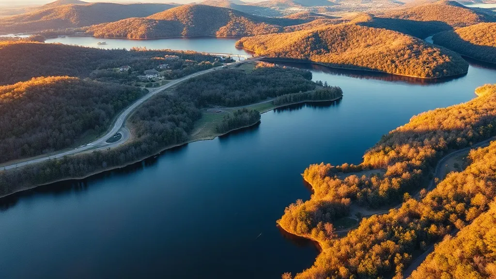
Request a Heber Springs Drone Operator
Heber Springs Aerial Imaging Options
Heber Springs is the county seat of Cleburne County and the primary commercial hub for the Greers Ferry Lake resort region in north-central Arkansas. The city sits at the intersection of Highways 25 and 16, approximately 55 miles north of Little Rock, and serves a trade area of over 30,000 residents including lakefront property owners, retirees, and vacation home investors. Greers Ferry Lake, a 40,000-acre US Army Corps of Engineers reservoir, drives the local economy through tourism, retirement migration, and vacation home construction. The Ozark foothills terrain with forested slopes, limestone bluffs, and meandering shorelines creates distinctive data collection conditions that demand experienced aerial operators familiar with ridge-line wind patterns and dense canopy coverage.
Heber Springs Construction & Development: An Aerial Perspective
This Greers Ferry Lake resort community has experienced sustained residential construction driven by retirement migration, vacation home development, and short-term rental investment along the shoreline. Over 200 new residential building permits were issued in Cleburne County in 2024, with lakefront and lake-view lots commanding premium prices. Major residential developments include the Edgewater Cove subdivision on the west side of the lake, ongoing expansion of the Little Red River Ranch community, and multiple custom home builds in the Sugarloaf Creek and Tillery Cove areas. Commercial development along Highway 25 and Highway 16 includes new retail centers, restaurants, and medical office buildings serving the growing retiree population. The Heber Springs School District completed a $12 million high school renovation and athletic facility expansion in 2023. Healthcare construction includes the Baptist Health Medical Center-Heber Springs expansion, which added a new emergency department wing and outpatient clinic space. The Arkansas Department of Transportation has invested in Highway 25 widening and safety improvements through Cleburne County, creating demand for corridor aerial imaging and grading verification. The US Army Corps of Engineers continues infrastructure maintenance and improvement projects at Greers Ferry Dam and surrounding recreation facilities.
Active Developers in the Area:
- Greers Ferry Lake Construction (Cleburne County lakefront residential — Edgewater Cove subdivision and Tillery Cove custom homes)
- Ozark Mountain Builders (Heber Springs retirement and vacation homes — Little Red River Ranch community expansion)
- EFCO Corporation (Cleburne County commercial and institutional — Heber Springs School District renovation and medical office buildout)
- Crafton Tull (North-Central Arkansas engineering and aerial imaging — Highway 25 corridor improvements and Cleburne County infrastructure projects)
- Baptist Health Construction Group (Heber Springs healthcare — Baptist Health Medical Center emergency department expansion and outpatient clinic)
- Sugarloaf Development (Heber Springs residential — Sugarloaf Creek area subdivision development and lake-view home construction)

What Drone Services Cost in Arkansas
These are typical Heber Springs-area project ranges, drawn from market data across Heber Springs, AR Micropolitan Statistical Area (Greers Ferry Lake, Cleburne County, North-Central Arkansas). Your final price depends on site size, complexity, and deliverables.
| Service Type | Low End | High End |
|---|---|---|
| Topographic Data Collection | $675 | $2,350 |
| Drone Inspection | $200 | $1,100 |
| LiDAR Scanning | $1,200 | $4,600 |
| Environmental Monitoring | $350 | $1,650 |
| Aerial Imagery | $150 | $700 |
| Construction Monitoring | $225 | $950 |
| Real Estate Photography | $150 | $400 |
| Roof Inspection | $150 | $550 |
Free cost calculator, ROI calculator, and 14-page buyer's guide. No signup required.
Are you a drone operator serving Heber Springs? List your business on AeriusView and get pre-qualified leads in your service area.
List Your Business →Heber Springs Airspace, FAA Rules & Local Drone Laws
FAA Part 107 Requirements
All commercial drone operations in Arkansas require an active FAA Part 107 Remote Pilot Certificate — every operator matched to Heber Springs projects is verified.
State Drone Laws
Heber Springs operates under Arkansas state drone law (Act 819 of 2019) with local regulations limited by Ark. Statewide, Arkansas drone law (AR Act 819 of 2019; Ark. Code Ann. § 5-60-130; Ark. Code Ann. § 14-361-120; FAA Part 107) sets the baseline for commercial operations — Part 107 rules apply on every Heber Springs job. Full Arkansas drone law →
Local Ordinances
Heber Springs operates under Arkansas state drone law (Act 819 of 2019) with local regulations limited by Ark. Code Ann. § 14-361-120, which preempts municipalities from regulating drone flight paths and navigable airspace. The city has no specific municipal drone ordinance beyond state law, but commercial drone takeoff and landing on city-owned property requires approval from the Heber Springs Parks and Recreation Department for city parks and the Heber Springs Airport Commission for Heber Springs Municipal Airport property. Cleburne County requires aerial imaging documentation for major subdivision and site plan submissions in the unincorporated portions of the county. The Heber Springs Planning Commission oversees residential and commercial development approvals along Highway 25 and the Greers Ferry Lake shoreline, and accepts drone-generated orthomosaic maps and topographic data collection for site plan submissions. The US Army Corps of Engineers Greers Ferry Project Office requires special use permits for commercial drone takeoff and landing on federal property surrounding Greers Ferry Lake, including dam infrastructure, recreation areas, and campgrounds. The Heber Springs Chamber of Commerce coordinates with local resorts and marina operators for commercial photography and marketing drone flights over lakefront properties.
Restricted Airspace
- Heber Springs Municipal Airport (KHBR) is a non-towered general aviation airport approximately 3 NM north of downtown Heber Springs. The airport operates under Class E airspace rules with no control tower. Drone operators within 5 nautical miles must notify the airport manager before flying under FAA Part 107.43. KHBR has a single runway (Runway 4/22), so avoid the extended runway centerline when conducting low-altitude data collection projects. Monitor CTAF 122.9 for self-announced traffic.
- Greers Ferry Lake is a US Army Corps of Engineers reservoir spanning over 40,000 acres in Cleburne County. Drone takeoff and landing on federal property managed by the Corps of Engineers requires a special use permit. The Greers Ferry Dam and hydroelectric facilities have security exclusion zones, and low-altitude flights over these facilities may trigger security concerns. The Corps manages multiple recreation areas, campgrounds, and marinas around the lake, each requiring coordination for commercial drone operations. Contact the Corps of Engineers Greers Ferry Project Office for data collection projects near dam infrastructure, spillways, or federal recreation areas.
- The Ozark National Forest borders Cleburne County to the north and west. While National Forest land is generally open to drone flight under FAA Part 107, commercial drone takeoff and landing may require a special use permit from the US Forest Service. The forest contains wilderness areas where motorized activities are restricted, but drone flight is regulated by FAA rules. Avoid low-altitude flights over wilderness visitors, hikers, and campers to comply with Arkansas Act 819 of 2019 privacy provisions. The Sylamore Ranger District office can provide guidance on commercial filming permits for Forest Service lands.
- Little Rock Air Force Base (KLRF) is approximately 60 NM south of Heber Springs in Jacksonville. While the base Class C airspace does not extend to Cleburne County, military training routes (MTRs) cross through the Ozark foothills region. Low-level military aircraft operations may occur along these routes, particularly in the river valleys. Check the FAA B4UFLY app for active TFRs and NOTAMs before flying, especially during military training exercises. The MTRs are charted on sectional maps and can affect drone mission planning at higher altitudes.
- Greers Ferry Lake and the Little Red River below the dam are popular recreational areas with marinas, resorts, and private homes along the shoreline. Privacy expectations under Arkansas Act 819 of 2019 apply to drone flights over private lake homes, boat docks, and recreation areas. Commercial drone operators should obtain property owner consent before conducting aerial photography or inspection of lakefront properties. The Arkansas Game and Fish Commission manages wildlife management areas near the lake that may have additional restrictions on drone operations during hunting seasons.
Airports in the area: KHBR — Heber Springs Municipal Airport (Class E airspace, non-towered general aviation airport approximately 3 NM north of downtown Heber Springs, CTAF 122.9), KLIT — Bill and Hillary Clinton National Airport (Class C airspace, approximately 60 NM south in Little Rock, major commercial hub, LAANC available), KCAO — Conway Municipal Airport (Class E airspace, approximately 40 NM south in Conway, non-towered general aviation), KBPK — Batesville Regional Airport (Class E airspace, approximately 45 NM northeast in Batesville, non-towered general aviation)
Why Heber Springs Contractors Trust Aerius View
FAA-Certified
Every operator holds an active Part 107 Remote Pilot Certificate.
Local to Heber Springs
Pilots who fly Heber Springs regularly — they know the Cleburne County staging spots, permit offices, and airspace quirks.
No Cost to Quote
Submit your project at no charge. Pay the operator directly if you proceed.
Fast Turnaround
Expect the first call within 2 business days from an operator covering Cleburne County.
AeriusView is expanding in Heber Springs, AR
Pilot coverage for Heber Springs is filling in — surrounding Heber Springs, AR Micropolitan Statistical Area (Greers Ferry Lake, Cleburne County, North-Central Arkansas) cities are already served. Requests from Heber Springs are routed to the nearest verified operator.
Request a QuoteWhat Aerial Data Products Do You Receive in Heber Springs?
a Heber Springs project wraps with professional-grade deliverables built for the software stacks Cleburne County crews already run. Projects like those delivered for Greers Ferry Lake Construction across Cleburne County need data that drops straight into their workflow.
- DEM/DSM terrain models for cut/fill and grade analysis
- Contour lines (DXF/DWG, CAD-ready) for Civil 3D and Revit
- Progress reports with side-by-side comparisons for construction monitoring
- Orthomosaic maps (GeoTIFF) for site overview and documentation
- Point clouds (LAS/LAZ) for 3D modeling and volumetric analysis
- Coordinate systems matched to your project datum — the Arkansas State Plane zone, UTM, or a local datum your surveyor specifies
Insurance & Liability Protection
Pilot Insurance Required
Every operator matched to a Heber Springs project carries active liability insurance — minimum $1,000,000 general liability, verified from the certificate before the pilot joins the network. Heber Springs operates under Arkansas state drone law (Act 819 of 2019) with local regulations limited by Ark. Code Ann. § 14-361-120, which preempts municipalities from regulating drone flight paths and navigable airspace. The city has no specific municipal drone ordinance beyond state law, but commercial drone takeoff and landing on city-owned property requires approval from the Heber Springs Parks and Recreation Department for city parks and the Heber Springs Airport Commission for Heber Springs Municipal Airport property. Cleburne County requires aerial imaging documentation for major subdivision and site plan submissions in the unincorporated portions of the county. The Heber Springs Planning Commission oversees residential and commercial development approvals along Highway 25 and the Greers Ferry Lake shoreline, and accepts drone-generated orthomosaic maps and topographic data collection for site plan submissions. The US Army Corps of Engineers Greers Ferry Project Office requires special use permits for commercial drone takeoff and landing on federal property surrounding Greers Ferry Lake, including dam infrastructure, recreation areas, and campgrounds. The Heber Springs Chamber of Commerce coordinates with local resorts and marina operators for commercial photography and marketing drone flights over lakefront properties.
FAA Part 107 Verified
Each pilot's Remote Pilot Certificate is checked against the FAA Airmen Inquiry before they can serve Cleburne County bookings. Expired certificates are flagged automatically.
Equipment Documentation
Pilots register their airframes and sensors (RGB, LiDAR, thermal, multispectral) so Heber Springs requests route to crews with the right payload for the job.
Site Safety Coordination
Pilots coordinate with your site superintendent for safe operations on active Heber Springs construction sites, including flight plans that avoid worker areas and equipment zones. Heber Springs operates under Arkansas state drone law (Act 819 of 2019) with local regulations limited by Ark. Code Ann. § 14-361-120, which preempts municipalities from regulating drone flight paths and navigable airspace. The city has no specific municipal drone ordinance beyond state law, but commercial drone takeoff and landing on city-owned property requires approval from the Heber Springs Parks and Recreation Department for city parks and the Heber Springs Airport Commission for Heber Springs Municipal Airport property. Cleburne County requires aerial imaging documentation for major subdivision and site plan submissions in the unincorporated portions of the county. The Heber Springs Planning Commission oversees residential and commercial development approvals along Highway 25 and the Greers Ferry Lake shoreline, and accepts drone-generated orthomosaic maps and topographic data collection for site plan submissions. The US Army Corps of Engineers Greers Ferry Project Office requires special use permits for commercial drone takeoff and landing on federal property surrounding Greers Ferry Lake, including dam infrastructure, recreation areas, and campgrounds. The Heber Springs Chamber of Commerce coordinates with local resorts and marina operators for commercial photography and marketing drone flights over lakefront properties.
Heber Springs, AR Drone & Aerial Imaging Questions
Do I need LAANC authorization to fly a drone in Heber Springs, Arkansas?
Heber Springs Municipal Airport (KHBR) is a non-towered Class E general aviation airport approximately 3 NM north of downtown. KHBR does not have controlled airspace requiring LAANC, but drone operators within 5 nautical miles must notify the airport manager before flying under FAA Part 107.43. Little Rock Air Force Base (KLRF) is approximately 60 NM south and its Class C airspace does not extend to Cleburne County. Check the FAA B4UFLY app for your specific location and any temporary TFRs, especially along military training routes through the Ozark foothills.
Are there drone restrictions near Greers Ferry Lake and the Corps of Engineers dam?
Greers Ferry Lake is a US Army Corps of Engineers reservoir spanning over 40,000 acres. Drone takeoff and landing on federal property managed by the Corps requires a special use permit. The Greers Ferry Dam and hydroelectric facilities have security exclusion zones, and low-altitude flights over these facilities may trigger security concerns. Contact the Corps of Engineers Greers Ferry Project Office for data collection projects near dam infrastructure, spillways, or federal recreation areas. Flying over the lake itself is permitted under FAA Part 107, but avoid low-altitude flights over boaters, swimmers, and recreation areas to comply with Arkansas Act 819 of 2019 privacy provisions.
What is the cost of an aerial imaging for a construction site in Heber Springs?
Topographic drone data collection in Heber Springs typically ranges from $750 to $2,600 depending on acreage and terrain. The Ozark foothills terrain with rolling hills, lake shorelines, and forested slopes creates moderate data collection complexity. Construction monitoring visits cost $250 to $1,050 per session. LiDAR scanning runs $1,300 to $5,000. The active lakefront residential development, Highway 25 corridor commercial construction, and Baptist Health Medical Center expansion make aerial mapping valuable for developers, healthcare administrators, and Cleburne County planners.
Can I fly a drone over private lakefront properties on Greers Ferry Lake?
Privacy expectations under Arkansas Act 819 of 2019 apply to drone flights over private lake homes, boat docks, and recreation areas. Commercial drone operators should obtain property owner consent before conducting aerial photography or inspection of lakefront properties. The Heber Springs Chamber of Commerce coordinates with local resorts and marina operators for commercial photography and marketing flights. For real estate photography of lakefront listings, coordinate with the listing agent and property owner to ensure consent is documented. Avoid capturing images of neighboring properties or recreational users without consent.
What drone services are most in demand for the Heber Springs construction market?
Heber Springs' retirement migration, lakefront vacation home construction, and healthcare expansion create strong demand for topographic data collection, real estate photography, and construction monitoring. The Edgewater Cove and Little Red River Ranch subdivisions drive demand for lot staking support, grading verification, and progress documentation. Lakefront custom home builds need aerial photography for marketing and insurance documentation. The Baptist Health Medical Center expansion requires construction progress documentation and aerial inspection. The Highway 25 widening project creates demand for corridor aerial imaging. LiDAR scanning is valuable for the Ozark foothills terrain mapping and Greers Ferry Lake shoreline analysis.
Does Arkansas require state drone registration for commercial operators in Heber Springs?
No. Arkansas does not require state drone registration. Commercial operators need a valid FAA Part 107 Remote Pilot Certificate and must comply with Ark. Code Ann. § 5-60-130 privacy restrictions under Act 819 of 2019. The state preempts local regulation of drone flight paths under Ark. Code Ann. § 14-361-120, though the Heber Springs Airport Commission may regulate takeoff and landing on Heber Springs Municipal Airport property and the Parks and Recreation Department may regulate takeoff and landing in city parks. The US Army Corps of Engineers requires separate permits for commercial operations on federal property around Greers Ferry Lake.
Aerial Imaging Terms for Heber Springs Projects
The vocabulary behind Heber Springs aerial data — useful before you request quotes. Most Heber Springs projects in our cost table start around $150.
Point Cloud
A 3D dataset of points representing the captured surface.
Real-Time Kinematic
RTK GPS correction for centimeter-level positional accuracy.
LiDAR
Laser scanning that captures terrain through vegetation.
Digital Elevation Model
A 3D representation of terrain elevation across the site.
Ground Control Point
Known reference markers used to anchor and validate mapping accuracy.
Aerial Mapping
Data collection from above to map and measure a site.
Volumetrics
Cut/fill and stockpile volume calculations derived from terrain models.
Thermal Imaging
Infrared capture that reveals heat signatures for inspections.
Nearby Cities
Are You a Drone Operator in Heber Springs?
Serve Heber Springs and the wider Heber Springs, AR Micropolitan Statistical Area (Greers Ferry Lake, Cleburne County, North-Central Arkansas) : leads routed by service area, no fees to join, first lead free.
Ready to Start Your Project in Heber Springs, AR?
One form, then a Heber Springs, AR Micropolitan Statistical Area (Greers Ferry Lake, Cleburne County, North-Central Arkansas)-based operator follows up with a quote. No cost, no commitment. Projects in Cleburne County start around $150.
Request a Free QuoteAeriusView connects clients with FAA-certified drone operators. Services are not licensed land surveying. Deliverables are not authoritative for boundary determination, design, or legal purposes.