Aerial Imaging Services in Jackson, WY
Jackson Hole valley aerial at golden hour showing the Teton Range rising sharply to the west, the Snake River winding through the valley floor, and luxury residential construction sites dotting the aspen groves near the town of Jackson.
With about 11,500 people in Teton County, Jackson is a community in the Jackson, WY Micropolitan Statistical Area (Teton County, northwest Wyoming) of Wyoming. Jackson is the gateway to Grand Teton and Yellowstone National Parks and sits in a valley with some of the highest residential property values in the American West. The town of just over 11,000 residents sustains a construction economy driven by ultra-luxury custom homes, resort expansion at Teton Village, and wealthy out-of-state migration. Drone aerial imaging here faces unique constraints: Grand Teton National Park covers most of the valley and prohibits all UAS operations, while Bridger-Teton National Forest requires special use permits for commercial flights. The viable operating area is private land in and around town, but the extreme property values on that land make aerial imaging work exceptionally well-compensated compared to other Wyoming markets.
Serving Teton County & the Jackson, WY Micropolitan Statistical Area (Teton County, northwest Wyoming) area
Request a Free Quote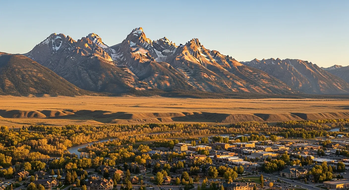
Find a Teton County Drone Pilot
Aerial Imaging Services Available in Jackson, WY
Jackson is the gateway to Grand Teton and Yellowstone National Parks and sits in a valley with some of the highest residential property values in the American West. The town of just over 11,000 residents sustains a construction economy driven by ultra-luxury custom homes, resort expansion at Teton Village, and wealthy out-of-state migration. Drone aerial imaging here faces unique constraints: Grand Teton National Park covers most of the valley and prohibits all UAS operations, while Bridger-Teton National Forest requires special use permits for commercial flights. The viable operating area is private land in and around town, but the extreme property values on that land make aerial imaging work exceptionally well-compensated compared to other Wyoming markets.
Airspace & Flying Rules in Jackson, WY
FAA Part 107 Requirements
Commercial flights over Jackson fall under FAA Part 107: the pilot must hold a current Remote Pilot Certificate. Network operators are checked before matching.
State Drone Laws
Drone rules in Jackson layer two ways: Jackson and Teton County have limited city-specific drone ordinances, but operators must navigate complex federal land management restrictions. plus Wyoming statewide UAS law (Wyo. Stat. § 31-1-101(a)(vi) (aircraft definition includes UAS); Wyoming Aeronautics Commission advisory guidance) governing commercial flights. Full Wyoming drone law →
Local Ordinances
Jackson and Teton County have limited city-specific drone ordinances, but operators must navigate complex federal land management restrictions. The National Park Service bans all drone operations within Grand Teton National Park (36 CFR 1.5, NPS Policy Memorandum 14-05) — this is the single most important restriction in the Jackson area, as the park surrounds the airport and covers much of the valley north of town. Bridger-Teton National Forest requires a special use permit for commercial drone operations on forest lands. Teton County parks and recreation areas may require authorization for commercial drone takeoff and landing. The Jackson Hole Airport (JAC) Class D airspace requires LAANC authorization. Jackson Hole Mountain Resort and Snow King Mountain require resort management authorization for drone operations on their properties. Operators must verify they are on private land outside NPS and USFS restricted areas before conducting any commercial drone work in the Jackson area.
Restricted Airspace
- Jackson Hole Airport (JAC) Class D airspace extends from the surface to 9,000 feet MSL within 4 nautical miles of the airport. LAANC authorization is required for commercial drone operations within this controlled airspace. The airport is uniquely situated inside Grand Teton National Park, and drone operations are further restricted by National Park Service regulations (see below). The control tower operates seasonally with extended hours in summer and winter ski season. Drone operators must use the LAANC system via the FAA B4UFLY app or approved providers (Aloft, AirMap) for authorization before flying within the Class D surface area.
- Grand Teton National Park completely surrounds the Jackson Hole Airport and encompasses most of the valley north of Jackson. The National Park Service prohibits all drone operations — including takeoff, landing, and flight — within national park boundaries under 36 CFR 1.5 and NPS Policy Memorandum 14-05. This is a total ban on commercial and recreational drone use within Grand Teton National Park, with no permits available for commercial aerial imaging work. The park boundary begins approximately 3 miles north of downtown Jackson, meaning much of the Jackson Hole valley is a no-drone zone. Operators must verify they are on private or non-federal land outside park boundaries before conducting any drone operations.
- Yellowstone National Park, located approximately 60 miles north of Jackson via the John D. Rockefeller Jr. Parkway, also prohibits all drone operations under the same NPS regulations. The park boundary extends into the greater Yellowstone ecosystem, and drone operators traveling north from Jackson toward Yellowstone should be aware that the NPS drone ban applies throughout all National Park Service lands in the region. No commercial drone permits are available for Yellowstone or Grand Teton.
- Bridger-Teton National Forest covers over 3.4 million acres surrounding Jackson Hole. Commercial drone operations on National Forest lands — including mapping, aerial imaging, real estate photography, or any revenue-generating aerial work — require a special use permit from the Bridger-Teton National Forest ranger district office. Recreational drone use under FAA TRUST does not require a Forest Service permit but must follow FAA Part 107 recreational guidelines. The forest includes the Gros Ventre Wilderness, Wind River Range, and Wyoming Range areas surrounding the Jackson Hole valley.
- The Jackson Hole Mountain Resort and Snow King Mountain ski areas have specific operational zones where drone flights are prohibited during operating hours for safety. Jackson Hole Mountain Resort in Teton Village requires explicit authorization from resort management for any drone operations on resort property. Snow King Mountain, located within the town of Jackson, has similar restrictions. Both resorts host year-round recreational activities including skiing, mountain biking, and scenic tram rides, and FAA Part 107 prohibits flying directly over non-participants. Winter helicopter traffic for ski patrol and medical evacuation adds additional airspace complexity during ski season.
Airports in the area: JAC — Jackson Hole Airport (KJAC, Class D airspace, controlled tower, commercial service with Delta and United, located inside Grand Teton National Park 7 miles north of downtown Jackson — the only commercial airport situated within a US national park), WYS — West Yellowstone Airport (Class E, 110 miles north in Montana, seasonal commercial and general aviation, reference for Greater Yellowstone ecosystem operators), IDA — Idaho Falls Regional Airport (Class D, 90 miles south in Idaho, controlled tower, commercial and GA, reference for cross-border operators from eastern Idaho), DRU — Driggs Reed Memorial Airport (Class E, 35 miles west in Driggs ID, general aviation, reference for Teton Valley operators serving the west side of the Teton Range)
Wyoming Aerial Imaging Cost Guide
Pricing below reflects the Jackson, WY Micropolitan Statistical Area (Teton County, northwest Wyoming) market. Site size, terrain, and the deliverables you need move the final number up or down.
| Service Type | Low End | High End |
|---|---|---|
| Topographic Data Collection | $1,150 | $5,250 |
| Drone Inspection | $425 | $1,850 |
| LiDAR Scanning | $2,050 | $7,000 |
| Environmental Monitoring | $575 | $2,650 |
| Aerial Imagery | $325 | $1,400 |
| Construction Monitoring | $475 | $1,700 |
| Real Estate Photography | $275 | $1,150 |
| Roof Inspection | $375 | $1,050 |
Free cost calculator, ROI calculator, and 14-page buyer's guide. No signup required.
Are you a drone operator serving Jackson? List your business on AeriusView and get pre-qualified leads in your service area.
List Your Business →Aerial Imaging Solutions for Jackson's Development Pipeline
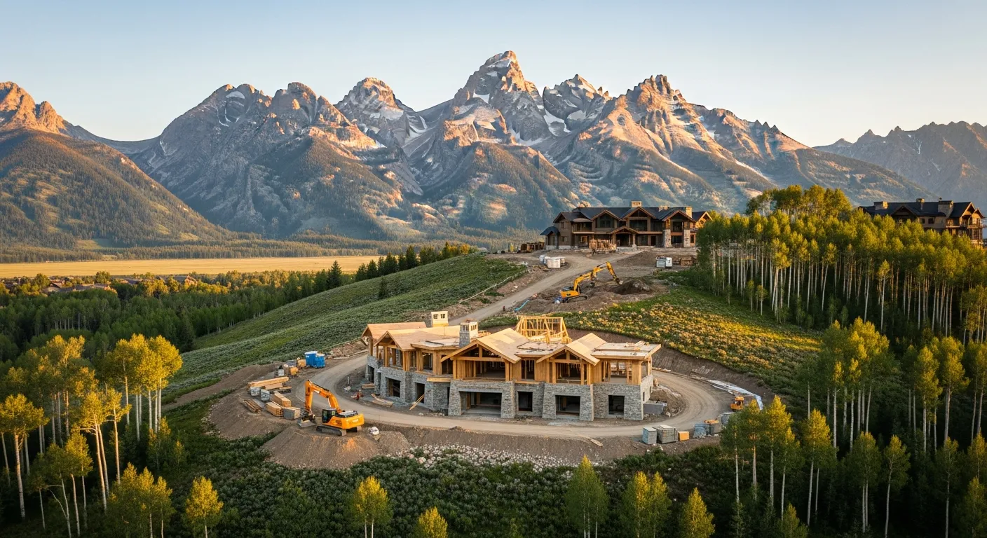
Jackson and Teton County represent one of the most expensive residential building markets in the American West. The Jackson Hole valley is experiencing sustained construction activity driven by ultra-luxury residential development, resort expansion, and a surge of wealthy out-of-state buyers relocating since 2020. Median home prices in Teton County regularly exceed $3 million, and new custom home construction in areas like Westbank, Teton Village, and the Spring Gulch area typically involves budgets from $5 million to $30 million or more. Major resort development includes Jackson Hole Mountain Resort base area expansion, Teton Village lodge and condo projects, and the Four Seasons resort renovation. The new Jackson Elementary School rebuild and Teton County Library expansion add public construction. Infrastructure projects include the Broadway reconstruction, the South Highway 89 wildlife crossing project, and ongoing WYDOT improvements to Highway 22 and the Teton Pass corridor. The Teton County School District and St. Johns Health hospital expansion add institutional construction. The extremely high property values mean that even small construction projects justify aerial imaging and inspection investment.
Active Developers in the Area:
- R.A. Nelson & Associates (Jackson-based luxury residential and resort construction, founded 1975, built many iconic Jackson Hole projects including Teton Village lodges)
- Vertical Horizons Construction (Jackson-based custom luxury home builder, active in Westbank and Spring Gulch high-end residential)
- Carney Logan Burke Architects (Jackson-based architecture firm specializing in mountain luxury residential, designs paired with regional builders)
- Teton Heritage Builders (Jackson-based fine home construction, active in Teton County and Teton Valley Idaho high-end residential)
- GE Johnson Construction (regional commercial and institutional contractor, Jackson Elementary School and healthcare projects)
- Kitchell Construction (national resort and hospitality specialist, Four Seasons Jackson Hole renovation and Teton Village projects)
Why Developers in Jackson Use Aerius View
FAA-Certified
Every operator holds an active Part 107 Remote Pilot Certificate.
Local to Jackson
Local crews covering Jackson and 8 surrounding cities, already current on Wyoming airspace and LAANC workflows.
No Cost to Quote
Submit your project at no charge. Pay the operator directly if you proceed.
Fast Turnaround
Quotes in Jackson commonly move inside 2 business days once your request is in.
AeriusView is expanding in Jackson, WY
We're onboarding Jackson operators to serve demand from R.A. Nelson & Associates and other area projects. Your request gets matched to verified coverage in Teton County.
Request a QuoteYour Project Deliverables Explained
Every deliverable below ships with your Jackson project, formatted for the construction and engineering platforms used throughout the Jackson, WY Micropolitan Statistical Area (Teton County, northwest Wyoming). Projects like those delivered for R.A. Nelson & Associates across Teton County need data that drops straight into their workflow.
- Point clouds (LAS/LAZ) for 3D modeling and volumetric analysis
- DEM/DSM terrain models for cut/fill and grade analysis
- Contour lines (DXF/DWG, CAD-ready) for Civil 3D and Revit
- Progress reports with side-by-side comparisons for construction monitoring
- Orthomosaic maps (GeoTIFF) for site overview and documentation
- Coordinate systems matched to your project datum — the Wyoming State Plane zone, UTM, or a local datum your surveyor specifies
Insurance & Liability Protection
Pilot Insurance Required
Every operator matched to a Jackson project carries active liability insurance — minimum $1,000,000 general liability, verified from the certificate before the pilot joins the network. Jackson and Teton County have limited city-specific drone ordinances, but operators must navigate complex federal land management restrictions. The National Park Service bans all drone operations within Grand Teton National Park (36 CFR 1.5, NPS Policy Memorandum 14-05) — this is the single most important restriction in the Jackson area, as the park surrounds the airport and covers much of the valley north of town. Bridger-Teton National Forest requires a special use permit for commercial drone operations on forest lands. Teton County parks and recreation areas may require authorization for commercial drone takeoff and landing. The Jackson Hole Airport (JAC) Class D airspace requires LAANC authorization. Jackson Hole Mountain Resort and Snow King Mountain require resort management authorization for drone operations on their properties. Operators must verify they are on private land outside NPS and USFS restricted areas before conducting any commercial drone work in the Jackson area.
FAA Part 107 Verified
Each pilot's Remote Pilot Certificate is checked against the FAA Airmen Inquiry before they can serve Teton County bookings. Expired certificates are flagged automatically.
Equipment Documentation
Pilots register their airframes and sensors (RGB, LiDAR, thermal, multispectral) so Jackson requests route to crews with the right payload for the job.
Site Safety Coordination
Pilots coordinate with your site superintendent for safe operations on active Jackson construction sites, including flight plans that avoid worker areas and equipment zones. Jackson and Teton County have limited city-specific drone ordinances, but operators must navigate complex federal land management restrictions. The National Park Service bans all drone operations within Grand Teton National Park (36 CFR 1.5, NPS Policy Memorandum 14-05) — this is the single most important restriction in the Jackson area, as the park surrounds the airport and covers much of the valley north of town. Bridger-Teton National Forest requires a special use permit for commercial drone operations on forest lands. Teton County parks and recreation areas may require authorization for commercial drone takeoff and landing. The Jackson Hole Airport (JAC) Class D airspace requires LAANC authorization. Jackson Hole Mountain Resort and Snow King Mountain require resort management authorization for drone operations on their properties. Operators must verify they are on private land outside NPS and USFS restricted areas before conducting any commercial drone work in the Jackson area.
Frequently Asked Questions — Jackson Aerial Imaging
Can I fly a drone in Grand Teton National Park near Jackson?
No. The National Park Service prohibits all drone operations — including takeoff, landing, and flight — within Grand Teton National Park under 36 CFR 1.5 and NPS Policy Memorandum 14-05. This is a total ban on both commercial and recreational drone use, with no permits available for commercial data collection work. Grand Teton National Park surrounds Jackson Hole Airport and covers most of the valley north of Jackson, so the park boundary begins approximately 3 miles north of downtown. Operators must verify they are on private or non-federal land outside park boundaries before conducting any drone operations. The same NPS ban applies to Yellowstone National Park 60 miles to the north.
Do I need LAANC authorization for drone flights in Jackson?
Yes, if you are flying within 4 nautical miles of Jackson Hole Airport (JAC), which has Class D airspace from the surface to 9,000 feet MSL. LAANC authorization is required for commercial drone operations within the JAC Class D surface area. Use the FAA B4UFLY app or an approved LAANC provider (Aloft or AirMap) to request authorization. JAC is located 7 miles north of downtown Jackson inside Grand Teton National Park, but the Class D airspace extends south toward the town of Jackson. However, most of the Class D area overlaps with the NPS drone ban, so commercially viable drone locations within the Class D zone that are also outside the national park are very limited. Always check both airspace and land ownership before flying.
What makes the Jackson construction market unique for drone aerial imaging?
Jackson and Teton County represent one of the highest-value residential construction markets in the United States, with median home prices exceeding $3 million and custom home builds ranging from $5 million to $30 million plus. The extreme property values mean that even small projects justify professional aerial imaging and inspection investment. Topographic data collection projects for luxury home sites on steep terrain typically range from $1,200 to $5,500, higher than most Wyoming markets. The mountain terrain, winter construction constraints, and the need for precise site planning on challenging topography make drone aerial imaging especially valuable. Major resort projects at Teton Village and institutional construction like the Jackson Elementary School rebuild add commercial and public-sector demand.
Do I need a permit to fly a drone on Bridger-Teton National Forest land near Jackson?
Yes. Bridger-Teton National Forest covers over 3.4 million acres surrounding Jackson Hole. Commercial drone operations on National Forest lands — including mapping, aerial imaging, real estate photography, or any revenue-generating aerial work — require a special use permit from the Bridger-Teton National Forest ranger district office. Recreational drone use under FAA TRUST does not require a Forest Service permit but must follow all FAA recreational guidelines. The forest includes the Gros Ventre Wilderness, Wind River Range, and Wyoming Range. Operators should contact the Jackson Ranger District office for commercial special use permit applications and verify land ownership before flying, as the boundary between national forest, national park, and private land is complex in the Jackson Hole area.
Can I fly a drone at Jackson Hole Mountain Resort or Snow King Mountain?
Both Jackson Hole Mountain Resort in Teton Village and Snow King Mountain within the town of Jackson require explicit authorization from resort management for any drone operations on their properties. Both ski areas prohibit drone flights during operating hours for guest safety, and winter helicopter traffic for ski patrol avalanche control and medical evacuation adds significant airspace complexity. Jackson Hole Mountain Resort operates the aerial tram and multiple lifts year-round, and FAA Part 107 prohibits flying directly over non-participants. Snow King Mountain hosts mountain biking, an alpine slide, and summer scenic chairlift rides. Contact resort operations management well in advance for any commercial drone authorization requests.
How does Jackson compare to Cheyenne and Casper for commercial drone operations?
Jackson has the most restrictive drone operating environment of the three major Wyoming cities due to Grand Teton National Park and Bridger-Teton National Forest covering most of the surrounding land. While Cheyenne has F.E. Warren Air Force Base restrictions and Casper has Powder River Basin energy TFRs, both cities have substantial private land where commercial drone operations are straightforward with LAANC authorization. In Jackson, the NPS drone ban within Grand Teton National Park eliminates most of the valley north of town, and USFS special use permits are required for commercial work on national forest land. The viable commercial operating area is primarily private land in and immediately around the town of Jackson, Westbank, and Teton Village — but the ultra-high-value construction market on that private land makes aerial imaging work exceptionally lucrative despite the restricted operating area.
Aerial Imaging Terms for Jackson Projects
Understand what Jackson drone operators mean when they quote orthomosaics, point clouds, and more. Most Jackson projects in our cost table start around $275.
Real-Time Kinematic
RTK GPS correction for centimeter-level positional accuracy.
LiDAR
Laser scanning that captures terrain through vegetation.
Digital Elevation Model
A 3D representation of terrain elevation across the site.
Ground Control Point
Known reference markers used to anchor and validate mapping accuracy.
Aerial Mapping
Data collection from above to map and measure a site.
Volumetrics
Cut/fill and stockpile volume calculations derived from terrain models.
Thermal Imaging
Infrared capture that reveals heat signatures for inspections.
Multispectral
Band-specific imagery used for vegetation and crop analysis.
Are You a Drone Operator in Jackson?
Construction and real-estate demand in Jackson grows every quarter. Get pre-qualified leads in your service area — first one free.
Ready to Start Your Project in Jackson, WY?
Free matching with FAA-verified pilots across Teton County and the Jackson, WY Micropolitan Statistical Area (Teton County, northwest Wyoming). Projects in Teton County start around $275.
Request a Free QuoteAeriusView connects clients with FAA-certified drone operators. Services are not licensed land surveying. Deliverables are not authoritative for boundary determination, design, or legal purposes.