Aerial Imaging Services in Macomb, IL
University and agricultural center — WIU campus renovation, Pella manufacturing expansion, and IL-336 bypass construction under Class E airspace.
The Macomb Micropolitan Area includes Macomb, where roughly 15,642 residents live in McDonough. Macomb is a university and manufacturing city in west-central Illinois with a population of approximately 15,600 and home to Western Illinois University with about 7,500 students. The city anchors the McDonough County micropolitan area and sits in the heart of Illinois agricultural country. The construction market is driven by four sectors: WIU campus renovation and facility maintenance (academic building upgrades, residence hall renovation, athletic facility improvements, agricultural research farm development), industrial park growth (Pella Corporation facility expansion, agribusiness processing plant upgrades, warehouse construction along US-67), transportation infrastructure (IL-336 bypass construction, US-67 bridge inspection, BNSF Railway track maintenance by IDOT District 4), and agricultural development (drainage tile installation, farm infrastructure construction, rural road maintenance). The strong agricultural base creates unique demand for rural land data collection, crop monitoring, and drainage infrastructure documentation.
Serving McDonough & the Macomb Micropolitan Area area
Request a Free Quote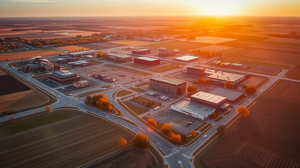
Request a Macomb Drone Operator
Macomb Aerial Imaging Options
Macomb is a university and manufacturing city in west-central Illinois with a population of approximately 15,600, home to Western Illinois University with about 7,500 students. The city sits in the heart of Illinois agricultural country, creating unique demand for rural land data collection, drainage tile mapping, and crop monitoring. Construction demand comes from WIU campus renovation, Pella Corporation manufacturing expansion, IL-336 bypass construction, and agricultural infrastructure development. The LaMoine River corridor creates environmental monitoring and bridge inspection demand.
Macomb Airspace, FAA Rules & Local Drone Laws
FAA Part 107 Requirements
All commercial drone operations in Illinois require an active FAA Part 107 Remote Pilot Certificate — every operator matched to Macomb projects is verified.
State Drone Laws
The City of Macomb does not have a specific municipal drone ordinance beyond Illinois state law, but commercial drone operators conducting business within city limits must hold a valid City of Macomb business license. Statewide, Illinois drone law (720 ILCS 5/48-1 et seq. (Drones Omnibus Act, PA 99-0566, 2017); FAA Part 107; IDOT Division of Aeronautics; Chicago Municipal Code 10-36-070) sets the baseline for commercial operations — Part 107 rules apply on every Macomb job. Full Illinois drone law →
Local Ordinances
The City of Macomb does not have a specific municipal drone ordinance beyond Illinois state law, but commercial drone operators conducting business within city limits must hold a valid City of Macomb business license. Drone takeoff and landing in Macomb parks requires coordination with the Macomb Park District, which manages Glenwood Park, Everly Park, and the Spring Lake Park area. Operations near Macomb Municipal Airport (MQG) should check the FAA LAANC dashboard for Class E surface area requirements. The Illinois Drones Omnibus Act (720 ILCS 5/48) prohibits surveillance of individuals without consent and restricts drone use over private property. Commercial operators should carry general liability insurance of at least $1 million for drone aerial imaging on university, industrial, and agricultural projects. Drone flights over the WIU campus should coordinate with WIU Public Safety.
Restricted Airspace
- Class E: Macomb Municipal Airport (MQG) Surface Area. Macomb Municipal Airport has Class E airspace from the surface up to 14,500 ft MSL. The airport serves general aviation, Western Illinois University flight operations, and corporate traffic from local manufacturers. Commercial drone operators near the airport should check the FAA LAANC dashboard. Most of Macomb outside the immediate airport surface area is uncontrolled Class G airspace.
- Infrastructure: Western Illinois University Campus. Western Illinois University (WIU) is the dominant institution in Macomb with approximately 7,500 students and a 1,400-acre campus. The campus has ongoing facility renovation, academic building maintenance, and residence hall upgrades. Drone operations over the WIU campus should coordinate with university security and the WIU Office of Public Safety. Hanson Field stadium aerial imaging and athletic facility documentation are recurring needs. WIU agricultural research farms create additional aerial mapping demand for crop monitoring and land assessment.
- Industrial: Macomb Industrial Park and Manufacturing Corridor. Macomb has a diverse manufacturing base anchored by the Macomb Industrial Park. Major manufacturers include Pella Corporation (window and door manufacturing), MTNT Technologies, and several agribusiness processing facilities. The industrial corridor along US-67 and the Macomb bypass has ongoing facility expansion, warehouse construction, and plant modernization. The city position in the heart of west-central Illinois agricultural country creates demand for agricultural land data collection, drainage tile mapping, and farm infrastructure documentation.
- Infrastructure: US-67 / US-136 / IL-336 Corridor. Macomb sits at the intersection of US-67 (north-south arterial connecting to the Quad Cities and St. Louis), US-136 (east-west arterial), and the IL-336 Macomb bypass. IDOT District 4 maintains highway improvements, bridge inspection, and interchange construction. The LaMoine River bridges on US-67 and US-136 require periodic structural inspection. The BNSF Railway line through McDonough County creates bridge and track inspection demand.
Airports in the area: MQG — Macomb Municipal Airport (Class E, general aviation, serves Western Illinois University and McDonough County), PIA — General Wayne A. Downing Peoria International Airport (Class C, located approximately 75 miles east), BRL — Burlington Regional Airport (Class E, located approximately 60 miles west)
What Drone Services Cost in Illinois
These are typical Macomb-area project ranges, drawn from market data across Macomb Micropolitan Area. Your final price depends on site size, complexity, and deliverables.
| Service Type | Low End | High End |
|---|---|---|
| Topographic Data Collection | $700 | $3,000 |
| Drone Inspection | $400 | $1,850 |
| LiDAR Scanning | $1,475 | $5,900 |
| Environmental Monitoring | $775 | $3,400 |
| Aerial Imagery | $275 | $1,250 |
| Construction Monitoring | $525 | $2,550 |
| Real Estate Photography | $175 | $600 |
| Roof Inspection | $200 | $800 |
Free cost calculator, ROI calculator, and 14-page buyer's guide. No signup required.
Are you a drone operator serving Macomb? List your business on AeriusView and get pre-qualified leads in your service area.
List Your Business →Macomb Construction & Development: An Aerial Perspective
Macomb is a university and manufacturing city in west-central Illinois with a population of approximately 15,600 and home to Western Illinois University with about 7,500 students. The city anchors the McDonough County micropolitan area and sits in the heart of Illinois agricultural country. The construction market is driven by four sectors: WIU campus renovation and facility maintenance (academic building upgrades, residence hall renovation, athletic facility improvements, agricultural research farm development), industrial park growth (Pella Corporation facility expansion, agribusiness processing plant upgrades, warehouse construction along US-67), transportation infrastructure (IL-336 bypass construction, US-67 bridge inspection, BNSF Railway track maintenance by IDOT District 4), and agricultural development (drainage tile installation, farm infrastructure construction, rural road maintenance). The strong agricultural base creates unique demand for rural land data collection, crop monitoring, and drainage infrastructure documentation.
Active Developers in the Area:
- Western Illinois University — Academic building renovation, residence hall upgrades, Hanson Field athletic facility improvements, agricultural research farm development, campus infrastructure modernization
- Pella Corporation — Macomb manufacturing facility expansion, production line modernization, warehouse construction, plant infrastructure upgrades
- IDOT District 4 — IL-336 bypass construction, US-67 corridor improvements, LaMoine River bridge inspection, BNSF Railway bridge inspection support, McDonough County bridge replacement program
- Macomb Industrial Park Companies — Manufacturing facility expansion, agribusiness processing plant upgrades, industrial corridor infrastructure, warehouse construction along US-67 bypass
- City of Macomb / Macomb Park District — Downtown Macomb revitalization, Glenwood Park and Everly Park facility upgrades, Spring Lake area development, water and sewer infrastructure, municipal building improvements
Why Macomb Contractors Trust Aerius View
FAA-Certified
Every operator holds an active Part 107 Remote Pilot Certificate.
Local to Macomb
Pilots who fly Macomb regularly — they know the McDonough staging spots, permit offices, and airspace quirks.
No Cost to Quote
Submit your project at no charge. Pay the operator directly if you proceed.
Fast Turnaround
Quotes in Macomb commonly move inside 2 business days once your request is in.
AeriusView is expanding in Macomb, IL
Pilot coverage for Macomb is filling in — surrounding Macomb Micropolitan Area cities are already served. Requests from Macomb are routed to the nearest verified operator.
Request a QuoteWhat Aerial Data Products Do You Receive in Macomb?
a Macomb project wraps with professional-grade deliverables built for the software stacks McDonough crews already run. Projects like those delivered for Western Illinois University across McDonough need data that drops straight into their workflow.
- Progress reports with side-by-side comparisons for construction monitoring
- Orthomosaic maps (GeoTIFF) for site overview and documentation
- Point clouds (LAS/LAZ) for 3D modeling and volumetric analysis
- DEM/DSM terrain models for cut/fill and grade analysis
- Contour lines (DXF/DWG, CAD-ready) for Civil 3D and Revit
- Coordinate systems matched to your project datum — the Illinois State Plane zone, UTM, or a local datum your surveyor specifies
Insurance & Liability Protection
Pilot Insurance Required
Every operator matched to a Macomb project carries active liability insurance — minimum $1,000,000 general liability, verified from the certificate before the pilot joins the network. The City of Macomb does not have a specific municipal drone ordinance beyond Illinois state law, but commercial drone operators conducting business within city limits must hold a valid City of Macomb business license. Drone takeoff and landing in Macomb parks requires coordination with the Macomb Park District, which manages Glenwood Park, Everly Park, and the Spring Lake Park area. Operations near Macomb Municipal Airport (MQG) should check the FAA LAANC dashboard for Class E surface area requirements. The Illinois Drones Omnibus Act (720 ILCS 5/48) prohibits surveillance of individuals without consent and restricts drone use over private property. Commercial operators should carry general liability insurance of at least $1 million for drone aerial imaging on university, industrial, and agricultural projects. Drone flights over the WIU campus should coordinate with WIU Public Safety.
FAA Part 107 Verified
Each pilot's Remote Pilot Certificate is checked against the FAA Airmen Inquiry before they can serve McDonough bookings. Expired certificates are flagged automatically.
Equipment Documentation
Pilots register their airframes and sensors (RGB, LiDAR, thermal, multispectral) so Macomb requests route to crews with the right payload for the job.
Site Safety Coordination
Pilots coordinate with your site superintendent for safe operations on active Macomb construction sites, including flight plans that avoid worker areas and equipment zones. The City of Macomb does not have a specific municipal drone ordinance beyond Illinois state law, but commercial drone operators conducting business within city limits must hold a valid City of Macomb business license. Drone takeoff and landing in Macomb parks requires coordination with the Macomb Park District, which manages Glenwood Park, Everly Park, and the Spring Lake Park area. Operations near Macomb Municipal Airport (MQG) should check the FAA LAANC dashboard for Class E surface area requirements. The Illinois Drones Omnibus Act (720 ILCS 5/48) prohibits surveillance of individuals without consent and restricts drone use over private property. Commercial operators should carry general liability insurance of at least $1 million for drone aerial imaging on university, industrial, and agricultural projects. Drone flights over the WIU campus should coordinate with WIU Public Safety.
Macomb, IL Drone & Aerial Imaging Questions
Do I need LAANC authorization to fly a drone in Macomb, IL?
Macomb Municipal Airport (MQG) has Class E surface area airspace. While Class E is less restrictive than Class B, C, or D, commercial drone operators near the airport should check the FAA LAANC dashboard for their specific grid square. Most of Macomb outside the immediate airport area is uncontrolled Class G airspace where Part 107 operations can proceed without LAANC authorization. Operators must maintain visual line of sight and comply with all FAA Part 107 regulations.
What are the drone laws in Illinois for commercial operators?
Illinois regulates commercial drone operations through the Drones Omnibus Act (720 ILCS 5/48-1 et seq., Public Act 99-0566, effective January 2017). The Act prohibits surveillance of individuals without consent, restricts law enforcement drone use without a warrant, and bans drone harassment. Commercial operators must hold a valid FAA Part 107 Remote Pilot Certificate and obtain LAANC authorization for controlled airspace. Illinois does not require additional state-level registration or licensing beyond FAA requirements.
Can I fly drones over the Western Illinois University campus?
Commercial drone operations over the WIU campus require coordination with WIU Public Safety and university security. WIU has approximately 7,500 students on a 1,400-acre campus with ongoing facility renovation and construction. Operators should submit flight plans in advance and schedule flights during low-activity periods. Hanson Field stadium and athletic facility aerial imaging require coordination with the WIU Athletics Department. The WIU agricultural research farms create additional demand for crop monitoring and land assessment.
What major construction projects in Macomb need drone aerial imaging?
Macomb has active construction demand from WIU campus renovation (academic building upgrades, residence hall renovation, athletic facility improvements), Pella Corporation manufacturing facility expansion, IL-336 bypass construction, US-67 LaMoine River bridge inspection, and downtown Macomb revitalization. The strong agricultural base creates demand for rural land data collection, drainage tile mapping, and farm infrastructure documentation. The BNSF Railway line through McDonough County creates ongoing track and bridge inspection needs.
Is Macomb a good market for drone aerial imaging businesses?
Macomb is a solid rural market for drone aerial imaging in west-central Illinois, anchored by Western Illinois University and a growing industrial park. The city position in the heart of Illinois agricultural country creates unique demand for agricultural land data collection, drainage tile mapping, and crop monitoring that urban markets do not have. The IL-336 bypass construction creates sustained infrastructure aerial imaging demand. Macomb location between the Quad Cities and Springfield makes it a strategic base for serving the west-central Illinois region.
How does the LaMoine River affect drone operations in Macomb?
The LaMoine River flows near Macomb, creating a natural corridor that affects drone flight planning. The river bridges on US-67 and US-136 require periodic structural inspection. The river corridor has ongoing erosion control and flood mitigation projects managed by the McDonough County Soil and Water Conservation District. The LaMoine River watershed creates environmental monitoring demand for wetland delineation and flood risk assessment. The river and surrounding agricultural land create demand for rural land data collection and drainage infrastructure documentation.
Aerial Imaging Terms for Macomb Projects
The vocabulary behind Macomb aerial data — useful before you request quotes. Most Macomb projects in our cost table start around $175.
Point Cloud
A 3D dataset of points representing the captured surface.
Real-Time Kinematic
RTK GPS correction for centimeter-level positional accuracy.
LiDAR
Laser scanning that captures terrain through vegetation.
Digital Elevation Model
A 3D representation of terrain elevation across the site.
Ground Control Point
Known reference markers used to anchor and validate mapping accuracy.
Aerial Mapping
Data collection from above to map and measure a site.
Volumetrics
Cut/fill and stockpile volume calculations derived from terrain models.
Thermal Imaging
Infrared capture that reveals heat signatures for inspections.
Nearby Cities
Are You a Drone Operator in Macomb?
Serve Macomb and the wider Macomb Micropolitan Area : leads routed by service area, no fees to join, first lead free.
Ready to Start Your Project in Macomb, IL?
One form, then a Macomb Micropolitan Area-based operator follows up with a quote. No cost, no commitment. Projects in McDonough start around $175.
Request a Free QuoteAeriusView connects clients with FAA-certified drone operators. Services are not licensed land surveying. Deliverables are not authoritative for boundary determination, design, or legal purposes.