Aerial Imaging Services in Midland, MI
Central Michigan corporate headquarters city, Dow Chemical $785M modernization project, 188,000 SF global headquarters building, Tittabawassee River environmental remediation, largest private investment in Michigan.
Midland (Michigan) is part of the Midland, MI Micropolitan Statistical Area (Midland County, Central Michigan) and has a population of approximately 42,000. Midland is a city in Midland County with 42,000 residents along the Tittabawassee River in Central Michigan. The construction market is dominated by the $785 million Dow Chemical manufacturing and R&D modernization project and the new 188,000 SF global headquarters building. The city serves as the global headquarters for Dow Chemical Company, one of the largest chemical manufacturers in the world. The Tittabawassee River environmental remediation creates ongoing environmental aerial imaging demand. The MBS International Airport Class D airspace is nearby but most of the city is outside the surface area, creating moderate airspace restrictions for commercial drone operations.
Serving Midland County & the Midland, MI Micropolitan Statistical Area (Midland County, Central Michigan) area
Request a Free Quote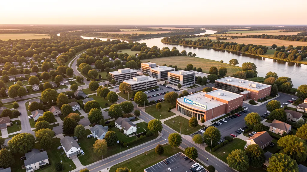
Get a Midland Aerial Quote
Drone Services Serving Midland, MI
Midland is a city in Midland County with 42,000 residents along the Tittabawassee River in Central Michigan. The construction market is dominated by the $785 million Dow Chemical manufacturing and R&D modernization project and the new 188,000 SF global headquarters building. The city serves as the global headquarters for Dow Chemical Company, one of the largest chemical manufacturers in the world. The Tittabawassee River environmental remediation creates ongoing environmental aerial imaging demand. The MBS International Airport Class D airspace is nearby but most of the city is outside the surface area, creating moderate airspace restrictions for commercial drone operations.
Drone Regulations & Airspace Rules for Midland
FAA Part 107 Requirements
Flying for hire in Midland? That is commercial operation under FAA Part 107, which requires a Remote Pilot Certificate — a credential we verify for every operator.
State Drone Laws
Commercial drone work in Midland follows Michigan UAS law (MCL 259.301 et seq. (Public Act 451 of 2016)), with city-level rules on top: Midland operates under the Michigan Unmanned Aircraft Systems Act (Public Act 451 of 2016, MCL 259.301 et seq.) which preempts local regulation of drone flight paths and navigable airspace. Full Michigan drone law →
Local Ordinances
Midland operates under the Michigan Unmanned Aircraft Systems Act (Public Act 451 of 2016, MCL 259.301 et seq.) which preempts local regulation of drone flight paths and navigable airspace. The City of Midland requires a business license for commercial drone operators. Drone takeoff and landing in city parks requires coordination with the Midland Parks and Recreation Department, including Chippewassee Park, Central Park, and Plymouth Park. Operations near the Dow Chemical Company manufacturing complex require coordination with Dow security. Operations near MBS International Airport Class D airspace require LAANC authorization. Commercial operators should carry minimum $1M liability insurance for aerial imaging projects.
Restricted Airspace
- Midland is near Class D airspace centered on MBS International Airport (MBS), located approximately 8 NM southeast in Freeland. The Class D surface area extends approximately 4.5 NM radius from MBS up to 3,000 feet AGL. Most of downtown Midland is outside the Class D surface area but operators should check the FAA B4UFLY app for specific boundaries. Flights in the southeastern part of Midland near the MBS approach path may require LAANC authorization.
- The Dow Chemical Company global headquarters campus is a major critical infrastructure consideration. The Dow Michigan Operations facility is one of the largest integrated chemical manufacturing sites in the world, covering approximately 5,000 acres along the Tittabawassee River. Industrial and chemical manufacturing facilities have enhanced security considerations for commercial drone operations. The Dow corporate campus and the Global Dow Center headquarters building have ongoing facility expansion and renovation activity. Operators should coordinate with Dow security for any flights near the manufacturing complex.
- The Tittabawassee River corridor and the Chippewa River watershed have environmental monitoring considerations. The Tittabawassee River flows through the heart of Midland and has ongoing environmental remediation and monitoring demand related to historical industrial contamination. The Chippewa Nature Center and the Chippewassee Park system have recreational and environmental considerations. Operations near the river corridor should coordinate with the Michigan EGLE and the Midland County Drain Commissioner.
- Midland is home to the Midland Center for the Arts, the Dow Gardens, and the Chippewa Nature Center, which have educational facility and privacy considerations. The Midland Center for the Arts campus includes the Alden B. Dow Home and Studio, a National Historic Landmark. The Dow Gardens botanical facility and the Whiting Forest canopy walk have visitor safety considerations for drone operations. Operations near these facilities should coordinate with facility management.
- The US-10 expressway corridor and the M-20 highway are major infrastructure assets. MDOT Bay Region manages state highway infrastructure in the area. The Eastman Avenue and Business US-10 corridor have ongoing commercial development. The St. Andrews Road and Patrick Road corridors have industrial and corporate facility development. The Midland County Road Commission has an active construction and infrastructure inspection program.
Airports in the area: MBS — Saginaw-Midland-Bay City International Airport (Class D airspace, located approximately 8 NM southeast of downtown Midland in Freeland, serves the Tri-Cities area with commercial and general aviation), LNP — Mount Pleasant Airport (Class E airspace, approximately 15 NM west in Isabella County, handles general aviation for the Mount Pleasant area), HYX — Coleman Municipal Airport (Class E airspace, approximately 12 NM south of Midland, small GA facility serving the southern Midland County area)
Aerial Imaging Pricing Across Michigan
Cost ranges are based on market data for Midland, MI Micropolitan Statistical Area (Midland County, Central Michigan). Actual pricing depends on site size, complexity, and deliverables.
| Service Type | Low End | High End |
|---|---|---|
| Topographic Data Collection | $900 | $3,600 |
| Drone Inspection | $525 | $2,150 |
| LiDAR Scanning | $1,800 | $5,500 |
| Environmental Monitoring | $1,000 | $3,450 |
| Aerial Imagery | $375 | $1,500 |
| Construction Monitoring | $625 | $2,650 |
| Real Estate Photography | $275 | $950 |
| Roof Inspection | $325 | $900 |
Free cost calculator, ROI calculator, and 14-page buyer's guide. No signup required.
Are you a drone operator serving Midland? List your business on AeriusView and get pre-qualified leads in your service area.
List Your Business →How Midland Builders Use Aerial Data
Midland is a city in Midland County with a population of 42,000, located in Central Michigan along the Tittabawassee River. The construction market is driven by five major sectors: industrial and chemical manufacturing development (Dow Chemical $785 million manufacturing and R&D modernization project retaining 5,000 jobs, the new 188,000 SF Dow global headquarters building with a 400-seat cafeteria and underground parking, the Global Dow Center corporate campus development, advanced materials facility upgrades along the Patrick Road corridor), residential development (subdivision construction in the northeastern Midland area, residential development along St. Andrews Road, downtown Midland residential and loft development, housing construction in the Greendale subdivision area), commercial and retail development (the Eastman Avenue commercial corridor, the Midland Mall area development, the Business US-10 retail corridor, the Downtown Development Authority streetscape improvements), educational and cultural facility expansion (the Midland Center for the Arts campus improvements, Northwood University campus growth, the Dow Gardens and Whiting Forest canopy walk development), and transportation infrastructure (US-10 expressway corridor improvements, M-20 highway maintenance, Eastman Avenue reconstruction, the Midland County Road Commission construction program). Midland has been one of the most active Central Michigan construction markets, driven by the massive Dow Chemical investment and the city's corporate campus development. The $785 million Dow modernization project is one of the largest private investments in Michigan. The city's chemical manufacturing base, the corporate headquarters campus, and the cultural facilities create diverse demand for construction monitoring, topographic data collection, and infrastructure inspection services. The Tittabawassee River environmental remediation creates ongoing environmental aerial imaging demand.
Active Developers in the Area:
- Dow Chemical Company — $785 million manufacturing and R&D modernization, new 188,000 SF global headquarters building, Global Dow Center corporate campus, advanced materials facility upgrades, Patrick Road corridor manufacturing expansion
- KIRCO / KIRCO MANIX — The Global Dow Center headquarters development and construction, corporate campus buildout, executive parking facility, 400-seat cafeteria construction
- City of Midland / DDA — Downtown Development Authority streetscape improvements, Eastman Avenue corridor development, Business US-10 improvements, municipal facility upgrades, Tittabawassee River waterfront development
- MDOT Bay Region — US-10 expressway corridor improvements, M-20 highway maintenance, Eastman Avenue reconstruction, Midland County highway infrastructure
- Midland Center for the Arts — Campus facility upgrades, Alden B. Dow Home and Studio preservation, Dow Gardens botanical facility expansion, Whiting Forest canopy walk construction

Why Hire Through Aerius View in Midland, MI?
FAA-Certified
Every operator holds an active Part 107 Remote Pilot Certificate.
Local to Midland
Based in the Midland, MI Micropolitan Statistical Area (Midland County, Central Michigan) and fluent in Michigan drone law, with 3 nearby Midland service communities in reach.
No Cost to Quote
Submit your project at no charge. Pay the operator directly if you proceed.
Fast Turnaround
Quotes in Midland commonly move inside 2 business days once your request is in.
AeriusView is expanding in Midland, MI
Midland is an expansion market for the network, with demand driven by projects from Dow Chemical Company and other local builders. Submit here and a verified operator covering Midland County is assigned.
Request a QuoteDrone Data Deliverables for Midland Projects
These are the files you receive with a Midland booking — all compatible with standard construction and engineering software. Projects like those delivered for Dow Chemical Company across Midland County need data that drops straight into their workflow.
- Point clouds (LAS/LAZ) for 3D modeling and volumetric analysis
- DEM/DSM terrain models for cut/fill and grade analysis
- Contour lines (DXF/DWG, CAD-ready) for Civil 3D and Revit
- Progress reports with side-by-side comparisons for construction monitoring
- Orthomosaic maps (GeoTIFF) for site overview and documentation
- Coordinate systems matched to your project datum — the Michigan State Plane zone, UTM, or a local datum your surveyor specifies
Insurance & Liability Protection
Pilot Insurance Required
Every operator matched to a Midland project carries active liability insurance — minimum $1,000,000 general liability, verified from the certificate before the pilot joins the network. Midland operates under the Michigan Unmanned Aircraft Systems Act (Public Act 451 of 2016, MCL 259.301 et seq.) which preempts local regulation of drone flight paths and navigable airspace. The City of Midland requires a business license for commercial drone operators. Drone takeoff and landing in city parks requires coordination with the Midland Parks and Recreation Department, including Chippewassee Park, Central Park, and Plymouth Park. Operations near the Dow Chemical Company manufacturing complex require coordination with Dow security. Operations near MBS International Airport Class D airspace require LAANC authorization. Commercial operators should carry minimum $1M liability insurance for aerial imaging projects.
FAA Part 107 Verified
Each pilot's Remote Pilot Certificate is checked against the FAA Airmen Inquiry before they can serve Midland County bookings. Expired certificates are flagged automatically.
Equipment Documentation
Pilots register their airframes and sensors (RGB, LiDAR, thermal, multispectral) so Midland requests route to crews with the right payload for the job.
Site Safety Coordination
Pilots coordinate with your site superintendent for safe operations on active Midland construction sites, including flight plans that avoid worker areas and equipment zones. Midland operates under the Michigan Unmanned Aircraft Systems Act (Public Act 451 of 2016, MCL 259.301 et seq.) which preempts local regulation of drone flight paths and navigable airspace. The City of Midland requires a business license for commercial drone operators. Drone takeoff and landing in city parks requires coordination with the Midland Parks and Recreation Department, including Chippewassee Park, Central Park, and Plymouth Park. Operations near the Dow Chemical Company manufacturing complex require coordination with Dow security. Operations near MBS International Airport Class D airspace require LAANC authorization. Commercial operators should carry minimum $1M liability insurance for aerial imaging projects.
Drone Services FAQ for Midland, MI
Do I need LAANC authorization to fly a drone in Midland, MI?
Most of downtown Midland is outside the Class D surface area of MBS International Airport (MBS), located approximately 8 miles southeast in Freeland. The Class D airspace extends 4.5 NM radius from MBS up to 3,000 feet AGL. Flights in the southeastern part of Midland near the MBS approach path may require LAANC authorization. Operators should check the FAA B4UFLY app for their specific location. The Dow Chemical manufacturing complex has additional security considerations that may restrict flights regardless of airspace class.
What are the drone laws in Michigan for commercial operators?
Michigan regulates commercial drone operations through the Michigan Unmanned Aircraft Systems Act (Public Act 451 of 2016, MCL 259.301 et seq.). The Act prohibits using drones to surveil or photograph individuals without consent in areas with a reasonable expectation of privacy and restricts drone use for hunting or fishing harassment. Commercial operators must hold a valid FAA Part 107 Remote Pilot Certificate and obtain LAANC authorization for controlled airspace. Michigan does not require additional state-level drone registration beyond FAA requirements.
Can I fly drones near the Dow Chemical manufacturing complex?
The Dow Chemical Company global headquarters and manufacturing complex covers approximately 5,000 acres along the Tittabawassee River and is one of the largest integrated chemical manufacturing sites in the world. Industrial and chemical manufacturing facilities have enhanced security considerations. Commercial drone operators should coordinate with Dow security for any flights near the manufacturing complex. The facility has ongoing construction and renovation activity from the $785 million modernization project, creating significant demand for drone aerial imaging, but security coordination is essential.
What major construction projects in Midland need drone aerial imaging?
Midland has active construction demand from the $785 million Dow Chemical manufacturing and R&D modernization project, the new 188,000 SF Dow global headquarters building, the Global Dow Center corporate campus development, US-10 expressway corridor improvements, Eastman Avenue reconstruction, residential subdivision development, and the Midland Center for the Arts campus improvements. The Dow modernization is one of the largest private investments in Michigan, creating sustained demand for construction monitoring and infrastructure inspection.
Is Midland a good market for drone aerial imaging businesses?
Midland is one of the most active Central Michigan drone aerial imaging markets, driven by the $785 million Dow Chemical modernization project, the new global headquarters building, and ongoing corporate campus development. The city's chemical manufacturing base creates specialized industrial inspection demand. The Tittabawassee River environmental remediation creates ongoing environmental aerial imaging demand. With 42,000 residents and one of Michigan's largest private investments underway, Midland offers diverse demand across industrial, corporate, residential, and environmental sectors. The proximity to MBS Class D airspace creates a moderate barrier for unlicensed operators.
How does the Midland airspace compare to other Central Michigan cities?
Midland is near Class D airspace from MBS International Airport (MBS), but most of the city is outside the surface area. This creates a moderate barrier for commercial drone operations compared to cities directly under controlled airspace. The Dow Chemical manufacturing complex adds security considerations that effectively restrict drone operations near the facility regardless of airspace class. The Tittabawassee River corridor and the Chippewa Nature Center have environmental and recreational considerations. The combination of industrial security and moderate airspace restrictions creates a defensible market for licensed commercial operators.
Aerial Imaging Terms for Midland Projects
First aerial project in Midland? These terms cover the deliverables local pilots will quote you. Most Midland projects in our cost table start around $275.
Orthomosaic
A geometrically corrected aerial photo map stitched from many images.
Point Cloud
A 3D dataset of points representing the captured surface.
Real-Time Kinematic
RTK GPS correction for centimeter-level positional accuracy.
LiDAR
Laser scanning that captures terrain through vegetation.
Digital Elevation Model
A 3D representation of terrain elevation across the site.
Ground Control Point
Known reference markers used to anchor and validate mapping accuracy.
Aerial Mapping
Data collection from above to map and measure a site.
Volumetrics
Cut/fill and stockpile volume calculations derived from terrain models.
Nearby Cities
Are You a Drone Operator in Midland?
Midland County buyers search here — 5 active developers tracked in Midland alone. Join the network and get matched leads. First lead free.
Ready to Start Your Project in Midland, MI?
Tell us about your Midland project and we route it to a vetted local pilot — free, no obligation. Projects in Midland County start around $275.
Request a Free QuoteAeriusView connects clients with FAA-certified drone operators. Services are not licensed land surveying. Deliverables are not authoritative for boundary determination, design, or legal purposes.