Aerial Imaging Services in Sand Springs, OK
From the Highway 97 commercial corridor development and the Sand Springs Public Schools campus improvements to the downtown Main Street revitalization and the westward residential subdivisions along the Arkansas River, Sand Springs' construction market is driven by its position as a growing Tulsa suburb with riverfront appeal.
Sand Springs (Oklahoma) is part of the Tulsa Metro and has a population of approximately 20,000. Sand Springs is a Tulsa suburb in Tulsa County, located west of Tulsa along the Arkansas River on Historic Route 66. The city is known for the Case Community Center, the Sand Springs Museum, and its riverfront position. Sand Springs benefits from proximity to downtown Tulsa while offering lower land costs, driving residential development westward. Eastern portions of the city fall within Tulsa International Class C airspace, while western areas are in uncontrolled airspace.
Serving Tulsa & the Tulsa Metro area
Request a Free Quote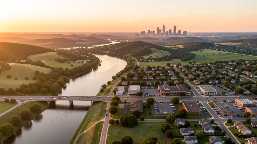
Get a Sand Springs Aerial Quote
Drone Services Serving Sand Springs, OK
Sand Springs is a Tulsa suburb in Tulsa County, located west of Tulsa along the Arkansas River on Historic Route 66. The city is known for the Case Community Center, the Sand Springs Museum, and its riverfront position. Sand Springs benefits from proximity to downtown Tulsa while offering lower land costs, driving residential development westward. Eastern portions of the city fall within Tulsa International Class C airspace, while western areas are in uncontrolled airspace.
Aerial Imaging Pricing Across Oklahoma
Cost ranges are based on market data for Tulsa Metro. Actual pricing depends on site size, complexity, and deliverables.
| Service Type | Low End | High End |
|---|---|---|
| Topographic Data Collection | $1,100 | $4,150 |
| Drone Inspection | $275 | $1,650 |
| LiDAR Scanning | $1,825 | $6,400 |
| Environmental Monitoring | $725 | $3,700 |
| Aerial Imagery | $225 | $1,400 |
| Construction Monitoring | $375 | $1,800 |
| Real Estate Photography | $175 | $750 |
| Roof Inspection | $225 | $850 |
Free cost calculator, ROI calculator, and 14-page buyer's guide. No signup required.
Are you a drone operator serving Sand Springs? List your business on AeriusView and get pre-qualified leads in your service area.
List Your Business →Drone Regulations & Airspace Rules for Sand Springs
FAA Part 107 Requirements
Flying for hire in Sand Springs? That is commercial operation under FAA Part 107, which requires a Remote Pilot Certificate — a credential we verify for every operator.
State Drone Laws
Commercial drone work in Sand Springs follows Oklahoma UAS law (Oklahoma HB 2599 (2021)), with city-level rules on top: Sand Springs follows Oklahoma state drone regulations under HB 2599 and FAA Part 107. Full Oklahoma drone law →
Local Ordinances
Sand Springs follows Oklahoma state drone regulations under HB 2599 and FAA Part 107. No city-specific drone ordinance has been enacted. Commercial drone operators must hold a valid FAA Part 107 Remote Pilot Certificate. Eastern portions of Sand Springs may fall within Tulsa International Class C airspace, requiring LAANC authorization.
Restricted Airspace
- R.L. Jones Jr. Airport Class D airspace is 5 miles south
- Tulsa International Airport Class C airspace extends into eastern Sand Springs
- No military restricted airspace within Sand Springs city limits
Airports in the area: RVS — R.L. Jones Jr. Airport (Class D airspace, 5 miles south), TUL — Tulsa International Airport (Class C airspace, 8 miles east)
How Sand Springs Builders Use Aerial Data
Sand Springs is a Tulsa suburb in Tulsa County, located west of Tulsa along the Arkansas River. The city is known for the Case Community Center, the Sand Springs Museum, and its position along the historic Route 66 corridor. Recent construction includes residential subdivisions expanding westward from Tulsa, the Sand Springs Public Schools campus improvements, the Highway 97 commercial corridor development, and downtown revitalization along Main Street. The city benefits from its riverfront position and proximity to downtown Tulsa.
Active Developers in the Area:
- Sand Springs Public Schools — Campus improvements and athletic facility upgrades
- City of Sand Springs — Downtown Main Street revitalization and riverfront development
- Residential developers — Highway 97 corridor and west Sand Springs subdivisions

Why Hire Through Aerius View in Sand Springs, OK?
FAA-Certified
Every operator holds an active Part 107 Remote Pilot Certificate.
Local to Sand Springs
Based in the Tulsa Metro and fluent in Oklahoma drone law, with 3 nearby Sand Springs service communities in reach.
No Cost to Quote
Submit your project at no charge. Pay the operator directly if you proceed.
Fast Turnaround
A local operator contacts you within 2 business days — typical for Tulsa Metro jobs.
AeriusView is expanding in Sand Springs, OK
Sand Springs is an expansion market for the network, with demand driven by projects from Sand Springs Public Schools and other local builders. Submit here and a verified operator covering Tulsa is assigned.
Request a QuoteDrone Data Deliverables for Sand Springs Projects
These are the files you receive with a Sand Springs booking — all compatible with standard construction and engineering software. Projects like those delivered for Sand Springs Public Schools across Tulsa need data that drops straight into their workflow.
- Contour lines (DXF/DWG, CAD-ready) for Civil 3D and Revit
- Progress reports with side-by-side comparisons for construction monitoring
- Orthomosaic maps (GeoTIFF) for site overview and documentation
- Point clouds (LAS/LAZ) for 3D modeling and volumetric analysis
- DEM/DSM terrain models for cut/fill and grade analysis
- Coordinate systems matched to your project datum — the Oklahoma State Plane zone, UTM, or a local datum your surveyor specifies
Insurance & Liability Protection
Pilot Insurance Required
Every operator matched to a Sand Springs project carries active liability insurance — minimum $1,000,000 general liability, verified from the certificate before the pilot joins the network. Sand Springs follows Oklahoma state drone regulations under HB 2599 and FAA Part 107. No city-specific drone ordinance has been enacted. Commercial drone operators must hold a valid FAA Part 107 Remote Pilot Certificate. Eastern portions of Sand Springs may fall within Tulsa International Class C airspace, requiring LAANC authorization.
FAA Part 107 Verified
Each pilot's Remote Pilot Certificate is checked against the FAA Airmen Inquiry before they can serve Tulsa bookings. Expired certificates are flagged automatically.
Equipment Documentation
Pilots register their airframes and sensors (RGB, LiDAR, thermal, multispectral) so Sand Springs requests route to crews with the right payload for the job.
Site Safety Coordination
Pilots coordinate with your site superintendent for safe operations on active Sand Springs construction sites, including flight plans that avoid worker areas and equipment zones. Sand Springs follows Oklahoma state drone regulations under HB 2599 and FAA Part 107. No city-specific drone ordinance has been enacted. Commercial drone operators must hold a valid FAA Part 107 Remote Pilot Certificate. Eastern portions of Sand Springs may fall within Tulsa International Class C airspace, requiring LAANC authorization.
Drone Services FAQ for Sand Springs, OK
Do I need a permit to fly a drone in Sand Springs?
No city-specific permit is required in Sand Springs, but commercial operators must hold an FAA Part 107 Remote Pilot Certificate. Eastern portions of the city may fall within Tulsa International Class C airspace, requiring LAANC authorization.
What airspace restrictions affect aerial imaging projects in Sand Springs?
Eastern Sand Springs falls within Tulsa International Airport (TUL) Class C airspace, requiring LAANC authorization. R.L. Jones Jr. Airport (RVS) Class D is 5 miles south. Western Sand Springs is in uncontrolled airspace where LAANC is not needed.
Can I fly a drone over the Arkansas River in Sand Springs?
The Arkansas River corridor through Sand Springs is a good location for aerial photography and inspection work. Check LAANC requirements for the eastern portion of the river, which may fall within Tulsa Class C airspace. Be cautious of the Keystone Dam area to the northwest.
How does proximity to Tulsa affect aerial imaging demand in Sand Springs?
Sand Springs benefits from its position as a Tulsa suburb with lower land costs, driving residential development westward. Topographic data collection projects for new subdivisions, construction monitoring for school campus expansion, and real estate photography are primary aerial imaging applications.
Is LAANC available in Sand Springs?
LAANC is available for the eastern portion of Sand Springs within Tulsa International Class C airspace. Western Sand Springs is in uncontrolled airspace where LAANC is not required. Always check the B4UFLY app for current airspace status before flying.
What are common aerial imaging applications in Sand Springs?
Topographic data collection projects for residential subdivisions along Highway 97, construction monitoring for Sand Springs Public Schools campus improvements, roof inspections for the aging housing stock, and real estate photography for the growing Tulsa suburb are the primary applications.
Aerial Imaging Terms for Sand Springs Projects
First aerial project in Sand Springs? These terms cover the deliverables local pilots will quote you. Most Sand Springs projects in our cost table start around $175.
Orthomosaic
A geometrically corrected aerial photo map stitched from many images.
Point Cloud
A 3D dataset of points representing the captured surface.
Real-Time Kinematic
RTK GPS correction for centimeter-level positional accuracy.
LiDAR
Laser scanning that captures terrain through vegetation.
Digital Elevation Model
A 3D representation of terrain elevation across the site.
Ground Control Point
Known reference markers used to anchor and validate mapping accuracy.
Aerial Mapping
Data collection from above to map and measure a site.
Volumetrics
Cut/fill and stockpile volume calculations derived from terrain models.
Nearby Cities
Are You a Drone Operator in Sand Springs?
Tulsa buyers search here — 3 active developers tracked in Sand Springs alone. Join the network and get matched leads. First lead free.
Ready to Start Your Project in Sand Springs, OK?
Tell us about your Sand Springs project and we route it to a vetted local pilot — free, no obligation. Projects in Tulsa start around $175.
Request a Free QuoteAeriusView connects clients with FAA-certified drone operators. Services are not licensed land surveying. Deliverables are not authoritative for boundary determination, design, or legal purposes.