Aerial Imaging Services in Silver City, NM
Mogollon foothills mining town at 5,900 feet with ponderosa pine forests and copper mining terrain
Located in Grant County with a population of 9,635, Silver City sits within the Silver City Micropolitan Area. Silver City construction is driven by Western New Mexico University campus projects, copper mining infrastructure at Freeport-McMoRan, and tourism development. The historic downtown has ongoing renovation projects. Residential development is modest. The Gila National Forest ranger station creates federal facility maintenance demand.
Serving Grant County & the Silver City Micropolitan Area area
Request a Free Quote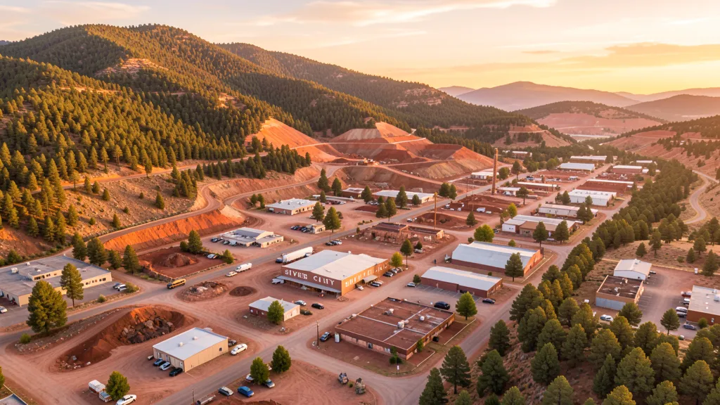
Get Matched With a Local Drone Operator
Aerial Data Services for Silver City Projects
Silver City economy blends copper mining at Freeport-McMoRan, Western New Mexico University, and tourism as a gateway to the Gila Wilderness. Mining inspection, campus construction, and environmental monitoring drive aerial imaging demand.
Local Airspace & Regulations in Silver City, NM
FAA Part 107 Requirements
Part 107 is the federal baseline for paid drone work in Silver City. Each operator in the network holds an active Remote Pilot Certificate, verified at onboarding.
State Drone Laws
Silver City sits under New Mexico's statewide UAS framework (SB 240 (2021), NMSA Ch. 60 Art. 6A); local permitting in Grant County is what varies site to site. Silver City follows FAA Part 107 regulations. Full New Mexico drone law →
Local Ordinances
Silver City follows FAA Part 107 regulations. The city is surrounded by Gila National Forest and the Gila Wilderness, which have flight restrictions for commercial drone operations. Freeport-McMoRan copper mining operations in the area may have private restrictions. Operators should coordinate with mining companies before flying near mine facilities.
Restricted Airspace
- Class D airspace around Grant County Airport (SVC)
- Gila National Forest and Wilderness flight restrictions surrounding the area
- Freeport-McMoRan copper mining operations with potential industrial TFRs
Airports in the area: Grant County Airport (SVC)
Typical Project Costs in New Mexico
What Silver City projects usually cost, based on current Silver City Micropolitan Area market data. Exact pricing depends on site size, complexity, and deliverables.
| Service Type | Low End | High End |
|---|---|---|
| Topographic Data Collection | $1,175 | $5,900 |
| Drone Inspection | $450 | $2,450 |
| LiDAR Scanning | $1,975 | $9,850 |
| Environmental Monitoring | $975 | $4,900 |
| Aerial Imagery | $250 | $1,450 |
| Construction Monitoring | $525 | $2,700 |
| Real Estate Photography | $200 | $950 |
| Roof Inspection | $250 | $1,150 |
Free cost calculator, ROI calculator, and 14-page buyer's guide. No signup required.
Are you a drone operator serving Silver City? List your business on AeriusView and get pre-qualified leads in your service area.
List Your Business →Aerial Imaging for Silver City's Construction Market
Silver City construction is driven by Western New Mexico University campus projects, copper mining infrastructure at Freeport-McMoRan, and tourism development. The historic downtown has ongoing renovation projects. Residential development is modest. The Gila National Forest ranger station creates federal facility maintenance demand.
Active Developers in the Area:
- Freeport-McMoRan — Copper mining facility upgrades and tailings management construction
- Western New Mexico University — Campus building renovation and expansion
- Gila National Forest — Forest Service facility maintenance and improvement

Why Silver City Project Managers Choose Aerius View
FAA-Certified
Every operator holds an active Part 107 Remote Pilot Certificate.
Local to Silver City
Operators working Grant County daily — familiar with Silver City Micropolitan Area airspace including Grant County Airport and local permitting.
No Cost to Quote
Submit your project at no charge. Pay the operator directly if you proceed.
Fast Turnaround
Quotes in Silver City commonly move inside 2 business days once your request is in.
AeriusView is expanding in Silver City, NM
AeriusView is building its Silver City network now — active development work by teams like Freeport-McMoRan keeps demand high. Nearby coverage is live across 3 surrounding cities, so projects in Silver City are matched on arrival.
Request a QuoteWhat Deliverables Do You Get?
Every Silver City project includes professional-grade deliverables compatible with the construction and engineering software used across the Silver City Micropolitan Area. Projects like those delivered for Freeport-McMoRan across Grant County need data that drops straight into their workflow.
- Progress reports with side-by-side comparisons for construction monitoring
- Orthomosaic maps (GeoTIFF) for site overview and documentation
- Point clouds (LAS/LAZ) for 3D modeling and volumetric analysis
- DEM/DSM terrain models for cut/fill and grade analysis
- Contour lines (DXF/DWG, CAD-ready) for Civil 3D and Revit
- Coordinate systems matched to your project datum — the New Mexico State Plane zone, UTM, or a local datum your surveyor specifies
Insurance & Liability Protection
Pilot Insurance Required
Every operator matched to a Silver City project carries active liability insurance — minimum $1,000,000 general liability, verified from the certificate before the pilot joins the network. Silver City follows FAA Part 107 regulations. The city is surrounded by Gila National Forest and the Gila Wilderness, which have flight restrictions for commercial drone operations. Freeport-McMoRan copper mining operations in the area may have private restrictions. Operators should coordinate with mining companies before flying near mine facilities.
FAA Part 107 Verified
Each pilot's Remote Pilot Certificate is checked against the FAA Airmen Inquiry before they can serve Grant County bookings. Expired certificates are flagged automatically.
Equipment Documentation
Pilots register their airframes and sensors (RGB, LiDAR, thermal, multispectral) so Silver City requests route to crews with the right payload for the job.
Site Safety Coordination
Pilots coordinate with your site superintendent for safe operations on active Silver City construction sites, including flight plans that avoid worker areas and equipment zones. Silver City follows FAA Part 107 regulations. The city is surrounded by Gila National Forest and the Gila Wilderness, which have flight restrictions for commercial drone operations. Freeport-McMoRan copper mining operations in the area may have private restrictions. Operators should coordinate with mining companies before flying near mine facilities.
Silver City Aerial Imaging FAQ
Can I fly a drone over the Gila Wilderness near Silver City?
The Gila Wilderness, the first designated wilderness area in the US, is managed by the US Forest Service. Drone flights over designated wilderness areas are restricted and require special use permits. Commercial drone operations in the Gila National Forest require Forest Service authorization.
What drone services are most needed in Silver City?
Mining facility inspection at Freeport-McMoRan copper operations is a specialized need. University campus data collection at WNMU creates institutional demand. Tourism and historic downtown renovation projects create modest construction monitoring work. Environmental monitoring of mining impacts is a potential service area.
Does Silver City have controlled airspace?
Grant County Airport (SVC) has Class D airspace. Drone operators flying within the Class D radius need LAANC authorization. The airport primarily serves general aviation.
Can I fly a drone near Freeport-McMoRan mining operations?
The Freeport-McMoRan copper mining operations near Silver City are private industrial property with security and safety considerations. Coordinate with mine management before any flights near mine facilities. Tailings impoundments and open pit operations may have additional restrictions.
How does Silver City elevation affect drone flying?
Silver City sits at approximately 5,900 feet elevation in the Mogollon foothills. The mountain location creates variable wind conditions. The elevation reduces drone performance. Surrounding terrain can create turbulent afternoon conditions. Morning flights are most reliable.
What makes Silver City unique for aerial imaging?
Silver City combines copper mining infrastructure, a university campus, and proximity to the Gila Wilderness. Mining inspection and environmental monitoring of mining impacts are specialized service areas. The mountain terrain and wilderness restrictions create operational planning challenges.
Aerial Imaging Terms for Silver City Projects
New to aerial imaging? These are the terms you will see in Silver City project quotes and deliverables. Most Silver City projects in our cost table start around $200.
Ground Sample Distance
The spatial resolution of drone imagery, measured in cm/pixel.
Orthomosaic
A geometrically corrected aerial photo map stitched from many images.
Point Cloud
A 3D dataset of points representing the captured surface.
Real-Time Kinematic
RTK GPS correction for centimeter-level positional accuracy.
LiDAR
Laser scanning that captures terrain through vegetation.
Digital Elevation Model
A 3D representation of terrain elevation across the site.
Ground Control Point
Known reference markers used to anchor and validate mapping accuracy.
Aerial Mapping
Data collection from above to map and measure a site.
Are You a Drone Operator in Silver City?
Get pre-qualified leads from Silver City and its 3 nearby communities. No membership fees, no monthly minimums. First lead free.
Ready to Start Your Project in Silver City, NM?
Get matched with a local, FAA-certified drone operator serving Silver City and 17+ surrounding zip codes. No cost, no obligation. Projects in Grant County start around $200.
Request a Free QuoteAeriusView connects clients with FAA-certified drone operators. Services are not licensed land surveying. Deliverables are not authoritative for boundary determination, design, or legal purposes.