Aerial Imaging Services in Ellicott City, MD
Howard County seat — Patapsco River valley, BWI Class B airspace, Columbia Gateway redevelopment, and Johns Hopkins APL campus expansion.
Ellicott City (Maryland) is part of the Baltimore-Columbia-Towson, MD MSA and has a population of approximately 75,947. Perched on the fall line of the Patapsco where the B&O Railroad first laid track west of Baltimore, Ellicott City blends 18th-century mill architecture with steep residential hillsides that test every photogrammetry flight plan. The historic downtown reconstructs after each flood cycle, while the Marriotts Ridge and Route 100 corridors add rooftops faster than county plat maps update. Surveyors here split work between river-terrace topography for floodplain studies and hillside boundary flights for estate lots above the valley. Main Street rebuilds itself constantly, and each reconstruction means fresh orthomosaics. Old lots have odd shapes. New subdivisions out toward Turf Valley and Glen Montrose need as-builts the moment the last curb goes in. Between the county permit desk and the BWI airspace floor, every flight here starts with paperwork before it starts with a propeller.
Serving Howard County & the Baltimore-Columbia-Towson, MD MSA area
Request a Free Quote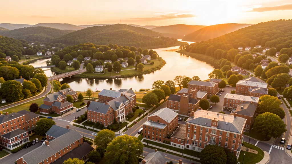
Get a Ellicott City Aerial Quote
Drone Services Serving Ellicott City, MD
Perched on the fall line of the Patapsco where the B&O Railroad first laid track west of Baltimore, Ellicott City blends 18th-century mill architecture with steep residential hillsides that test every photogrammetry flight plan. The historic downtown reconstructs after each flood cycle, while the Marriotts Ridge and Route 100 corridors add rooftops faster than county plat maps update. Surveyors here split work between river-terrace topography for floodplain studies and hillside boundary flights for estate lots above the valley. Main Street rebuilds itself constantly, and each reconstruction means fresh orthomosaics. Old lots have odd shapes. New subdivisions out toward Turf Valley and Glen Montrose need as-builts the moment the last curb goes in. Between the county permit desk and the BWI airspace floor, every flight here starts with paperwork before it starts with a propeller.
Drone Regulations & Airspace Rules for Ellicott City
FAA Part 107 Requirements
Flying for hire in Ellicott City? That is commercial operation under FAA Part 107, which requires a Remote Pilot Certificate — a credential we verify for every operator.
State Drone Laws
Commercial drone work in Ellicott City follows Maryland UAS law (MD Code § 3-703 (drone voyeurism prohibition); MD Code § 4-1201 et seq (UAS Task Force); HB 128 (2015); HB 693 (2021); FAA Part 107; FAA LAANC; 49 USC § 40103), with city-level rules on top: Howard County Parks Department requires permits for commercial drone operations in public parks. Full Maryland drone law →
Local Ordinances
Howard County Parks Department requires permits for commercial drone operations in public parks. The Maryland Consolidated Development Company (MCD) oversees private property regulations in the Columbia/Ellicott City planned community area. No specific Ellicott City municipal drone ordinance exists beyond state law. Commercial operators must comply with FAA Part 107 and obtain LAANC authorization for BWI Class B airspace. The Patapsco River valley and surrounding parklands create environmental sensitivity zones where drone operations may be restricted. Historic district review applies along Main Street, where the county reviews anything that lingers over the rebuilt storefronts. County park permits carry published fees, so budget them like any other mobilization cost.
Restricted Airspace
- BWI Class B surface area and outer shelf cover most of Howard County. LAANC approval is required for drone operations.
- I-95 corridor medevac helicopter traffic (restricted below 3000 ft AGL)
- I-70 and I-95 commuter helicopter activity (prohibited without prior coordination)
- Patapsco Valley State Park (no-fly zone for sensitive wildlife habitat)
- Howard County park and recreation areas (takeoff/landing requires county permit)
- BWI Class B shelf edges cross the Patapsco valley, so two job sites a mile apart can sit under different airspace floors and different LAANC requirements.
- Temporary flight restrictions for stadium events and VIP movements compress usable airspace across the Baltimore-Washington corridor, and LAANC grid slots go to zero on short notice.
Airports in the area: BWI (Baltimore/Washington Thurgood Marshall, Class B, ~15 miles west, primary commercial airport for the region), IAD (Washington Dulles, Class B, ~45 miles north, high-traffic airspace), MTN (Martin State, Class D, ~25 miles northeast, general aviation)
Aerial Imaging Pricing Across Maryland
Cost ranges are based on market data for Baltimore-Columbia-Towson, MD MSA. Actual pricing depends on site size, complexity, and deliverables.
| Service Type | Low End | High End |
|---|---|---|
| Topographic Data Collection | $1,225 | $4,300 |
| Drone Inspection | $400 | $1,950 |
| LiDAR Scanning | $2,225 | $7,100 |
| Environmental Monitoring | $550 | $2,650 |
| Aerial Imagery | $350 | $1,450 |
| Construction Monitoring | $400 | $1,750 |
| Real Estate Photography | $250 | $700 |
| Roof Inspection | $275 | $900 |
Free cost calculator, ROI calculator, and 14-page buyer's guide. No signup required.
Are you a drone operator serving Ellicott City? List your business on AeriusView and get pre-qualified leads in your service area.
List Your Business →How Ellicott City Builders Use Aerial Data
Ellicott City is the county seat of Howard County with a population of approximately 76,000. The city sits along the Patapsco River in the Baltimore metro area and has experienced significant redevelopment after historic flooding events. Construction demand is driven by four sectors: commercial redevelopment along the Route 40 corridor (Columbia Gateway business district, retail and office expansion), Howard County public infrastructure (I-70 interchange improvements, Patapsco River bridge replacements, flood mitigation projects), Johns Hopkins Applied Physics Laboratory campus expansion, and residential growth in the Columbia and Ellicott City areas. The Rouse Company's original Columbia development continues to drive nearby construction activity. Howard Community College campus expansion and the Howard County Public School System's capital improvement program add educational facility demand. Flood work alone keeps crews busy. The Ellicott City Safe and Sound program is a five-year, $140 million commitment, and retention ponds like the H7 pond at the Route 29/40 underpass and the Quaker Mill pond reshaped the construction schedule for years. Route 40 hotel renovations, medical office fit-outs near Route 100, and warehouse work toward Dorsey also feed steady aerial imaging demand. Site documentation needs differ by job, from LiDAR scans for floodplain grading to monthly progress photography on county projects to pre-construction baselines for every commercial site. Contractors who document weekly keep disputes down, and drone crews fit that cadence well. Remember that every job here sits under managed airspace, so LAANC approval belongs on the mobilization checklist next to the dig permit.
Active Developers in the Area:
- Maryland Consolidated Development Company (MCD)
- The Rouse Company
- Johns Hopkins University / Applied Physics Laboratory
- Howard County Government
- Columbia Association

Why Hire Through Aerius View in Ellicott City, MD?
FAA-Certified
Every operator holds an active Part 107 Remote Pilot Certificate.
Local to Ellicott City
Based in the Baltimore-Columbia-Towson, MD MSA and fluent in Maryland drone law, with 6 nearby Ellicott City service communities in reach.
No Cost to Quote
Submit your project at no charge. Pay the operator directly if you proceed.
Fast Turnaround
Quotes in Ellicott City commonly move inside 2 business days once your request is in.
AeriusView is expanding in Ellicott City, MD
Ellicott City is an expansion market for the network, with demand driven by projects from Maryland Consolidated Development Company and other local builders. Submit here and a verified operator covering Howard County is assigned.
Request a QuoteDrone Data Deliverables for Ellicott City Projects
These are the files you receive with an Ellicott City booking — all compatible with standard construction and engineering software. Projects like those delivered for Maryland Consolidated Development Company across Howard County need data that drops straight into their workflow.
- Point clouds (LAS/LAZ) for 3D modeling and volumetric analysis
- DEM/DSM terrain models for cut/fill and grade analysis
- Contour lines (DXF/DWG, CAD-ready) for Civil 3D and Revit
- Progress reports with side-by-side comparisons for construction monitoring
- Orthomosaic maps (GeoTIFF) for site overview and documentation
- Coordinate systems matched to your project datum — the Maryland State Plane zone, UTM, or a local datum your surveyor specifies
Insurance & Liability Protection
Pilot Insurance Required
Every operator matched to an Ellicott City project carries active liability insurance — minimum $1,000,000 general liability, verified from the certificate before the pilot joins the network. Howard County Parks Department requires permits for commercial drone operations in public parks. The Maryland Consolidated Development Company (MCD) oversees private property regulations in the Columbia/Ellicott City planned community area. No specific Ellicott City municipal drone ordinance exists beyond state law. Commercial operators must comply with FAA Part 107 and obtain LAANC authorization for BWI Class B airspace. The Patapsco River valley and surrounding parklands create environmental sensitivity zones where drone operations may be restricted. Historic district review applies along Main Street, where the county reviews anything that lingers over the rebuilt storefronts. County park permits carry published fees, so budget them like any other mobilization cost.
FAA Part 107 Verified
Each pilot's Remote Pilot Certificate is checked against the FAA Airmen Inquiry before they can serve Howard County bookings. Expired certificates are flagged automatically.
Equipment Documentation
Pilots register their airframes and sensors (RGB, LiDAR, thermal, multispectral) so Ellicott City requests route to crews with the right payload for the job.
Site Safety Coordination
Pilots coordinate with your site superintendent for safe operations on active Ellicott City construction sites, including flight plans that avoid worker areas and equipment zones. Howard County Parks Department requires permits for commercial drone operations in public parks. The Maryland Consolidated Development Company (MCD) oversees private property regulations in the Columbia/Ellicott City planned community area. No specific Ellicott City municipal drone ordinance exists beyond state law. Commercial operators must comply with FAA Part 107 and obtain LAANC authorization for BWI Class B airspace. The Patapsco River valley and surrounding parklands create environmental sensitivity zones where drone operations may be restricted. Historic district review applies along Main Street, where the county reviews anything that lingers over the rebuilt storefronts. County park permits carry published fees, so budget them like any other mobilization cost.
Drone Services FAQ for Ellicott City, MD
Do I need LAANC authorization to fly a drone in Ellicott City?
Yes. BWI Airport has Class B airspace that covers most of Howard County, including Ellicott City. Commercial drone operators must obtain LAANC authorization before flying. The Class B surface area extends from the surface up to approximately 3,000 ft MSL within a 10 NM radius of BWI. Most of Ellicott City falls within this surface area. Part 107 operations are permitted outside the Class B boundaries with proper LAANC approval. Check your grid before every flight: two sites a mile apart can sit under different shelf heights. Book morning LAANC slots in peak season, because afternoon allocations near BWI fill fast.
What are the drone laws in Maryland for commercial operators?
Maryland regulates drone operations primarily through privacy statutes and a state-level UAS Task Force framework. Maryland Code § 3-703 prohibits using a drone to conduct visual surveillance of a private place without consent. HB 693 (2021) added data collection restrictions for commercial operators. The Maryland Park Service requires a special use permit for all commercial drone operations in state parks. The DC Flight Restricted Zone (15 NM radius from DCA) affects parts of the region. All commercial operators must hold a valid FAA Part 107 Remote Pilot Certificate. Keep insurance certificates and flight logs on file, since Howard County project managers ask for both during bidding.
Can I fly drones near the Patapsco River in Ellicott City?
The Patapsco River and surrounding parklands are environmentally sensitive areas. Drone operations near Patapsco Valley State Park may be restricted due to wildlife protections. Howard County requires permits for commercial drone takeoff and landing in county parks. Operators should coordinate with the Howard County Department of Recreation and Parks before conducting flights in the river corridor. Flights over the water itself still need your airspace check, since the valley runs beneath the BWI shelf. Winter flights avoid eagle season closures and the summer crowd noise.
What major construction projects in Ellicott City need drone aerial imaging?
Active construction demand includes the Columbia Gateway business district redevelopment, Route 40 corridor commercial projects, I-70 interchange improvements, Patapsco River bridge replacements, flood mitigation infrastructure, Johns Hopkins APL campus expansion, Howard Community College campus growth, and Howard County Public School System capital projects. The city's post-flood redevelopment creates significant demand for site documentation and progress monitoring. The Safe and Sound ponds and culverts alone generate steady survey flights, and each stormwater milestone triggers a new documentation cycle. Progress photography on a fixed weekly schedule is the cheapest deliverable a construction crew can buy.
Is Ellicott City a good market for drone aerial imaging businesses?
Ellicott City is a strong secondary market for drone aerial imaging in the Baltimore metro area. The city's position as Howard County seat, combined with active commercial redevelopment, educational institution expansion, and infrastructure projects, creates consistent demand for aerial imaging services. Proximity to BWI Airport and the Baltimore metro area provides regional aerial imaging opportunities. The Columbia planned community and Route 40 corridor are key growth areas. Expect competition from Baltimore crews, so local response time is your edge. Pair monitoring contracts with the flood mitigation schedule and the work compounds.
Aerial Imaging Terms for Ellicott City Projects
First aerial project in Ellicott City? These terms cover the deliverables local pilots will quote you. Most Ellicott City projects in our cost table start around $250.
Orthomosaic
A geometrically corrected aerial photo map stitched from many images.
Point Cloud
A 3D dataset of points representing the captured surface.
Real-Time Kinematic
RTK GPS correction for centimeter-level positional accuracy.
LiDAR
Laser scanning that captures terrain through vegetation.
Digital Elevation Model
A 3D representation of terrain elevation across the site.
Ground Control Point
Known reference markers used to anchor and validate mapping accuracy.
Aerial Mapping
Data collection from above to map and measure a site.
Volumetrics
Cut/fill and stockpile volume calculations derived from terrain models.
Are You a Drone Operator in Ellicott City?
Howard County buyers search here — 5 active developers tracked in Ellicott City alone. Join the network and get matched leads. First lead free.
Ready to Start Your Project in Ellicott City, MD?
Tell us about your Ellicott City project and we route it to a vetted local pilot — free, no obligation. Projects in Howard County start around $250.
Request a Free QuoteAeriusView connects clients with FAA-certified drone operators. Services are not licensed land surveying. Deliverables are not authoritative for boundary determination, design, or legal purposes.